Field Visit
Date 16 August 1910
Event ID 1168416
Category Recording
Type Field Visit
Permalink http://canmore.org.uk/event/1168416
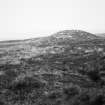
About 100 yards N of the E end of the long cairn (RCAHMS 1911, No. 369) is another cairn (RCAHMS 1911, p. XXXV) of similar type, stretching along the crest of the hill as it begins to slope towards the NNE. It lies NNE and SSW and rises in height and increases in breadth towards the latter direction. The horns at that extremity are not apparent on the surface, but at the NNE end they are both visible, where that on the E side has been exposed to some extent by the removal of the turf. The total length, irrespective of the horns at the SSW end, is some 240ft [73.1m]. The cairn begins to expand at about 60ft [18.2m] from the SSW end, and attains to a width of 53ft [16.1m] and an elevation of 8ft [2.4m]. Immediately in rear of the expanded head, which rises almost like a separate cairn, is a slight depression or trench across the body, which, however, is probably secondary. The breadth of the body of the cairn is about 35' and its elevation 4ft. All along its length are small pits from which stones have been quarried. The width of the terminal portion towards the NNE is 37ft and its elevation about 4ft, but it has originally been higher, as three large slabs set on end protrude for about 1ft 6in through the turf indicating the existence of a chamber. The length of the horns is about 20ft; the distance between their outer extremities 46ft; and thence to the centre of the concavity at that end of the cairn 29ft. The SSW end shows no signs of excavation, and the whole cairn is overgrown with turf.
The OS map indicates ‘standing-stones’ beside these cairns, but none were observed except those protruding from the denuded chamber at the NNW end of the second cairn.
RCAHMS 1911, visited 16 August 1910
OS 6” map (1907) ‘Supposed Broughs’ and ‘Standing Stones’


