Following the launch of trove.scot in February 2025 we are now planning the retiral of some of our webservices. Canmore will be switched off on 24th June 2025. Information about the closure can be found on the HES website: Retiral of HES web services | Historic Environment Scotland
HES Archaeological Survey, Luing


Date January 2022 - October 2022
Event ID 1133029
Category Project
Type Project
Permalink http://canmore.org.uk/event/1133029
An archaeological survey of the Isle of Luing was undertaken by the Archaeological Survey team of Historic Environment Scotland (HES) between January and October 2022, with fieldwork carried out in March and April 2022. The aims of the survey were to enhance the National Record of the Historic Environment (NRHE) through a combination of record revision and the identification of new sites, capitalising on the availability of Airborne Laser Scanning (ALS) data. The project was managed by George Geddes and the project executive was David Cowley.
The survey benefited greatly from the work undertaken since 2017 by the Luing History Group (LHG) and the Association of Certificated Field Archaeologists (ACFA) (DES 2017, 41; DES 2018, 41; Braithwaite 2021). Together they have recorded more than 400 features, many of them new discoveries, and were generous in sharing both the draft survey report and digital spatial information in early 2022. In many instances, HES survey work was limited to the enhancement of geometry (whether precise grid references or digital site-areas) and the correlation of site classifications with the terminology used in the NRHE. Interpretation occasionally differed but much of this can be explained by variance in the scope, method and purpose of the different surveys.
The project made use of Airborne Laser Scanning (ALS) commissioned by the Luing History Group and captured by Fugro in 2019 alongside vertical aerial photographs. With a point density of about 30 last returns per m², the point cloud data was processed by Lukasz Banaszek (HES) to generate digital surface and digital terrain models (DSM and DTM) with a resolution of 0.5m. Visualisations were subsequently produced using the Relief Visualisation Toolbox (Relief Visualization Toolbox (RVT) | ZRC SAZU (zrc-sazu.si)).
The HES survey covered the entirety of the Isle of Luing and its attendant islets, as well as the Isle of Torsa and the southern tip of Seil. No attempt was made to survey Ballachuan Wood (see Regan et al DES 2005, 26) and the islands of Belnahua and Fladda were also excluded. While there is a sizeable acreage of arable on Luing, particularly around Kilchattan, and large areas of 19th century rig and furrow survive on Àird Luing and along the eastern foreshore, much of the island is now rough grazing. The remains of 19th century cultivation are extensive and allied agricultural improvements include large areas of drainage and enclosure that have impacted the survival of earlier archaeological features. The quarrying of slate, so fundamental to the economy of the area from the mid-18th century, has dramatically affected the topography of the NW coast of Luing, in particular from Cullipool to Cuan Point.
The HES survey was mainly concerned with the documentation of discrete archaeological features, with a particular focus on those that can be shown to pre-date the 1st edition of the OS 6-inch map, surveyed in the 1870s. Abandoned later features were also included on a discretionary basis, but no attempt was made to systematically record relict features later in date than 1900, the publication date of the 2nd edition. Roofed buildings and related architectural monuments were omitted (though existing records were replotted with precise national grid references). Plots of relict cultivation (rig and furrow and lazy beds) below 1 hectare in extent were recorded, the larger plots having been delineated on a map of Scotland’s historic land-use (hlamap.org.uk). Field boundaries were generally omitted where they appear on modern or historic OS maps. Both large quarries and small quarry scoops were included in recognition of the extensive effects that quarrying has had on the landscape.
The survey specification was designed to ensure rapid coverage and to meet the minimum record requirements of the NRHE with regard to location, classification and period, with the addition of brief written descriptions. Every site was delineated with a polygon, digitised at a scale between 1:1,000 and 1:2,000, with a centre point with 1m precision subsequently generated from the polygon. The classification and period of each site was recorded using the published thesauri of the NHRE (https://canmore.org.uk/thesaurus). Site descriptions were limited to a relatively brief note unless the character of the site demanded further detail. Every site record was internally peer-reviewed.
The survey methodology foregrounded revision of the 50 previously known archaeological sites, with a desk-based survey then concentrating on the identification of new features in a desktop GIS environment. ALS datasets were viewed using a series of visualisations with priority given to a combination of Local Dominance and Multidirectional Hillshade at a search scale of between 1:1,000 and 1:2,000. Vertical aerial photographs captured up to 2018 (supplied by Getmapping plc) provided additional information to those captured with the ALS data, as did successive iterations of OS Historic Maps at 6-inch and smaller scales (supplied by the National Library of Scotland) as well as current OS digital and raster mapping, and the 1:10,000 Record Sheets of the OS Archaeology Division. Identifications were also correlated against rectified estate maps of 1787 and 1847 (NRS, RHP975 and RHP571), HLAmap and, finally, the information provided by ACFA and LHG. Every new feature identified was peer-reviewed before being assigned a high or a low confidence rating. Those features where the classification, location or character was in doubt were visited in the field.
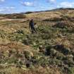
The fieldwork was carried out over two separate weeks in March and April 2022 and undertaken by George Geddes, Darroch Bratt and Alison McCaig. The first week comprised visits by two staff to 72 features of uncertain character, as well as a list of 15 sites of particular interest to the LHG. The second week focussed a series of revisits to known or challenging sites, and on the measured survey of three monuments chosen in discussion with LHG – the hut circle at Dubh Leathad (NM71SW 54; Braithwaite 2021, No. 45), the farmstead at Mid Ardlarach (NM71SW 10; Braithwaite 2021, No. 42) and the promontory fort and building at Àird Luing (NM70NW 64; Braithwaite 2021, No. 32). In addition, GNSS data (TM 002152) was gathered at four sites – the aforementioned fort and hut circle, and the duns at Ardinamir (NM71SE 68) and Eilean an Atha (NM70NW 6). Mary Braithwaite kindly shared some of the results of the recent survey work on site.
The HES survey recorded 294 sites that are new to the record, including 35 that were subsequently visited. It is important to emphasise that 86 of these sites had already been recorded by LHG and ACFA and that many of the others lay out with the scope of their project. Among the large number of newly discovered sites fewer than 10 can be assigned with confidence to the prehistoric or medieval periods. This is likely due to the extent of post-medieval agricultural improvement on the lower-lying ground, the extent of previous survey and the character of some of the ground, much of the interior being dominated by bedrock and poor soils, and a predominantly waterlogged foreshore. The discoveries of prehistoric sites included two hut circles at Dubh Leathad (NM71SW 54 and NM71SW 56) and a thick-walled dun above Ardinamir Bay (NM71SE 68) (Braithwaite 2021, Nos. 13, 44 and 45). An unusual small promontory protected by a single wall and containing a round-ended building at Àird Luing (NM70NW 64) (Braithwaite 2021 No. 32) is probably medieval in date and invites comparison with some of the internal structures at Dùn Chonaill (NM61SE 3; e.g. NM 68071 12649). Although the general location of Luing’s medieval townships is known (Braithwaite 2021; e.g. NM70NW 79), it has proved harder to identify individual structures due to the reuse of the same locations in later centuries and the farmsteads, of which 28 were recorded, are in general of late 18th to late 19th century in date. The same comment pertains to the surviving remains of field boundaries, all of which appear to be post-medieval in date. A small number of isolated buildings were also recorded along with a series of individual huts, but only one certain shieling group (NM71SW 62) with a gathering fold.
More than 90 small quarries were recorded, ranging from piecemeal scoops associated with dyke-building, to linear quarries and some that bear graffiti (NM70NW 106). The disposition of slate quarries in the late 18th century is depicted on an estate map of 1787 (NRS, RHP975) and early remains survive at Balure (NM71SE 25), Black Mill Bay (NM70NW 112) and Eilean Mhic Chiarain (e.g. NM71SW 70). The floruit of slate mining in the late 19th century has left extensive remains at Toberonochy (e.g. NM70NW 10), Cullipool (e.g. NM71SW 25) and North Cuan Point, while a 20th century resurgence resulted in the huge fingers of spoil on the remote W coast at Tir nan Oig (NM71SW 65).
The project archive includes the spatial data and layers created during desk-based mapping and subsequent stages of the survey (TM002165 and TM002164), tracks recorded by handheld GPS (TM002162), the metadata for the ALS processing and visualisations (WP007916), and the extent of the survey area (TM002163). More than 300 oblique aerial photographs and 238 ground photographs were captured over the course of the fieldwork. Quality assurance and review was undertaken in the summer of 2022 and the project dataset was entered into the NRHE between July and October 2022.
Information from HES Archaeological Survey (G F Geddes), 13 October 2022.