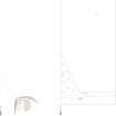
Measured Survey
Date 6 October 2015
Event ID 1128314
Category Recording
Type Measured Survey
Permalink http://canmore.org.uk/event/1128314
HES surveyed the remains of the stone circle at Nether Coullie with GNSS on 6 October 2015. The GNSS linework was used to create a plan in vector graphics software that indicates the locations of the surviving stones at a scale of 1:1000.


