
2020 HES Aerial Survey (UAV)


Date 2020
Event ID 1093044
Category Project
Type Project
Permalink http://canmore.org.uk/event/1093044
HES undertook a series of 7 UAV (drone) sorties in 2020 at a range of archaeological sites, with operations being curtailed by Coronavirus restrictions. Flights were in general undertake to capture oblique aerial photographs that would enhance the record of particular sites or landscapes and support other HES recording projects. Approximately 3 hours were spent airborne and a total of more than 650 images and 1 video were captured documenting about 10 archaeological sites. Images for 3D modelling with GNSS ground control points were captured at two sites: Union Canal, Polmont (NS97NW 61) and Dunmore fort, Callander (NN60NW 7). Each of the images and videos has been catalogued and the flight records are available on request. Flights were undertaken with a DJI Phantom 4 Pro, and a DJI Inspire 2 mounted with a DJI X7 camera and 16mm and 35mm lenses.
Information from HES Survey and Recording (GFG) 8 April 2021.

| Event | Type | Subtype | Notes | Date |
|---|---|---|---|---|
| 1103024 | RECORDING | MEASURED SURVEY | HES Survey and Recording undertook a survey of a breach in the Polmont section of the Union Canal that took place on 12 August 2020 in response to a request from colleagues in Casework. The breach occurred in the NE embankment between Almondhall Farm and Kirk Bridge at NS 9532 7731, some 265m NW of the bridge. [...] | 20 August 2020 |
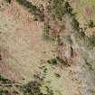
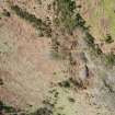
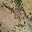
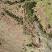
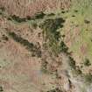
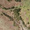
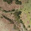
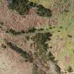
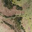
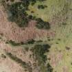
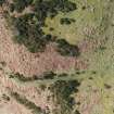
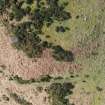
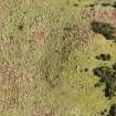
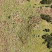
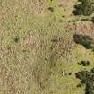
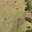
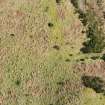
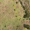
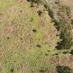
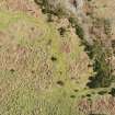
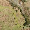
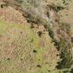
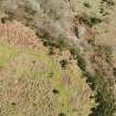
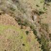
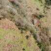
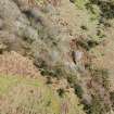
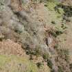
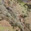
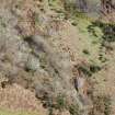
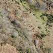
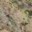
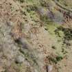
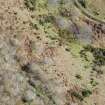
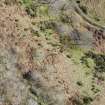
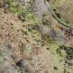
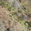
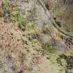
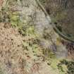
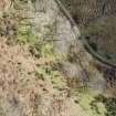
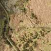
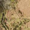
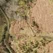
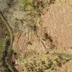
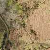
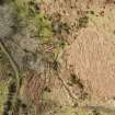
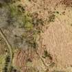
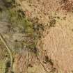
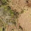
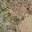
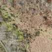
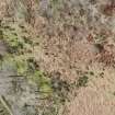
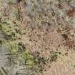
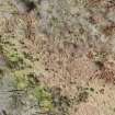
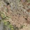
| 1111344 | RECORDING | MEASURED SURVEY | HES Survey and Recording undertook a UAV survey of Dunmore fort on 13 March 2020 in order to support colleagues undertaking a planned training survey at the site later in the year. [...] | 13 March 2020 |

DP 327621
Oblique aerial view
Historic Environment Scotland
13/3/2020
© Copyright: HES

DP 327622
Oblique aerial view
Historic Environment Scotland
13/3/2020
© Copyright: HES

DP 327623
Oblique aerial view
Historic Environment Scotland
13/3/2020
© Copyright: HES

DP 327624
Oblique aerial view
Historic Environment Scotland
13/3/2020
© Copyright: HES

DP 327625
Oblique aerial view
Historic Environment Scotland
13/3/2020
© Copyright: HES

DP 327626
Oblique aerial view
Historic Environment Scotland
13/3/2020
© Copyright: HES

DP 327627
Oblique aerial view
Historic Environment Scotland
13/3/2020
© Copyright: HES

DP 327628
Oblique aerial view
Historic Environment Scotland
13/3/2020
© Copyright: HES

DP 327629
Oblique aerial view
Historic Environment Scotland
13/3/2020
© Copyright: HES

DP 327630
Oblique aerial view
Historic Environment Scotland
13/3/2020
© Copyright: HES

DP 327631
Oblique aerial view
Historic Environment Scotland
13/3/2020
© Copyright: HES

DP 327632
Oblique aerial view
Historic Environment Scotland
13/3/2020
© Copyright: HES

DP 327633
Oblique aerial view
Historic Environment Scotland
13/3/2020
© Copyright: HES

DP 327634
Oblique aerial view
Historic Environment Scotland
13/3/2020
© Copyright: HES

DP 327635
Oblique aerial view
Historic Environment Scotland
13/3/2020
© Copyright: HES

DP 327636
Oblique aerial view
Historic Environment Scotland
13/3/2020
© Copyright: HES

DP 327637
Oblique aerial view
Historic Environment Scotland
13/3/2020
© Copyright: HES

DP 327638
Oblique aerial view
Historic Environment Scotland
13/3/2020
© Copyright: HES

DP 327639
Oblique aerial view
Historic Environment Scotland
13/3/2020
© Copyright: HES

DP 327640
Vertical aerial view
Historic Environment Scotland
13/3/2020
© Copyright: HES

DP 327641
Vertical aerial view
Historic Environment Scotland
13/3/2020
© Copyright: HES

DP 327642
Vertical aerial view
Historic Environment Scotland
13/3/2020
© Copyright: HES

DP 327643
Vertical aerial view
Historic Environment Scotland
13/3/2020
© Copyright: HES

DP 327644
Vertical aerial view
Historic Environment Scotland
13/3/2020
© Copyright: HES

DP 327645
Vertical aerial view
Historic Environment Scotland
13/3/2020
© Copyright: HES

DP 327646
Vertical aerial view
Historic Environment Scotland
13/3/2020
© Copyright: HES

DP 327647
Vertical aerial view
Historic Environment Scotland
13/3/2020
© Copyright: HES

DP 327648
Vertical aerial view
Historic Environment Scotland
13/3/2020
© Copyright: HES

DP 327649
Vertical aerial view
Historic Environment Scotland
13/3/2020
© Copyright: HES

DP 327650
Vertical aerial view
Historic Environment Scotland
13/3/2020
© Copyright: HES

DP 327651
Vertical aerial view
Historic Environment Scotland
13/3/2020
© Copyright: HES

DP 327652
Vertical aerial view
Historic Environment Scotland
13/3/2020
© Copyright: HES

DP 327653
Vertical aerial view
Historic Environment Scotland
13/3/2020
© Copyright: HES

DP 327654
Vertical aerial view
Historic Environment Scotland
13/3/2020
© Copyright: HES

DP 327655
Vertical aerial view
Historic Environment Scotland
13/3/2020
© Copyright: HES

DP 327656
Vertical aerial view
Historic Environment Scotland
13/3/2020
© Copyright: HES

DP 327657
Vertical aerial view
Historic Environment Scotland
13/3/2020
© Copyright: HES

DP 327658
Vertical aerial view
Historic Environment Scotland
13/3/2020
© Copyright: HES

DP 327659
Vertical aerial view
Historic Environment Scotland
13/3/2020
© Copyright: HES

DP 327660
Vertical aerial view
Historic Environment Scotland
13/3/2020
© Copyright: HES

DP 327661
Vertical aerial view
Historic Environment Scotland
13/3/2020
© Copyright: HES

DP 327662
Vertical aerial view
Historic Environment Scotland
13/3/2020
© Copyright: HES

DP 327663
Vertical aerial view
Historic Environment Scotland
13/3/2020
© Copyright: HES

DP 327664
Vertical aerial view
Historic Environment Scotland
13/3/2020
© Copyright: HES

DP 327665
Vertical aerial view
Historic Environment Scotland
13/3/2020
© Copyright: HES

DP 327666
Vertical aerial view
Historic Environment Scotland
13/3/2020
© Copyright: HES

DP 327667
Vertical aerial view
Historic Environment Scotland
13/3/2020
© Copyright: HES

DP 327668
Vertical aerial view
Historic Environment Scotland
13/3/2020
© Copyright: HES

DP 327669
Vertical aerial view
Historic Environment Scotland
13/3/2020
© Copyright: HES

DP 327670
Vertical aerial view
Historic Environment Scotland
13/3/2020
© Copyright: HES

DP 327671
Vertical aerial view
Historic Environment Scotland
13/3/2020
© Copyright: HES

DP 327672
Vertical aerial view
Historic Environment Scotland
13/3/2020
© Copyright: HES

DP 327673
Vertical aerial view
Historic Environment Scotland
13/3/2020
© Copyright: HES

DP 327674
Vertical aerial view
Historic Environment Scotland
13/3/2020
© Copyright: HES

DP 327675
Vertical aerial view
Historic Environment Scotland
13/3/2020
© Copyright: HES

DP 327676
Vertical aerial view
Historic Environment Scotland
13/3/2020
© Copyright: HES

DP 327677
Vertical aerial view
Historic Environment Scotland
13/3/2020
© Copyright: HES

DP 327678
Vertical aerial view
Historic Environment Scotland
13/3/2020
© Copyright: HES

DP 327679
Vertical aerial view
Historic Environment Scotland
13/3/2020
© Copyright: HES

DP 327680
Vertical aerial view
Historic Environment Scotland
13/3/2020
© Copyright: HES

DP 327681
Vertical aerial view
Historic Environment Scotland
13/3/2020
© Copyright: HES

DP 327682
Vertical aerial view
Historic Environment Scotland
13/3/2020
© Copyright: HES

DP 327683
Vertical aerial view
Historic Environment Scotland
13/3/2020
© Copyright: HES

DP 327684
Vertical aerial view
Historic Environment Scotland
13/3/2020
© Copyright: HES

DP 327685
Vertical aerial view
Historic Environment Scotland
13/3/2020
© Copyright: HES

DP 327686
Vertical aerial view
Historic Environment Scotland
13/3/2020
© Copyright: HES

DP 327687
Vertical aerial view
Historic Environment Scotland
13/3/2020
© Copyright: HES

DP 327688
Vertical aerial view
Historic Environment Scotland
13/3/2020
© Copyright: HES

DP 327689
Vertical aerial view
Historic Environment Scotland
13/3/2020
© Copyright: HES

DP 327690
Vertical aerial view
Historic Environment Scotland
13/3/2020
© Copyright: HES

DP 327691
Vertical aerial view
Historic Environment Scotland
13/3/2020
© Copyright: HES

DP 327692
Vertical aerial view
Historic Environment Scotland
13/3/2020
© Copyright: HES

DP 327693
Vertical aerial view
Historic Environment Scotland
13/3/2020
© Copyright: HES

DP 327694
Vertical aerial view
Historic Environment Scotland
13/3/2020
© Copyright: HES

DP 327695
Vertical aerial view
Historic Environment Scotland
13/3/2020
© Copyright: HES

DP 327696
Vertical aerial view
Historic Environment Scotland
13/3/2020
© Copyright: HES

DP 327697
Vertical aerial view
Historic Environment Scotland
13/3/2020
© Copyright: HES

DP 327698
Vertical aerial view
Historic Environment Scotland
13/3/2020
© Copyright: HES

DP 327699
Vertical aerial view
Historic Environment Scotland
13/3/2020
© Copyright: HES

DP 327700
Vertical aerial view
Historic Environment Scotland
13/3/2020
© Copyright: HES

DP 327701
Vertical aerial view
Historic Environment Scotland
13/3/2020
© Copyright: HES

DP 327702
Vertical aerial view
Historic Environment Scotland
13/3/2020
© Copyright: HES

DP 327703
Vertical aerial view
Historic Environment Scotland
13/3/2020
© Copyright: HES

DP 327704
Vertical aerial view
Historic Environment Scotland
13/3/2020
© Copyright: HES

DP 327705
Vertical aerial view
Historic Environment Scotland
13/3/2020
© Copyright: HES

DP 327706
Vertical aerial view
Historic Environment Scotland
13/3/2020
© Copyright: HES

DP 327707
Vertical aerial view
Historic Environment Scotland
13/3/2020
© Copyright: HES

DP 327708
Vertical aerial view
Historic Environment Scotland
13/3/2020
© Copyright: HES

DP 327709
Vertical aerial view
Historic Environment Scotland
13/3/2020
© Copyright: HES

DP 327710
Vertical aerial view
Historic Environment Scotland
13/3/2020
© Copyright: HES

DP 327711
Vertical aerial view
Historic Environment Scotland
13/3/2020
© Copyright: HES

DP 327712
Vertical aerial view
Historic Environment Scotland
13/3/2020
© Copyright: HES

DP 327713
Vertical aerial view
Historic Environment Scotland
13/3/2020
© Copyright: HES

DP 327714
Vertical aerial view
Historic Environment Scotland
13/3/2020
© Copyright: HES

DP 327715
Vertical aerial view
Historic Environment Scotland
13/3/2020
© Copyright: HES

DP 327716
Vertical aerial view
Historic Environment Scotland
13/3/2020
© Copyright: HES

DP 327717
Vertical aerial view
Historic Environment Scotland
13/3/2020
© Copyright: HES

DP 327718
Vertical aerial view
Historic Environment Scotland
13/3/2020
© Copyright: HES

DP 327719
Vertical aerial view
Historic Environment Scotland
13/3/2020
© Copyright: HES

DP 327720
Vertical aerial view
Historic Environment Scotland
13/3/2020
© Copyright: HES


First 100 images shown.
UAV photographs and video captured in 2020
UAV Sortie 2020/1
Primary data: vertical aerial photographs (96)
