
Following the launch of trove.scot in February 2025 we are now planning the retiral of some of our webservices. Canmore will be switched off on 24th June 2025. Information about the closure can be found on the HES website: Retiral of HES web services | Historic Environment Scotland
Watching Brief


Date 11 January 2011 - 1 March 2014
Event ID 1014132
Category Recording
Type Watching Brief
Permalink http://canmore.org.uk/event/1014132
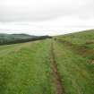
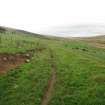
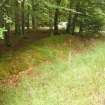
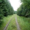
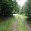
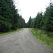
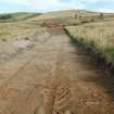
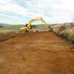
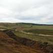
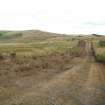
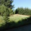
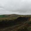
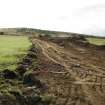
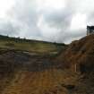
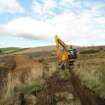
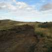
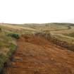
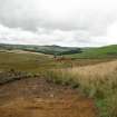
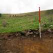
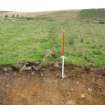
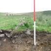
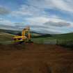
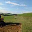
A watching brief took place during groundbreaking works for the construction of new access roads and turbine bases outside of previously forested areas. The exception to this was where a new access road
passed to the north-west of Site 2, a farmhouse and associated structures to the east of the Oxter Burn. No archaeological remains were recorded along the new access roads.
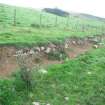
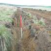
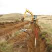
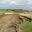
The Oxter Burn settlement was part of Corrydown Township and the OS Second Edition map of 1901 shows various farm buildings and other agricultural infrastructure including a pond and sluice ('Sl' on the map). The surviving elements of the site were surveyed by GPS and a route for the new road agreed. This aimed to avoid all parts of the site with the exception of a ditch leading east from the pond. Although the area had been badly affected by commercial forestry, the ditch (or possible mill lead) from the pond was located during the watching brief.
Information from Tamlin Barton, Georgia Marina Andreou Ptychion and Ian Suddaby (CFA Archaeology) March 2014
OASIS ID: cfaarcha1-168458
Ordnance Survey licence number AC0000807262. All rights reserved.
Canmore Disclaimer.
© Bluesky International Limited 2025.

DP 321185
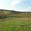
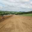
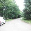
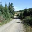
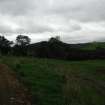
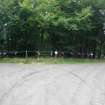
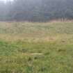
Watching brief, Entrance access track to forest area, Clashindarroch Windfarm, Aberdeenshire
Records of CFA Archaeology Ltd, archaeologists, Musselburgh, East Lothian, Scotland
26/8/2013
© Copyright: CFA Archaeology Ltd.. Courtesy of HES.

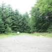
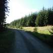
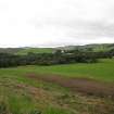
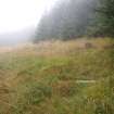
DP 321186
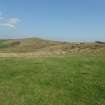
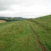
Watching brief, Access track, Clashindarroch Windfarm, Aberdeenshire
Records of CFA Archaeology Ltd, archaeologists, Musselburgh, East Lothian, Scotland
26/8/2013
© Copyright: CFA Archaeology Ltd.. Courtesy of HES.

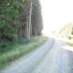
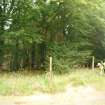
DP 321187
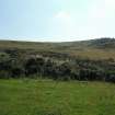
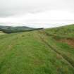
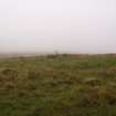
Watching brief, General shot looking NE, Clashindarroch Windfarm, Aberdeenshire
Records of CFA Archaeology Ltd, archaeologists, Musselburgh, East Lothian, Scotland
26/8/2013
© Copyright: CFA Archaeology Ltd.. Courtesy of HES.

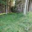
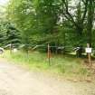
DP 321188
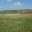
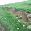
Watching brief, Lime kilns, site 24 looking NE, Clashindarroch Windfarm, Aberdeenshire
Records of CFA Archaeology Ltd, archaeologists, Musselburgh, East Lothian, Scotland
26/8/2013
© Copyright: CFA Archaeology Ltd.. Courtesy of HES.

DP 321189
Watching brief, Lime kilns, site 24 looking NE, Clashindarroch Windfarm, Aberdeenshire
Records of CFA Archaeology Ltd, archaeologists, Musselburgh, East Lothian, Scotland
26/8/2013
© Copyright: CFA Archaeology Ltd.. Courtesy of HES.

DP 321190
Watching brief, Access track looking SW, Clashindarroch Windfarm, Aberdeenshire
Records of CFA Archaeology Ltd, archaeologists, Musselburgh, East Lothian, Scotland
26/8/2013
© Copyright: CFA Archaeology Ltd.. Courtesy of HES.

DP 321191
Watching brief, Access track looking SW, Clashindarroch Windfarm, Aberdeenshire
Records of CFA Archaeology Ltd, archaeologists, Musselburgh, East Lothian, Scotland
26/8/2013
© Copyright: CFA Archaeology Ltd.. Courtesy of HES.

DP 321192
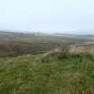
Watching brief, General shot looking E, Clashindarroch Windfarm, Aberdeenshire
Records of CFA Archaeology Ltd, archaeologists, Musselburgh, East Lothian, Scotland
26/8/2013
© Copyright: CFA Archaeology Ltd.. Courtesy of HES.

DP 321193
Watching brief, General shot looking N, Clashindarroch Windfarm, Aberdeenshire
Records of CFA Archaeology Ltd, archaeologists, Musselburgh, East Lothian, Scotland
26/8/2013
© Copyright: CFA Archaeology Ltd.. Courtesy of HES.

DP 321194
Watching brief, General shot looking NW, Clashindarroch Windfarm, Aberdeenshire
Records of CFA Archaeology Ltd, archaeologists, Musselburgh, East Lothian, Scotland
26/8/2013
© Copyright: CFA Archaeology Ltd.. Courtesy of HES.

DP 321195
Watching brief, General shot looking S, Clashindarroch Windfarm, Aberdeenshire
Records of CFA Archaeology Ltd, archaeologists, Musselburgh, East Lothian, Scotland
26/8/2013
© Copyright: CFA Archaeology Ltd.. Courtesy of HES.

DP 321196
Watching brief, Access track looking N, Clashindarroch Windfarm, Aberdeenshire
Records of CFA Archaeology Ltd, archaeologists, Musselburgh, East Lothian, Scotland
26/8/2013
© Copyright: CFA Archaeology Ltd.. Courtesy of HES.

DP 321197
Watching brief, Access track looking S, Clashindarroch Windfarm, Aberdeenshire
Records of CFA Archaeology Ltd, archaeologists, Musselburgh, East Lothian, Scotland
26/8/2013
© Copyright: CFA Archaeology Ltd.. Courtesy of HES.

DP 321198
Watching brief, Access track up to site 46, Clashindarroch Windfarm, Aberdeenshire
Records of CFA Archaeology Ltd, archaeologists, Musselburgh, East Lothian, Scotland
27/8/2013
© Copyright: CFA Archaeology Ltd.. Courtesy of HES.

DP 321199
Watching brief, Access track up to site 46, Clashindarroch Windfarm, Aberdeenshire
Records of CFA Archaeology Ltd, archaeologists, Musselburgh, East Lothian, Scotland
27/8/2013
© Copyright: CFA Archaeology Ltd.. Courtesy of HES.

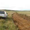
DP 321200
Watching brief, Farmer's track, Clashindarroch Windfarm, Aberdeenshire
Records of CFA Archaeology Ltd, archaeologists, Musselburgh, East Lothian, Scotland
28/8/2013
© Copyright: CFA Archaeology Ltd.. Courtesy of HES.

DP 321201
Watching brief, Farmer's track, Clashindarroch Windfarm, Aberdeenshire
Records of CFA Archaeology Ltd, archaeologists, Musselburgh, East Lothian, Scotland
28/8/2013
© Copyright: CFA Archaeology Ltd.. Courtesy of HES.

DP 321202
Watching brief, Detail of machine marks, Clashindarroch Windfarm, Aberdeenshire
Records of CFA Archaeology Ltd, archaeologists, Musselburgh, East Lothian, Scotland
28/8/2013
© Copyright: CFA Archaeology Ltd.. Courtesy of HES.

DP 321203
Watching brief, Detail of machine marks, Clashindarroch Windfarm, Aberdeenshire
Records of CFA Archaeology Ltd, archaeologists, Musselburgh, East Lothian, Scotland
28/8/2013
© Copyright: CFA Archaeology Ltd.. Courtesy of HES.

DP 321204
Watching brief, Farmer's track, Clashindarroch Windfarm, Aberdeenshire
Records of CFA Archaeology Ltd, archaeologists, Musselburgh, East Lothian, Scotland
28/8/2013
© Copyright: CFA Archaeology Ltd.. Courtesy of HES.

DP 321205
Watching brief, Farmer's track, Clashindarroch Windfarm, Aberdeenshire
Records of CFA Archaeology Ltd, archaeologists, Musselburgh, East Lothian, Scotland
28/8/2013
© Copyright: CFA Archaeology Ltd.. Courtesy of HES.

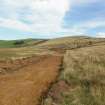
DP 321206
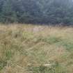
Watching brief, Field boundary site 15, Clashindarroch Windfarm, Aberdeenshire
Records of CFA Archaeology Ltd, archaeologists, Musselburgh, East Lothian, Scotland
28/8/2013
© Copyright: CFA Archaeology Ltd.. Courtesy of HES.

DP 321207
Watching brief, Field boundary site 15, Clashindarroch Windfarm, Aberdeenshire
Records of CFA Archaeology Ltd, archaeologists, Musselburgh, East Lothian, Scotland
28/8/2013
© Copyright: CFA Archaeology Ltd.. Courtesy of HES.

DP 321208
Watching brief, Forest track site 15, Clashindarroch Windfarm, Aberdeenshire
Records of CFA Archaeology Ltd, archaeologists, Musselburgh, East Lothian, Scotland
28/8/2013
© Copyright: CFA Archaeology Ltd.. Courtesy of HES.

DP 321209
Watching brief, Forest track site 15, Clashindarroch Windfarm, Aberdeenshire
Records of CFA Archaeology Ltd, archaeologists, Musselburgh, East Lothian, Scotland
28/8/2013
© Copyright: CFA Archaeology Ltd.. Courtesy of HES.

DP 321210
Watching brief, Forest track site 15, Clashindarroch Windfarm, Aberdeenshire
Records of CFA Archaeology Ltd, archaeologists, Musselburgh, East Lothian, Scotland
28/8/2013
© Copyright: CFA Archaeology Ltd.. Courtesy of HES.

DP 321211
Watching brief, Forest track site 15, Clashindarroch Windfarm, Aberdeenshire
Records of CFA Archaeology Ltd, archaeologists, Musselburgh, East Lothian, Scotland
28/8/2013
© Copyright: CFA Archaeology Ltd.. Courtesy of HES.

DP 321212
Watching brief, Forest track site 15, Clashindarroch Windfarm, Aberdeenshire
Records of CFA Archaeology Ltd, archaeologists, Musselburgh, East Lothian, Scotland
28/8/2013
© Copyright: CFA Archaeology Ltd.. Courtesy of HES.

DP 321213
Watching brief, Access track CH4100-CH1700, Clashindarroch Windfarm, Aberdeenshire
Records of CFA Archaeology Ltd, archaeologists, Musselburgh, East Lothian, Scotland
4/9/2013
© Copyright: CFA Archaeology Ltd.. Courtesy of HES.

DP 321214
Watching brief, Access track CH4100-CH1700, Clashindarroch Windfarm, Aberdeenshire
Records of CFA Archaeology Ltd, archaeologists, Musselburgh, East Lothian, Scotland
4/9/2013
© Copyright: CFA Archaeology Ltd.. Courtesy of HES.

DP 321215
Watching brief, Access track CH4100-CH1700, Clashindarroch Windfarm, Aberdeenshire
Records of CFA Archaeology Ltd, archaeologists, Musselburgh, East Lothian, Scotland
4/9/2013
© Copyright: CFA Archaeology Ltd.. Courtesy of HES.

DP 321216
Watching brief, Topsoil stripping - access track, Clashindarroch Windfarm, Aberdeenshire
Records of CFA Archaeology Ltd, archaeologists, Musselburgh, East Lothian, Scotland
4/9/2013
© Copyright: CFA Archaeology Ltd.. Courtesy of HES.

DP 321217
Watching brief, Access track, Clashindarroch Windfarm, Aberdeenshire
Records of CFA Archaeology Ltd, archaeologists, Musselburgh, East Lothian, Scotland
4/9/2013
© Copyright: CFA Archaeology Ltd.. Courtesy of HES.

DP 321218
Watching brief, Access track, Clashindarroch Windfarm, Aberdeenshire
Records of CFA Archaeology Ltd, archaeologists, Musselburgh, East Lothian, Scotland
4/9/2013
© Copyright: CFA Archaeology Ltd.. Courtesy of HES.

DP 321219
Watching brief, Area site 3, Clashindarroch Windfarm, Aberdeenshire
Records of CFA Archaeology Ltd, archaeologists, Musselburgh, East Lothian, Scotland
4/9/2013
© Copyright: CFA Archaeology Ltd.. Courtesy of HES.

DP 321220
Watching brief, Area site 3, Clashindarroch Windfarm, Aberdeenshire
Records of CFA Archaeology Ltd, archaeologists, Musselburgh, East Lothian, Scotland
4/9/2013
© Copyright: CFA Archaeology Ltd.. Courtesy of HES.

DP 321221
Watching brief, Area site 3, Clashindarroch Windfarm, Aberdeenshire
Records of CFA Archaeology Ltd, archaeologists, Musselburgh, East Lothian, Scotland
4/9/2013
© Copyright: CFA Archaeology Ltd.. Courtesy of HES.

DP 321222
Watching brief, Area site 3, Clashindarroch Windfarm, Aberdeenshire
Records of CFA Archaeology Ltd, archaeologists, Musselburgh, East Lothian, Scotland
4/9/2013
© Copyright: CFA Archaeology Ltd.. Courtesy of HES.

DP 321223
Watching brief, Area site 3, Clashindarroch Windfarm, Aberdeenshire
Records of CFA Archaeology Ltd, archaeologists, Musselburgh, East Lothian, Scotland
4/9/2013
© Copyright: CFA Archaeology Ltd.. Courtesy of HES.

DP 321224
Watching brief, Site 3 "Corshalloch", Clashindarroch Windfarm, Aberdeenshire
Records of CFA Archaeology Ltd, archaeologists, Musselburgh, East Lothian, Scotland
4/9/2013
© Copyright: CFA Archaeology Ltd.. Courtesy of HES.

DP 321225
Watching brief, Site 3 "Corshalloch", Clashindarroch Windfarm, Aberdeenshire
Records of CFA Archaeology Ltd, archaeologists, Musselburgh, East Lothian, Scotland
4/9/2013
© Copyright: CFA Archaeology Ltd.. Courtesy of HES.

DP 321226
Watching brief, Site 3 "Corshalloch", Clashindarroch Windfarm, Aberdeenshire
Records of CFA Archaeology Ltd, archaeologists, Musselburgh, East Lothian, Scotland
4/9/2013
© Copyright: CFA Archaeology Ltd.. Courtesy of HES.

DP 321227
Watching brief, Site 3 "Corshalloch", Clashindarroch Windfarm, Aberdeenshire
Records of CFA Archaeology Ltd, archaeologists, Musselburgh, East Lothian, Scotland
4/9/2013
© Copyright: CFA Archaeology Ltd.. Courtesy of HES.

DP 321228
Watching brief, Site 3 "Corshalloch", Clashindarroch Windfarm, Aberdeenshire
Records of CFA Archaeology Ltd, archaeologists, Musselburgh, East Lothian, Scotland
4/9/2013
© Copyright: CFA Archaeology Ltd.. Courtesy of HES.

DP 321229
Watching brief, Site 3 "Corshalloch", Clashindarroch Windfarm, Aberdeenshire
Records of CFA Archaeology Ltd, archaeologists, Musselburgh, East Lothian, Scotland
4/9/2013
© Copyright: CFA Archaeology Ltd.. Courtesy of HES.

DP 321230
Watching brief, Area site 67, Clashindarroch Windfarm, Aberdeenshire
Records of CFA Archaeology Ltd, archaeologists, Musselburgh, East Lothian, Scotland
4/9/2013
© Copyright: CFA Archaeology Ltd.. Courtesy of HES.

DP 321231
Watching brief, Area site 67, Clashindarroch Windfarm, Aberdeenshire
Records of CFA Archaeology Ltd, archaeologists, Musselburgh, East Lothian, Scotland
4/9/2013
© Copyright: CFA Archaeology Ltd.. Courtesy of HES.

DP 321232
Watching brief, Area site 67, Clashindarroch Windfarm, Aberdeenshire
Records of CFA Archaeology Ltd, archaeologists, Musselburgh, East Lothian, Scotland
4/9/2013
© Copyright: CFA Archaeology Ltd.. Courtesy of HES.

DP 321233
Watching brief, Area site 67, Clashindarroch Windfarm, Aberdeenshire
Records of CFA Archaeology Ltd, archaeologists, Musselburgh, East Lothian, Scotland
4/9/2013
© Copyright: CFA Archaeology Ltd.. Courtesy of HES.

DP 321234
Watching brief, Area site 21, Clashindarroch Windfarm, Aberdeenshire
Records of CFA Archaeology Ltd, archaeologists, Musselburgh, East Lothian, Scotland
4/9/2013
© Copyright: CFA Archaeology Ltd.. Courtesy of HES.

DP 321235
Watching brief, Area site 21, Clashindarroch Windfarm, Aberdeenshire
Records of CFA Archaeology Ltd, archaeologists, Musselburgh, East Lothian, Scotland
4/9/2013
© Copyright: CFA Archaeology Ltd.. Courtesy of HES.

DP 321236
Watching brief, Area site 2, Clashindarroch Windfarm, Aberdeenshire
Records of CFA Archaeology Ltd, archaeologists, Musselburgh, East Lothian, Scotland
4/9/2013
© Copyright: CFA Archaeology Ltd.. Courtesy of HES.

DP 321237
Watching brief, Area site 2, Clashindarroch Windfarm, Aberdeenshire
Records of CFA Archaeology Ltd, archaeologists, Musselburgh, East Lothian, Scotland
4/9/2013
© Copyright: CFA Archaeology Ltd.. Courtesy of HES.

DP 321238
Watching brief, Area site 2, Clashindarroch Windfarm, Aberdeenshire
Records of CFA Archaeology Ltd, archaeologists, Musselburgh, East Lothian, Scotland
4/9/2013
© Copyright: CFA Archaeology Ltd.. Courtesy of HES.

DP 321239
Watching brief, Area site 2, Clashindarroch Windfarm, Aberdeenshire
Records of CFA Archaeology Ltd, archaeologists, Musselburgh, East Lothian, Scotland
4/9/2013
© Copyright: CFA Archaeology Ltd.. Courtesy of HES.

DP 321240
Watching brief, Machines working on trackway (5/9/13), Clashindarroch Windfarm, Aberdeenshire
Records of CFA Archaeology Ltd, archaeologists, Musselburgh, East Lothian, Scotland
5/9/2013
© Copyright: CFA Archaeology Ltd.. Courtesy of HES.

DP 321241
Watching brief, Access track development (5/9/13 14:00), Clashindarroch Windfarm, Aberdeenshire
Records of CFA Archaeology Ltd, archaeologists, Musselburgh, East Lothian, Scotland
5/9/2013
© Copyright: CFA Archaeology Ltd.. Courtesy of HES.

DP 321242
Watching brief, Ditch digging across the trackway, Clashindarroch Windfarm, Aberdeenshire
Records of CFA Archaeology Ltd, archaeologists, Musselburgh, East Lothian, Scotland
5/9/2013
© Copyright: CFA Archaeology Ltd.. Courtesy of HES.

DP 321243
Watching brief, Ditch digging across the trackway, Clashindarroch Windfarm, Aberdeenshire
Records of CFA Archaeology Ltd, archaeologists, Musselburgh, East Lothian, Scotland
5/9/2013
© Copyright: CFA Archaeology Ltd.. Courtesy of HES.

DP 321244
Watching brief, Earthworks, land scraping, track expansion, Clashindarroch Windfarm, Aberdeenshire
Records of CFA Archaeology Ltd, archaeologists, Musselburgh, East Lothian, Scotland
5/9/2013
© Copyright: CFA Archaeology Ltd.. Courtesy of HES.

DP 321245
Watching brief, Track and ditch, Clashindarroch Windfarm, Aberdeenshire
Records of CFA Archaeology Ltd, archaeologists, Musselburgh, East Lothian, Scotland
5/9/2013
© Copyright: CFA Archaeology Ltd.. Courtesy of HES.

DP 321246
Watching brief, Earthworks across the track, Clashindarroch Windfarm, Aberdeenshire
Records of CFA Archaeology Ltd, archaeologists, Musselburgh, East Lothian, Scotland
5/9/2013
© Copyright: CFA Archaeology Ltd.. Courtesy of HES.

DP 321247
Watching brief, Earthworks across the track (CH4500), Clashindarroch Windfarm, Aberdeenshire
Records of CFA Archaeology Ltd, archaeologists, Musselburgh, East Lothian, Scotland
5/9/2013
© Copyright: CFA Archaeology Ltd.. Courtesy of HES.

DP 321248
Watching brief, Ditch excavation across the track - progress shot, Clashindarroch Windfarm, Aberdeenshire
Records of CFA Archaeology Ltd, archaeologists, Musselburgh, East Lothian, Scotland
5/9/2013
© Copyright: CFA Archaeology Ltd.. Courtesy of HES.

DP 321249
Watching brief, Earthworks - progress shot, Clashindarroch Windfarm, Aberdeenshire
Records of CFA Archaeology Ltd, archaeologists, Musselburgh, East Lothian, Scotland
5/9/2013
© Copyright: CFA Archaeology Ltd.. Courtesy of HES.

DP 321250
Watching brief, Trackway levelling, Clashindarroch Windfarm, Aberdeenshire
Records of CFA Archaeology Ltd, archaeologists, Musselburgh, East Lothian, Scotland
6/9/2013
© Copyright: CFA Archaeology Ltd.. Courtesy of HES.

DP 321251
Watching brief, Trackway stripping - progress shot although bog was not stripped (6/9/13), Clashindarroch Windfarm, Aberdeenshire
Records of CFA Archaeology Ltd, archaeologists, Musselburgh, East Lothian, Scotland
6/9/2013
© Copyright: CFA Archaeology Ltd.. Courtesy of HES.

DP 321252
Watching brief, Trackway stripping - progress shot although bog was not stripped (6/9/13), Clashindarroch Windfarm, Aberdeenshire
Records of CFA Archaeology Ltd, archaeologists, Musselburgh, East Lothian, Scotland
6/9/2013
© Copyright: CFA Archaeology Ltd.. Courtesy of HES.

DP 321253
Watching brief, Stone concentration just N of CH2700, Clashindarroch Windfarm, Aberdeenshire
Records of CFA Archaeology Ltd, archaeologists, Musselburgh, East Lothian, Scotland
6/9/2013
© Copyright: CFA Archaeology Ltd.. Courtesy of HES.

DP 321254
Watching brief, Stone concentration just N of CH2700, Clashindarroch Windfarm, Aberdeenshire
Records of CFA Archaeology Ltd, archaeologists, Musselburgh, East Lothian, Scotland
6/9/2013
© Copyright: CFA Archaeology Ltd.. Courtesy of HES.

DP 321255
Watching brief, Close-up to machine cut, Clashindarroch Windfarm, Aberdeenshire
Records of CFA Archaeology Ltd, archaeologists, Musselburgh, East Lothian, Scotland
6/9/2013
© Copyright: CFA Archaeology Ltd.. Courtesy of HES.

DP 321256
Watching brief, Trackway stripping - progress shot (9/9/13), Clashindarroch Windfarm, Aberdeenshire
Records of CFA Archaeology Ltd, archaeologists, Musselburgh, East Lothian, Scotland
9/9/2013
© Copyright: CFA Archaeology Ltd.. Courtesy of HES.

DP 321257
Watching brief, Site 116 area - related to lime kiln, Clashindarroch Windfarm, Aberdeenshire
Records of CFA Archaeology Ltd, archaeologists, Musselburgh, East Lothian, Scotland
9/9/2013
© Copyright: CFA Archaeology Ltd.. Courtesy of HES.

DP 321258
Watching brief, Site 116 area - related to lime kiln, Clashindarroch Windfarm, Aberdeenshire
Records of CFA Archaeology Ltd, archaeologists, Musselburgh, East Lothian, Scotland
9/9/2013
© Copyright: CFA Archaeology Ltd.. Courtesy of HES.

DP 321259
Watching brief, Site 116 area - related to lime kiln, Clashindarroch Windfarm, Aberdeenshire
Records of CFA Archaeology Ltd, archaeologists, Musselburgh, East Lothian, Scotland
9/9/2013
© Copyright: CFA Archaeology Ltd.. Courtesy of HES.

DP 321260
Watching brief, Trackway stripping and extension of existing track - progress shots, Clashindarroch Windfarm, Aberdeenshire
Records of CFA Archaeology Ltd, archaeologists, Musselburgh, East Lothian, Scotland
9/9/2013
© Copyright: CFA Archaeology Ltd.. Courtesy of HES.

DP 321261
Watching brief, Trackway stripping and extension of existing track - progress shots, Clashindarroch Windfarm, Aberdeenshire
Records of CFA Archaeology Ltd, archaeologists, Musselburgh, East Lothian, Scotland
9/9/2013
© Copyright: CFA Archaeology Ltd.. Courtesy of HES.

DP 321262
Watching brief, Almost imperceptible round feature in the area of site 116, Kiln remains?, Clashindarroch Windfarm, Aberdeenshire
Records of CFA Archaeology Ltd, archaeologists, Musselburgh, East Lothian, Scotland
10/9/2013
© Copyright: CFA Archaeology Ltd.. Courtesy of HES.

DP 321263
Watching brief, Site 116 area - fenced (10/9/13), Clashindarroch Windfarm, Aberdeenshire
Records of CFA Archaeology Ltd, archaeologists, Musselburgh, East Lothian, Scotland
10/9/2013
© Copyright: CFA Archaeology Ltd.. Courtesy of HES.

DP 321264
Watching brief, Site 116 area - fenced (10/9/13), Clashindarroch Windfarm, Aberdeenshire
Records of CFA Archaeology Ltd, archaeologists, Musselburgh, East Lothian, Scotland
10/9/2013
© Copyright: CFA Archaeology Ltd.. Courtesy of HES.

DP 321265
Watching brief, Final part of trackway stripping in area around 116, Clashindarroch Windfarm, Aberdeenshire
Records of CFA Archaeology Ltd, archaeologists, Musselburgh, East Lothian, Scotland
10/9/2013
© Copyright: CFA Archaeology Ltd.. Courtesy of HES.

DP 321266
Watching brief, Existing track extension a few metres S of the end of the new trackway, Clashindarroch Windfarm, Aberdeenshire
Records of CFA Archaeology Ltd, archaeologists, Musselburgh, East Lothian, Scotland
10/9/2013
© Copyright: CFA Archaeology Ltd.. Courtesy of HES.

DP 321267
Watching brief, The remains of site 46, which is partly covered by forestry and located within a modern farm area, Clashindarroch Windfarm, Aberdeenshire
Records of CFA Archaeology Ltd, archaeologists, Musselburgh, East Lothian, Scotland
10/9/2013
© Copyright: CFA Archaeology Ltd.. Courtesy of HES.

DP 321268
Watching brief, General area of site 10, the site, however, is not visible, Clashindarroch Windfarm, Aberdeenshire
Records of CFA Archaeology Ltd, archaeologists, Musselburgh, East Lothian, Scotland
10/9/2013
© Copyright: CFA Archaeology Ltd.. Courtesy of HES.

DP 321269
Watching brief, General area of site 10, the site, however, is not visible, Clashindarroch Windfarm, Aberdeenshire
Records of CFA Archaeology Ltd, archaeologists, Musselburgh, East Lothian, Scotland
10/9/2013
© Copyright: CFA Archaeology Ltd.. Courtesy of HES.

DP 321270
Watching brief, General area of site 10, the site, however, is not visible, Clashindarroch Windfarm, Aberdeenshire
Records of CFA Archaeology Ltd, archaeologists, Musselburgh, East Lothian, Scotland
10/9/2013
© Copyright: CFA Archaeology Ltd.. Courtesy of HES.

DP 321271
Watching brief, Fencing site 15 - enclosure dyke, curving into a side track, Clashindarroch Windfarm, Aberdeenshire
Records of CFA Archaeology Ltd, archaeologists, Musselburgh, East Lothian, Scotland
10/9/2013
© Copyright: CFA Archaeology Ltd.. Courtesy of HES.

DP 321272
Watching brief, Fencing site 15 - enclosure dyke, curving into a side track, Clashindarroch Windfarm, Aberdeenshire
Records of CFA Archaeology Ltd, archaeologists, Musselburgh, East Lothian, Scotland
10/9/2013
© Copyright: CFA Archaeology Ltd.. Courtesy of HES.

DP 321273
Watching brief, Fencing site 15 - enclosure dyke, curving into a side track, Clashindarroch Windfarm, Aberdeenshire
Records of CFA Archaeology Ltd, archaeologists, Musselburgh, East Lothian, Scotland
10/9/2013
© Copyright: CFA Archaeology Ltd.. Courtesy of HES.

DP 321274
Watching brief, Site 116 fenced, Clashindarroch Windfarm, Aberdeenshire
Records of CFA Archaeology Ltd, archaeologists, Musselburgh, East Lothian, Scotland
3/10/2013
© Copyright: CFA Archaeology Ltd.. Courtesy of HES.

DP 321275
Watching brief, Within 116, Clashindarroch Windfarm, Aberdeenshire
Records of CFA Archaeology Ltd, archaeologists, Musselburgh, East Lothian, Scotland
3/10/2013
© Copyright: CFA Archaeology Ltd.. Courtesy of HES.

DP 321276
Watching brief, Lime kiln indentified - site 116, Clashindarroch Windfarm, Aberdeenshire
Records of CFA Archaeology Ltd, archaeologists, Musselburgh, East Lothian, Scotland
3/10/2013
© Copyright: CFA Archaeology Ltd.. Courtesy of HES.

DP 321277
Watching brief, Lime kiln indentified - site 116, Clashindarroch Windfarm, Aberdeenshire
Records of CFA Archaeology Ltd, archaeologists, Musselburgh, East Lothian, Scotland
3/10/2013
© Copyright: CFA Archaeology Ltd.. Courtesy of HES.

DP 321278
Watching brief, Lime kiln indentified - site 116, Clashindarroch Windfarm, Aberdeenshire
Records of CFA Archaeology Ltd, archaeologists, Musselburgh, East Lothian, Scotland
3/10/2013
© Copyright: CFA Archaeology Ltd.. Courtesy of HES.

DP 321279
Watching brief, Lime kiln (centre) from further down slope, Clashindarroch Windfarm, Aberdeenshire
Records of CFA Archaeology Ltd, archaeologists, Musselburgh, East Lothian, Scotland
3/10/2013
© Copyright: CFA Archaeology Ltd.. Courtesy of HES.

DP 321280
Watching brief, Lime kiln slightly up slope, Clashindarroch Windfarm, Aberdeenshire
Records of CFA Archaeology Ltd, archaeologists, Musselburgh, East Lothian, Scotland
3/10/2013
© Copyright: CFA Archaeology Ltd.. Courtesy of HES.

DP 321281
Watching brief, Earthworks between track and 116, Clashindarroch Windfarm, Aberdeenshire
Records of CFA Archaeology Ltd, archaeologists, Musselburgh, East Lothian, Scotland
3/10/2013
© Copyright: CFA Archaeology Ltd.. Courtesy of HES.

DP 321282
Watching brief, Earthworks at edge forest, possibly associated with site 21, centred on NGR, Clashindarroch Windfarm, Aberdeenshire
Records of CFA Archaeology Ltd, archaeologists, Musselburgh, East Lothian, Scotland
3/10/2013
© Copyright: CFA Archaeology Ltd.. Courtesy of HES.

DP 321283
Watching brief, Earthworks at edge forest, possibly associated with site 21, centred on NGR, Clashindarroch Windfarm, Aberdeenshire
Records of CFA Archaeology Ltd, archaeologists, Musselburgh, East Lothian, Scotland
3/10/2013
© Copyright: CFA Archaeology Ltd.. Courtesy of HES.

DP 321284
Watching brief, Area S of site 21, possible association, Clashindarroch Windfarm, Aberdeenshire
Records of CFA Archaeology Ltd, archaeologists, Musselburgh, East Lothian, Scotland
3/10/2013
© Copyright: CFA Archaeology Ltd.. Courtesy of HES.


First 100 images shown.

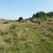
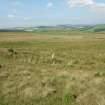
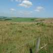
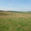
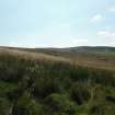
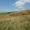
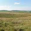
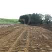
Archive from archaeological mitigation works at Clashindarroch Windfarm, Aberdeenshire
Reports from archaeological mitigation works at Clashindarroch Windfarm, Aberdeenshire
Photographs from archaeological mitigation works at Clashindarroch Windfarm, Aberdeenshire
