 |
On-line Digital Images |
DP 172383 |
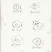
Survey plans of 6 chapels;
Cill Mhoire; Cill Eileagain, Mulreesh; Cill Choman; Kilslevan, Cill Slebhan; Duisker; Cill Eathain. |
c. 1980 |
Item Level |
|
Prints and Drawings |
DC 45 |
Distribution map of forts, broch, duns. Inv. p.21. RCAHMS |
c. 1984 |
Item Level |
|
Prints and Drawings |
DC 41 |
Distribution map of chambered cairns, cairns and barrows Inv p.6. RCAHMS |
c. 1984 |
Item Level |
|
Prints and Drawings |
DC 42 |
Distribution map of cists, standing stones, stone circles and cup-and-ring markings |
c. 1984 |
Item Level |
|
Prints and Drawings |
DC 43 |
Distribution map of Bronze Age pottery and metalwork Inv p.9. RCAHMS |
c. 1984 |
Item Level |
|
Prints and Drawings |
DC 40 |
Topographical map of islands Jura, Islay, Colonsay, Oronsay.
Inv.p.1. RCAHMS Copy in library.
(Currently missing - 31/5/96) |
|
Item Level |
|
Prints and Drawings |
DC 44 |
Distribution map of hut circles, field systems, settlement and burnt mounds.
Inv p.12 RCAHMS. Copy in library. |
c. 1984 |
Item Level |
|
Prints and Drawings |
AGD 816/2 |
Publication drawings; plans of Island dwellings, Loch Nan Deala and Loch Laingeadail, Islay.
|
1979 |
Item Level |
|
Prints and Drawings |
DC 3420 |
Chapels, Islay.
Survey plans of 6 chapels;
Cill Mhoire; Cill Eileagain, Mulreesh; Cill Choman; Kilslevan, Cill Slebhan; Duisker; Cill Eathain. |
c. 1980 |
Item Level |
|
Prints and Drawings |
DC 3422 |
Six publication drawings.
Titled:
1) 'Burial Ground, Cill a' Bhuilg, Islay'.Inv.321 c.1979
2) 'Chapel, Cill Catriona, Colonsay'.Inv.322 c.1978
3) 'Chapel and Burial Ground, Carn, Port Charlotte, Islay'. Inv.326 c.
4) 'Chapel, Cill Tobar Lasrach, Islay'. Inv.337 c.1978
5) 'Chapel,Cill Mhoire, Oronsay'. Inv.340 c.1973
6) 'Burial Ground, Gartacharra, Islay'. Inv.355 c.1979
Ink, paper. Scale 1:400.
|
c. 1979 |
Item Level |
|
Prints and Drawings |
DC 3419 |
4 Survey drawings of chapel site plan.
Bruichladdich Chapel; Duisker; Cill Mhoire; Craigens, Cill Eilehean. |
|
Item Level |
|
Photographs and Off-line Digital Images |
DC 45 P |
Distribution map of forts, broch, duns. Inv. p.21. RCAHMS |
c. 1984 |
Item Level |
|
Photographs and Off-line Digital Images |
DC 384 P |
Comparative plans of hut circles ink 1:400 RCAHMS Inv no 280 (Print filed NR45SW 3) |
|
Item Level |
|
Photographs and Off-line Digital Images |
DC 331 P |
Location map of monuments at Ardnave ink 1:10,000 RCAHMS Inv no. 241 and 242 |
1980 |
Item Level |
|
Photographs and Off-line Digital Images |
DC 327 P |
Comparative plan of hut circles ink 1:400 RCAHMS Inv no. 252 (Print filed NR44NW 8) |
|
Item Level |
|
Photographs and Off-line Digital Images |
DC 42 P |
Distribution map of cists, standing stones, stone circles and cup-and-ring markings |
c. 1984 |
Item Level |
|
Photographs and Off-line Digital Images |
DC 43 P |
Distribution map of Bronze Age pottery and metalwork Inv p.9. RCAHMS |
c. 1984 |
Item Level |
|
Photographs and Off-line Digital Images |
DC 41 P |
Distribution map of chambered cairns, barrows Inv p.6. RCAHMS |
|
Item Level |
|
Photographs and Off-line Digital Images |
DC 376 P |
Comparative hut circle plans 1:400 RCAHMS (Print Filed NR36SE 2) Inv no. 269 |
|
Item Level |
|
Photographs and Off-line Digital Images |
B 36915 |
4 Survey drawings.
1) Bruichladdich, Chapel and Burial Ground, Islay. Plan. c.1975
2) Islay, Craigens, Cill Eileagain, Chapel and Burial Ground, Islay. Plan. c.1975
3) Cill Mhoire, Lagavulin, Burial ground, Islay. Plan.
4) Duisber chapel and Burial Ground, plan c.1975.
|
10/5/1976 |
Item Level |
|
Photographs and Off-line Digital Images |
B 36914 P |
Cill Eileagain, Chapel and Burial Ground, Mulreesh, Islay.
Copy of survey drawing of 6 plans (published).
Titled: 'Duisker 225'; 'Kilslevan, Cill Slehbhan244' 'Cill Eathan 215' 'Cill Mhoire 221' 'Cill Eileagain, Mulkreesh 217'.
|
c. 1975 |
Item Level |


