 |
On-line Digital Images |
DP 393018 |
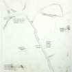
Overlay showing possible old watercourses in relation to modern features for Old Windsor, Kingsbury, Berkshire, England. |
12/1985 |
Item Level |
 |
On-line Digital Images |
DP 393019 |
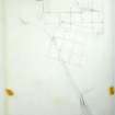
Overlay with grid and location of watercourse (Great Drain) for Old Windsor, Kingsbury, Berkshire, England. |
12/1985 |
Item Level |
 |
On-line Digital Images |
DP 393024 |
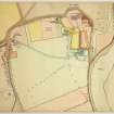
Map of area surrounding the Priory for Old Windsor, Kingsbury, Berkshire, England. |
|
Item Level |
 |
On-line Digital Images |
DP 394202 |
Grid overlay used in site plans for Old Windsor, Kingsbury, Berkshire, England. |
12/1985 |
Item Level |
 |
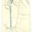
On-line Digital Images |
DP 393619 |
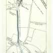
Plan of Great Ditch and other water features using 1912 OS map as base for Old Windsor, Kingsbury, Berkshire, England. |
6/1981 |
Item Level |
 |
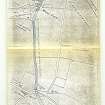
On-line Digital Images |
DP 393620 |
Photocopied plan of Great Ditch and other water features, with annotations, using 1912 OS map as base for Old Windsor, Kingsbury, Berkshire, England. |
6/1981 |
Item Level |
 |
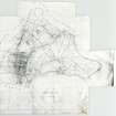
On-line Digital Images |
DP 393621 |
Photocopied plan of Great Ditch and other water features, with annotations, using 1912 OS map as base for Old Windsor, Kingsbury, Berkshire, England. |
6/1981 |
Item Level |
 |
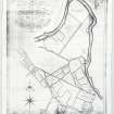
On-line Digital Images |
DP 394187 |
Map showing Enclosure Award for the Parish of New Windsor for Old Windsor, Kingsbury, Berkshire, England. |
1817 |
Item Level |
 |
On-line Digital Images |
DP 394188 |
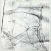
Estate Plan for the Historic Parish of Old Windsor, Kingsbury, Berkshire, England. |
1820 |
Item Level |
 |
On-line Digital Images |
DP 394189 |
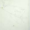
Enlarged copy of the 1842 Tithe Map for Old Windsor, Kingsbury, Berkshire, England. |
1842 |
Item Level |
 |
On-line Digital Images |
DP 394107 |
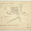
Overlay showing pipe trench and location of trees and other features around Priory for Old Windsor, Kingsbury, Berkshire, England. |
12/1985 |
Item Level |
 |
On-line Digital Images |
DP 394111 |
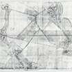
Ministry of Works (Ancient Monuments) plan showing location of trial trenches, Squares I-IV and AI-AV, Area A+I, GDI, GDIII (Butterfly A & B), and meggered area, including annotations for Old Windsor, Kingsbury, Berkshire, England. |
1953 |
Item Level |
 |
On-line Digital Images |
DP 394190 |
Photocopy of Tithe Map with water features coloured in for Old Windsor, Kingsbury, Berkshire, England. |
1842 |
Item Level |
|
Prints and Drawings |
DC 48996/1 |
Overlay showing possible old watercourses in relation to modern features for Old Windsor, Kingsbury, Berkshire, England. |
12/1985 |
Item Level |
|
Prints and Drawings |
DC 48997 |
Annotated 1971 OS Map (SU9875-9975) indicating extent of area fully investigated and aspects of the surrounding historic landscape for Old Windsor, Kingsbury, Berkshire, England. |
1/1983 |
Item Level |
|
Prints and Drawings |
DC 48998 |
Map of area surrounding the Priory for Old Windsor, Kingsbury, Berkshire, England. |
|
Item Level |
|
Prints and Drawings |
DC 49116/1 |
Drawing showing location of previous Geophysical Surveys superimposed on OS Map for Old Windsor, Kingsbury, Berkshire, England. |
11/1/1983 |
Item Level |
|
Prints and Drawings |
DC 49235 |
Map showing Enclosure Award for the Parish of New Windsor for Old Windsor, Kingsbury, Berkshire, England. |
1817 |
Item Level |
|
Prints and Drawings |
DC 49236 |
Estate Plan for the Historic Parish of Old Windsor, Kingsbury, Berkshire, England. |
1820 |
Item Level |
|
Prints and Drawings |
DC 49237 |
Enlarged copy of the 1842 Tithe Map for Old Windsor, Kingsbury, Berkshire, England. |
1842 |
Item Level |
|
Prints and Drawings |
DC 49238 |
Photocopy of Tithe Map with water features coloured in for Old Windsor, Kingsbury, Berkshire, England. |
1842 |
Item Level |
|
Prints and Drawings |
DC 49239 |
Photocopy of Ordnance Survey Map of Old Windsor Parish for Old Windsor, Kingsbury, Berkshire, England. |
|
Item Level |
|
Prints and Drawings |
DC 49240 |
Ordnance Survey Map of the area surrounding Manor Farm for Old Windsor, Kingsbury, Berkshire, England. |
1880 |
Item Level |
|
Prints and Drawings |
DC 49241 |
Ordnance Survey Map with water features coloured in for Old Windsor, Kingsbury, Berkshire, England. |
1880 |
Item Level |


