Pricing Change
New pricing for orders of material from this site will come into place shortly. Charges for supply of digital images, digitisation on demand, prints and licensing will be altered.
Upcoming Maintenance
Please be advised that this website will undergo scheduled maintenance on the following dates:
Thursday, 9 January: 11:00 AM - 3:00 PM
Thursday, 23 January: 11:00 AM - 3:00 PM
Thursday, 30 January: 11:00 AM - 3:00 PM
During these times, some functionality such as image purchasing may be temporarily unavailable. We apologise for any inconvenience this may cause.
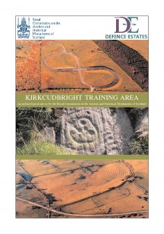
RCAHMS Archaeological Survey - Kirkcudbright Training Area - Survey Report
WP 007324
Description RCAHMS Archaeological Survey - Kirkcudbright Training Area - Survey Report
Date 19/9/2003
Collection Records of the Royal Commission on the Ancient and Historical Monuments of Scotland (RCAHMS), Edinbu
Catalogue Number WP 007324
Category Digital Files (Non-image)
Scope and Content This report outlines the results of an archaeological survey undertaken by the Royal Commission on the Ancient and Historical Monuments of Scotland (RCAHMS) of the Kirkcudbright Training Area (KTA), Dumfries and Galloway, in 2002 – 3. The survey follows an approach by MOD/Defence Estates (DE) to provide, in partnership, a baseline survey to enhance the historic component of the Land Management Plan for the KTA. The survey set out to record all visible archaeological features, including all relict military features as well as traditional archaeological monuments. In addition, all boundary features were characterised and the condition of the archaeological monuments assessed. The KTA covers some 19 km² of predominately south-facing ground on a promontory protruding into the Solway to the south of the county town of Kirkcudbright. The area was acquired by the War Department in 1942, taking in a series of lowland farms with an emphasis on stock raising. The promontory is dissected by watercourses, generally trending north to south trending and separated by low undulating ridges and hills, rising to a local high point on Brown Hill of just under 160m OD. The coastline is rocky and low cliffs extend along most of the coastline, broken by more dramatic cliffs up to 70m in height at Big Raeberry.
Permalink http://canmore.org.uk/collection/2120618
File Format (PDF) Adobe Acrobat document
Attribution: © Crown Copyright: HES
Licence Type: Internally Generated
You may: copy, display, store and make derivative works [eg documents] solely for licensed personal use at home or solely for licensed educational institution use by staff and students on a secure intranet.
Under these conditions: Display Attribution, No Commercial Use or Sale, No Public Distribution [eg by hand, email, web]


