 |
On-line Digital Images |
DP 163211 |
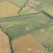
Oblique aerial view of the cropmarks of the enclosures and round houses, looking NNE. |
27/7/2013 |
Item Level |
 |
On-line Digital Images |
DP 163212 |
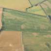
Oblique aerial view of the cropmarks of the enclosures and round houses, looking N. |
27/7/2013 |
Item Level |
 |
On-line Digital Images |
DP 163213 |
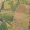
Oblique aerial view of the cropmarks of the rig, looking SSE. |
27/7/2013 |
Item Level |
 |
On-line Digital Images |
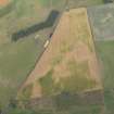
DP 163214 |
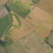
Oblique aerial view of the cropmarks of the rig, looking SE. |
27/7/2013 |
Item Level |
 |
On-line Digital Images |
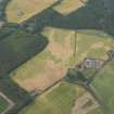
DP 163215 |
Oblique aerial view of the cropmarks of the rig, looking ENE. |
27/7/2013 |
Item Level |
 |
On-line Digital Images |
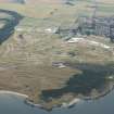
DP 163216 |
Oblique aerial view of St Ford farmsteading and the cropmarks of the rig, looking SSE. |
27/7/2013 |
Item Level |
 |
On-line Digital Images |
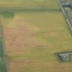
DP 163217 |
Oblique aerial view of Muirfield golf course showing the set up for the Open Championship 2013 with Gullane beyond, looking SSE. |
27/7/2013 |
Item Level |
 |
On-line Digital Images |
DP 163219 |
Oblique aerial view of the cropmarks of the possible building, the enclosure and the possible frost wedges, looking NNW. |
27/7/2013 |
Item Level |
 |
On-line Digital Images |
DP 163221 |
Oblique aerial view of the cropmarks of the possible building, the enclosure and the possible frost wedges, lookingSW. |
27/7/2013 |
Item Level |
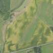 |
On-line Digital Images |
DP 163224 |
Oblique aerial view of the cropmarks of the linear feature, looking W. |
27/7/2013 |
Item Level |
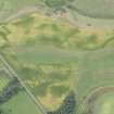 |
On-line Digital Images |
DP 163226 |
Oblique aerial view of the cropmarks of the settlment and the linear feature, looking N. |
27/7/2013 |
Item Level |
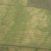 |
On-line Digital Images |
DP 163228 |
Oblique aerial view of the cropmarks of the settlement enclosure and the possible round house, looking WSW. |
27/7/2013 |
Item Level |
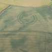 |
On-line Digital Images |
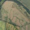
DP 163230 |
Oblique aerial view of the cropmarks of the fort at The Chesters, Spott, looking SW. |
27/7/2013 |
Item Level |
 |
On-line Digital Images |
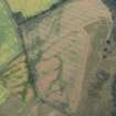
DP 163233 |
Oblique aerial view of the cropmarks of the forts on Doon Hill, looking W. |
27/7/2013 |
Item Level |
 |
On-line Digital Images |
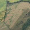
DP 163235 |
Oblique aerial view of the cropmarks of the forts on Doon Hill, looking SW. |
27/7/2013 |
Item Level |
 |
On-line Digital Images |
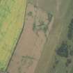
DP 163236 |
Oblique aerial view of the cropmarks of the forts on Doon Hill, looking SSW. |
27/7/2013 |
Item Level |
 |
On-line Digital Images |
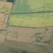
DP 163238 |
Oblique aerial view of the cropmarks of the settlement, looking W. |
27/7/2013 |
Item Level |
 |
On-line Digital Images |
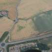
DP 163240 |
Oblique aerial view of the cropmarks of the settlement, looking SSE. |
27/7/2013 |
Item Level |
 |
On-line Digital Images |
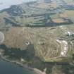
DP 163243 |
Oblique aerial view of the cropmarks of the enclosure with Easter Broomhouse farmstead beyond, looking SSW. |
27/7/2013 |
Item Level |
 |
On-line Digital Images |
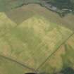
DP 163246 |
General oblique aerial view of Muirfield golf course showing the set up for the Open Championship 2013, looking ENE. |
27/7/2013 |
Item Level |
 |
On-line Digital Images |
DP 163249 |
Oblique aerial view of the cropmarks of the settlement enclosure and the possible round house, looking NNW. |
27/7/2013 |
Item Level |
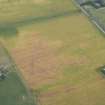 |
On-line Digital Images |
DP 163218 |
Oblique aerial view of the cropmarks of the possible building, the enclosure and the possible frost wedges, looking N. |
27/7/2013 |
Item Level |
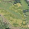 |
On-line Digital Images |
DP 163223 |
Oblique aerial view of the cropmarks of the settlment and the linear feature, looking N. |
27/7/2013 |
Item Level |
 |
On-line Digital Images |
DP 163242 |
Oblique aerial view of the cropmarks of the pit-defined boundary, looking N. |
27/7/2013 |
Item Level |


