|
Digital Files (Non-image) |
TM 000834 |
GPS recorded flight path and map for Sortie 2013/32 |
27/7/2013 |
Item Level |
 |
On-line Digital Images |
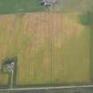
DP 163220 |
Oblique aerial view of the cropmarks of the possible building, the enclosure and the possible frost wedges, looking WSW. |
27/7/2013 |
Item Level |
 |
On-line Digital Images |
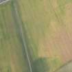
DP 163222 |
Oblique aerial view of the cropmarks of the possible building, the enclosure and the possible frost wedges, looking SW. |
27/7/2013 |
Item Level |
 |
On-line Digital Images |
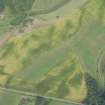
DP 163225 |
Oblique aerial view of the cropmarks of the settlment and the linear feature, looking N. |
27/7/2013 |
Item Level |
 |
On-line Digital Images |
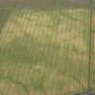
DP 163227 |
Oblique aerial view of the cropmarks of the settlement enclosure and the possible round house, looking NNW. |
27/7/2013 |
Item Level |
 |
On-line Digital Images |
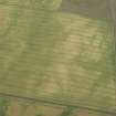
DP 163229 |
Oblique aerial view of the cropmarks of the settlement enclosure and the possible round house, looking SW. |
27/7/2013 |
Item Level |
 |
On-line Digital Images |
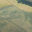
DP 163231 |
Oblique aerial view of the cropmarks of the fort at The Chesters, Spott, looking S. |
27/7/2013 |
Item Level |
 |
On-line Digital Images |
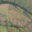
DP 163232 |
Oblique aerial view of the cropmarks of the forts on Doon Hill, looking NW. |
27/7/2013 |
Item Level |
 |
On-line Digital Images |
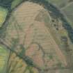
DP 163234 |
Oblique aerial view of the cropmarks of the forts on Doon Hill, looking WSW. |
27/7/2013 |
Item Level |
 |
On-line Digital Images |
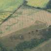
DP 163237 |
Oblique aerial view of the cropmarks of the forts on Doon Hill, looking SSE. |
27/7/2013 |
Item Level |
 |
On-line Digital Images |
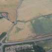
DP 163244 |
Oblique aerial view of the cropmarks of the enclosure with Easter Broomhouse farmstead beyond, looking SSW. |
27/7/2013 |
Item Level |
 |
On-line Digital Images |
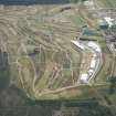
DP 163247 |
oblique aerial view of Muirfield golf course showing the set up for the Open Championship 2013, looking E. |
27/7/2013 |
Item Level |
 |
On-line Digital Images |
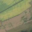
DP 163239 |
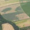
Oblique aerial view of the cropmarks of the settlement, looking SW. |
27/7/2013 |
Item Level |
 |
On-line Digital Images |
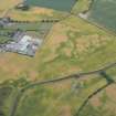
DP 163241 |
Oblique aerial view of the cropmarks of the pit-defined boundary, looking NNE. |
27/7/2013 |
Item Level |
 |
On-line Digital Images |
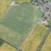
DP 163196 |
Oblique aerial view of the cropmarks of the possible henge, looking SW. |
27/7/2013 |
Item Level |
 |
On-line Digital Images |
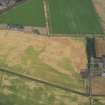
DP 163197 |
Oblique aerial view of the cropmarks of the rig, looking SSE. |
27/7/2013 |
Item Level |
 |
On-line Digital Images |
DP 163198 |
Oblique aerial view of the cropmarks of the rig, looking SSE. |
27/7/2013 |
Item Level |
 |
On-line Digital Images |
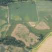
DP 163199 |
Oblique aerial view of the cropmarks of the possible round houses, looking NNW. |
27/7/2013 |
Item Level |
 |
On-line Digital Images |
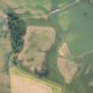
DP 163201 |
Oblique aerial view of the cropmarks of the possible round houses, the enclosures and the rig, looking WSW. |
27/7/2013 |
Item Level |
 |
On-line Digital Images |
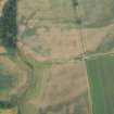
DP 163203 |
Oblique aerial view of the cropmarks of the round houses, looking ENE. |
27/7/2013 |
Item Level |
 |
On-line Digital Images |
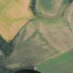
DP 163205 |
Oblique aerial view of the cropmarks of the round houses, looking N. |
27/7/2013 |
Item Level |
 |
On-line Digital Images |
DP 163207 |
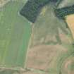
Oblique aerial view of the cropmarks of the round houses, looking WSW. |
27/7/2013 |
Item Level |
 |
On-line Digital Images |
DP 163208 |
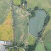
Oblique aerial view of the cropmarks of the pit and the possible enclosure at Dairsie, looking NNE. |
27/7/2013 |
Item Level |
 |
On-line Digital Images |
DP 163209 |
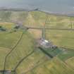
Oblique aerial view of Easter Kincaple farmsteading and the cropmarks of the rig, looking NNE. |
27/7/2013 |
Item Level |


