 |
On-line Digital Images |
SC 1009479 |
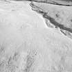
Oblique aerial view centred on the remains of a settlement, ring ditches and field system at Burn of Mannie, looking to the ESE. |
25/1/1985 |
Item Level |
 |
On-line Digital Images |
SC 1009480 |
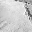
Oblique aerial view centred on the remains of a settlement, ring ditches and field system at Burn of Mannie, looking to the ESE. |
25/1/1985 |
Item Level |
 |
On-line Digital Images |
SC 1009481 |
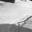
Oblique aerial view centred on the remains of a settlement, ring ditches and field system at Burn of Mannie, looking to the ENE. |
25/1/1985 |
Item Level |
 |
On-line Digital Images |
SC 1009482 |
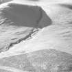
Oblique aerial view centred on the remains of a settlement, ring ditches and field system at Burn of Mannie, looking to the W. |
25/1/1985 |
Item Level |
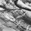 |
On-line Digital Images |
SC 1009486 |
Oblique aerial view centred on the remains of hut circles at Cornescorn, looking to the N. |
25/1/1985 |
Item Level |
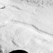 |
On-line Digital Images |
SC 1009497 |
Oblique aerial view centred on the remains of ring ditches, cairnfield and field system at White Caterthun, looking to the NE. |
25/1/1985 |
Item Level |
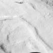 |
On-line Digital Images |
SC 1009498 |
Oblique aerial view centred on the remains of ring ditches, cairnfield and field system at White Caterthun, looking to the NE. |
25/1/1985 |
Item Level |
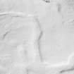 |
On-line Digital Images |
SC 1009499 |
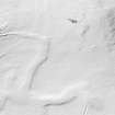
Oblique aerial view centred on the remains of ring ditches, cairnfield and field system at White Caterthun, looking to the NE. |
25/1/1985 |
Item Level |
 |
On-line Digital Images |
SC 1009500 |
Oblique aerial view centred on the remains of ring ditches, cairnfield and field system at White Caterthun, looking to the NE. |
25/1/1985 |
Item Level |
 |
On-line Digital Images |
SC 1009501 |
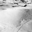
Oblique aerial view centred on the remains of ring ditches, cairnfield and field system at White Caterthun, looking to the N. |
25/1/1985 |
Item Level |
 |
On-line Digital Images |
SC 1009503 |
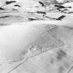
Oblique aerial view centred on the remains of the fort at Brown Caterthun, looking to the NW. |
25/1/1985 |
Item Level |
 |
On-line Digital Images |
SC 1009504 |
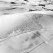
Oblique aerial view centred on the remains of the fort at Brown Caterthun, looking to the WNW. |
25/1/1985 |
Item Level |
 |
On-line Digital Images |
SC 1009505 |
Oblique aerial view centred on the remains of the fort at Brown Caterthun, looking to the W. |
25/1/1985 |
Item Level |
 |
On-line Digital Images |
SC 1009506 |
Oblique aerial view centred on the remains of a field system and enclosures at Jacksbank, looking to the W. |
25/1/1985 |
Item Level |
 |
On-line Digital Images |
SC 1009507 |
Oblique aerial view centred on the remains of a field system and enclosures at Jacksbank, looking to the WSW. |
25/1/1985 |
Item Level |
 |
On-line Digital Images |
SC 1009508 |
Oblique aerial view centred on the remains of a field system and enclosures at Jacksbank, looking to the SSW. |
25/1/1985 |
Item Level |
 |
On-line Digital Images |
SC 1009509 |
Oblique aerial view centred on the remains of a field system and enclosures at Jacksbank, looking to the SSE. |
25/1/1985 |
Item Level |
 |
On-line Digital Images |
SC 1009510 |
Oblique aerial view centred on the remains of an earthwork and possible fort at Broad Haven, Mains of Portlethen, looking to the W. |
25/1/1985 |
Item Level |
 |
On-line Digital Images |
SC 1009511 |
Oblique aerial view centred on the remains of an earthwork and possible fort at Broad Haven, Mains of Portlethen, looking to the W. |
25/1/1985 |
Item Level |
 |
On-line Digital Images |
SC 1009432 |
Oblique aerial view centred on the remains of a motte at Loch Kinord, looking to the ESE. |
25/1/1985 |
Item Level |
 |
On-line Digital Images |
SC 1009433 |
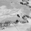
Oblique aerial view centred on the remains of a motte at Loch Kinord, looking to the ENE. |
25/1/1985 |
Item Level |
 |
On-line Digital Images |
SC 1009434 |
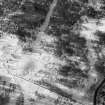
Oblique aerial view centred on the remains of a motte at Loch Kinord, looking to the NE. |
25/1/1985 |
Item Level |
 |
On-line Digital Images |
SC 1009435 |
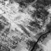
Oblique aerial view centred on the remains of hut circles, enclosures and a field system at New Kinord, looking to the WNW. |
25/1/1985 |
Item Level |
 |
On-line Digital Images |
SC 1009451 |
Oblique aerial view centred on the remains of hut circles, enclosures and a field system at New Kinord, looking to the WSW. |
25/1/1985 |
Item Level |


