 |
On-line Digital Images |
SC 1008447 |
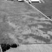
Oblique aerial view centred on the cropmarks of the ring ditch house, pits and rig, looking to the SSE. |
18/7/1984 |
Item Level |
 |
On-line Digital Images |
SC 1008458 |
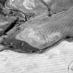
Oblique aerial view centred on the cropmarks of the promontory fort, looking to the SW. |
18/7/1984 |
Item Level |
 |
On-line Digital Images |
SC 1008459 |
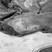
Oblique aerial view centred on the cropmarks of the promontory fort, looking to the SSW. |
18/7/1984 |
Item Level |
 |
On-line Digital Images |
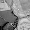
SC 1014615 |
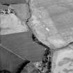
Oblique aerial view of the cropmarks of the enclosure at West Mains of Colliston with the cropmarks at Newton in the foreground, looking to the WSW. |
18/7/1984 |
Item Level |
 |
On-line Digital Images |
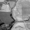
SC 1014616 |
Oblique aerial view of the cropmarks of the enclosure at West Mains of Colliston with the cropmarks at Newton in the foreground, looking to the SW. |
18/7/1984 |
Item Level |
 |
On-line Digital Images |
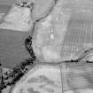
SC 1014622 |
Oblique aerial view of the cropmarks of the enclosure at West Mains of Colliston with the cropmarks at Newton in the foreground, looking to the SSW. |
18/7/1984 |
Item Level |
 |
On-line Digital Images |
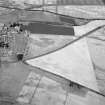
SC 1014641 |
Oblique aerial view of the cropmarks of the enclosure at West Mains of Colliston with the cropmarks at Newton in the foreground, looking to the SSW. |
18/7/1984 |
Item Level |
 |
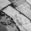
On-line Digital Images |
SC 1014652 |
General oblique aerial view of the roughly circular enclosure, looking to the NW. |
18/7/1984 |
Item Level |
 |
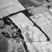
On-line Digital Images |
SC 1014653 |
Oblique aerial view of the cropmarks of the unenclosed settlement at Priestfield, with Anniston House adjacent, looking to the W. |
18/7/1984 |
Item Level |
 |
On-line Digital Images |
SC 1014654 |
Oblique aerial view of the cropmarks of the unenclosed settlement at Priestfield, with Anniston House adjacent, looking to the W. |
18/7/1984 |
Item Level |
 |
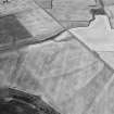
On-line Digital Images |
SC 1014658 |
Oblique aerial view of the cropmarks of the unenclosed settlement at Newbarns, looking to the NW. |
18/7/1984 |
Item Level |
 |
On-line Digital Images |
SC 1014659 |
Oblique aerial view of the cropmarks of the unenclosed settlement at Newbarns, looking to the W. |
18/7/1984 |
Item Level |
 |
On-line Digital Images |
SC 1014660 |
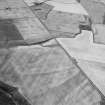
Oblique aerial view of the cropmarks of the unenclosed settlement at Newbarns, looking to the WSW. |
18/7/1984 |
Item Level |
 |
On-line Digital Images |
SC 1014661 |
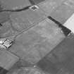
Oblique aerial view of the cropmarks of the enclosure at Ethie Castle, looking to the WNW. |
18/7/1984 |
Item Level |
 |
On-line Digital Images |
SC 1014662 |
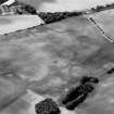
Oblique aerial view of the cropmarks of the enclosure, barrow, rig and plantation banks at Langleypark, looking to the SSW. |
18/7/1984 |
Item Level |
 |
On-line Digital Images |
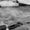
SC 1014663 |
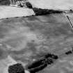
Oblique aerial view of the cropmarks of the enclosure, barrow, rig and plantation banks at Langleypark, looking to the S. |
18/7/1984 |
Item Level |
 |
On-line Digital Images |
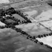
SC 1014664 |
Oblique aerial view of the cropmarks of the enclosure, barrow, rig and plantation banks at Langleypark, looking to the S. |
18/7/1984 |
Item Level |
 |
On-line Digital Images |
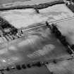
SC 1014665 |
Oblique aerial view of the cropmarks of the unenclosed settlements and barrow at West Broomley, looking to the S. |
18/7/1984 |
Item Level |
 |
On-line Digital Images |
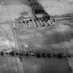
SC 1014666 |
Oblique aerial view of the cropmarks of the ring ditches and rig at West Broomley and Angus Nurseries, looking to the S. |
18/7/1984 |
Item Level |
 |
On-line Digital Images |
SC 1014667 |
Oblique aerial view of the cropmarks of the ring ditches and rig at West Broomley, looking to the S. |
18/7/1984 |
Item Level |
 |
On-line Digital Images |
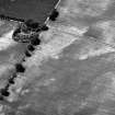
SC 1014668 |
Unidentified oblique aerial view (A.A.S. 1984) |
18/7/1984 |
Item Level |
 |
On-line Digital Images |
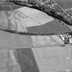
SC 1014407 |
General oblique aerial view looking across the site of the pit-defined cursus towards Friockheim, looking to the ESE. |
18/7/1984 |
Item Level |
 |
On-line Digital Images |
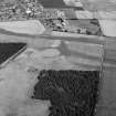
SC 1014408 |
General oblique aerial view of Friockheim, looking to the NNE. |
18/7/1984 |
Item Level |
 |
On-line Digital Images |
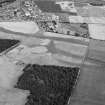
SC 1014409 |
General oblique aerial view of Friockheim, looking to the N. |
18/7/1984 |
Item Level |


