 |
On-line Digital Images |
SC 1007753 |
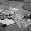
General oblique aerial view centred on the cropmarks of the barrow, enclosures, roundhouses, souterrain, pits and rig at Hatton of Fintray with the village adjacent, looking to the ESE. |
7/7/1984 |
Item Level |
 |
On-line Digital Images |
SC 1007754 |
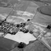
General oblique aerial view centred on the cropmarks of the barrow, enclosures, roundhouses, souterrain, pits and rig at Hatton of Fintray with the village adjacent, looking to the SSE. |
7/7/1984 |
Item Level |
 |
On-line Digital Images |
SC 1007634 |
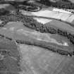
Oblique aerial view centred on the cropmarks of the possible ring ditches, circular and rectlinear enclosure, pits and linear features at Meadowheads, looking to the NNE. |
7/7/1984 |
Item Level |
 |
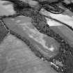
On-line Digital Images |
SC 1007635 |
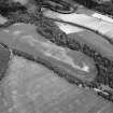
Oblique aerial view centred on the cropmarks of the possible ring ditches, circular and rectlinear enclosure, pits and linear features at Meadowheads, looking to the N. |
7/7/1984 |
Item Level |
 |
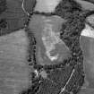
On-line Digital Images |
SC 1007636 |
Oblique aerial view centred on the cropmarks of the possible ring ditches, circular and rectlinear enclosure, pits and linear features at Meadowheads, looking to the N. |
7/7/1984 |
Item Level |
 |
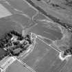
On-line Digital Images |
SC 1007637 |
Oblique aerial view centred on the cropmarks of the possible ring ditches, circular and rectlinear enclosure, pits and linear features at Meadowheads, looking to the NW. |
7/7/1984 |
Item Level |
 |
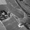
On-line Digital Images |
SC 1007638 |
Oblique aerial view centred on the cropmarks of the unenclosed settlement, ring ditches, possible roundhouses and pits at Auldtown of Netherdale, looking to the E. |
7/7/1984 |
Item Level |
 |
On-line Digital Images |
SC 1007639 |
Oblique aerial view centred on the cropmarks of the unenclosed settlement, ring ditches, possible roundhouses and pits at Auldtown of Netherdale, looking to the ENE. |
7/7/1984 |
Item Level |
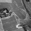 |
On-line Digital Images |
SC 1007647 |
Oblique aerial view centred on the cropmarks of the unenclosed settlement, ring ditches, possible roundhouses and pits at Auldtown of Netherdale, looking to the ENE. |
7/7/1984 |
Item Level |
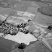 |
On-line Digital Images |
SC 1007767 |
General oblique aerial view centred on the cropmarks of the barrow, enclosures, roundhouses, souterrain, pits and rig at Hatton of Fintray with the village adjacent, looking to the ESE. |
7/7/1984 |
Item Level |
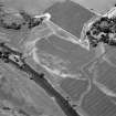 |
On-line Digital Images |
SC 1007648 |
Oblique aerial view centred on the cropmarks of the unenclosed settlement, ring ditches, possible roundhouses and pits at Auldtown of Netherdale, looking to the WNW. |
7/7/1984 |
Item Level |
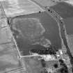 |
On-line Digital Images |
SC 1007650 |
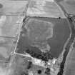
Oblique aerial view centred on the cropmarks of the frost wedge polygons at Backwood Hill, looking to the NNE. |
7/1984 |
Item Level |
 |
On-line Digital Images |
SC 1007661 |
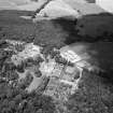
blique aerial view centred on the cropmarks of the frost wedge polygons at Backwood Hill, looking to the NNE. |
7/1984 |
Item Level |
 |
On-line Digital Images |
SC 1007663 |
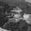
Oblique aerial view centred on Crathes Castle and gardens with the cropmarks of the pit alignment and timber hall adjacent, looking to the NNE. |
7/7/1984 |
Item Level |
 |
On-line Digital Images |
SC 1007664 |
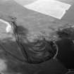
Oblique aerial view centred on Crathes Castle and gardens with the cropmarks of the pit alignment and timber hall adjacent, looking to the NNW. |
7/7/1984 |
Item Level |
 |
On-line Digital Images |
SC 1007673 |
Oblique aerial view centred on the remains of a pit alignment, rig and enclosures at Corbie's Pot with a possible souterrain at Mill of Mondynes adjacent, looking to the ENE. |
7/7/1984 |
Item Level |
 |
On-line Digital Images |
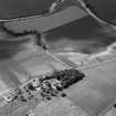
SC 1007471 |
Oblique aerial view centred on the cropmarks of an enclosure, ring ditches, field system and pits at Wester Fintray, looking to the SW. |
5/7/1984 |
Item Level |
 |
On-line Digital Images |
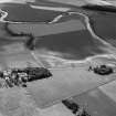
SC 1007474 |
Oblique aerial view centred on the cropmarks of an enclosure, ring ditches, field system and pits at Wester Fintray, looking to the SSW. |
5/7/1984 |
Item Level |
 |
On-line Digital Images |
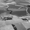
SC 1007478 |
Oblique aerial view centred on the cropmarks of an enclosure, ring ditches, field system and pits at Wester Fintray, looking to the S. |
5/7/1984 |
Item Level |
 |
On-line Digital Images |
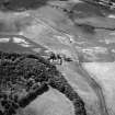
SC 1007486 |
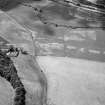
Oblique aerial view centred on the cropmarks of the enclosure, rig, pits and possible rectangular buildings, looking to the S. |
5/7/1984 |
Item Level |
 |
On-line Digital Images |
SC 1007487 |
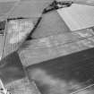
Oblique aerial view centred on the cropmarks of the enclosure, rig, pits and possible rectangular buildings at Legatesden, looking to the S. |
5/7/1984 |
Item Level |
 |
On-line Digital Images |
SC 1007490 |
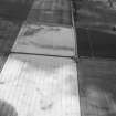
Oblique aerial view centred on the cropmarks of ring ditches, a roundhouse and possible souterrain at Hill of Newleslie and Littlemill, looking to the W. |
5/7/1984 |
Item Level |
 |
On-line Digital Images |
SC 1007687 |
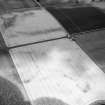
Oblique aerial view centred on the cropmarks of a palisaded enclosure, ring ditches, pits and rig at Suttie, looking to the NNW. |
7/7/1984 |
Item Level |
 |
On-line Digital Images |
SC 1007688 |
Oblique aerial view centred on the cropmarks of a palisaded enclosure, ring ditches, pits and rig at Suttie, looking to the N. |
7/7/1984 |
Item Level |


