 |
On-line Digital Images |
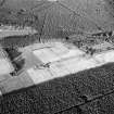
SC 1005272 |
Oblique aerial view centred on the cropmarks of ring ditches at Inglismaldie, looking to the ENE. |
27/7/1983 |
Item Level |
 |
On-line Digital Images |
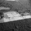
SC 1005273 |
Oblique aerial view centred on the cropmarks of ring ditches at Inglismaldie, looking to the ENE. |
27/7/1983 |
Item Level |
 |
On-line Digital Images |
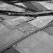
SC 1005283 |
Oblique aerial view centred on the cropmarks of possible ring ditches at Inglismaldie, looking to the NE. |
29/7/1983 |
Item Level |
 |
On-line Digital Images |
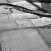
SC 1005284 |
Oblique aerial view centred on the cropmarks of possible ring ditches at Inglismaldie, looking to the NNW. |
29/7/1983 |
Item Level |
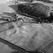 |
On-line Digital Images |
SC 1005286 |
Oblique aerial view centred on the cropmarks of a possible ring ditch with Edzell Castle and gardens adjacent, looking to the SSW. |
29/7/1983 |
Item Level |
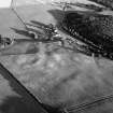 |
On-line Digital Images |
SC 1005287 |
Oblique aerial view centred on the cropmarks of a possible ring ditch with Edzell Castle and gardens adjacent, looking to the S. |
29/7/1983 |
Item Level |
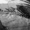 |
On-line Digital Images |
SC 1005288 |
Oblique aerial view centred on the cropmarks of a possible ring ditch with Edzell Castle and gardens adjacent, looking to the SE. |
29/7/1983 |
Item Level |
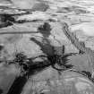 |
On-line Digital Images |
SC 1005289 |
Oblique aerial view centred on the cropmarks of the frost wedge polygons and field boundaries at Clochie, looking to the ENE. |
29/7/1983 |
Item Level |
 |
On-line Digital Images |
SC 1005290 |
Oblique aerial view centred on the remains of ring ditch houses at White Caterthun, looking to the E. |
|
Item Level |
 |
On-line Digital Images |
SC 1005291 |
Oblique aerial view centred on the remains of ring ditch houses at White Caterthun, looking to the E. |
|
Item Level |
 |
On-line Digital Images |
SC 1005292 |
General oblique aerial view centred on the remains of ring ditch houses at White Caterthun, looking to the NNE. |
|
Item Level |
 |
On-line Digital Images |
SC 1005293 |
Oblique aerial view centred on the remains of Kemp's Castle fort at Turin Hill, looking to the NNE. |
29/7/1983 |
Item Level |
 |
On-line Digital Images |
SC 1005294 |
Oblique aerial view centred on the remains of Kemp's Castle fort at Turin Hill, looking to the WSW. |
29/7/1983 |
Item Level |
 |
On-line Digital Images |
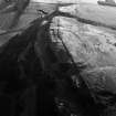
SC 1005295 |
Oblique aerial view centred on the remains of Kemp's Castle fort at Turin Hill, looking to the WSW. |
29/7/1983 |
Item Level |
 |
On-line Digital Images |
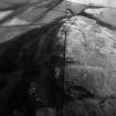
SC 1005306 |
Oblique aerial view centred on the remains of Kemp's Castle fort at Turin Hill, looking to the SW. |
29/7/1983 |
Item Level |
 |
On-line Digital Images |
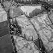
SC 1005307 |
Oblique aerial view centred on the cropmarks of an enclosure, pit alignment and rig at Damside, looking to the ESE. |
29/7/1983 |
Item Level |
 |
On-line Digital Images |
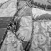
SC 1005308 |
Oblique aerial view centred on the cropmarks of an enclosure, pit alignment and rig at Damside, looking to the ESE. |
29/7/1983 |
Item Level |
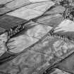 |
On-line Digital Images |
SC 1005310 |
Oblique aerial view centred on the cropmarks of an enclosure, pit alignment and rig at Damside, looking to the ENE. |
29/7/1983 |
Item Level |
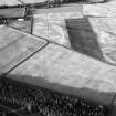 |
On-line Digital Images |
SC 1005317 |
Oblique aerial view centred on the cropmarks of the unenclosed settlement, possible souterrain and rig, looking to the ENE. |
29/7/1983 |
Item Level |
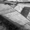 |
On-line Digital Images |
SC 1005318 |
Oblique aerial view centred on the cropmarks of the unenclosed settlement, possible souterrain and rig, looking to the ENE. |
29/7/1983 |
Item Level |
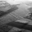 |
On-line Digital Images |
SC 1005319 |
Oblique aerial view centred on the cropmarks of the unenclosed settlement, possible souterrain and rig, looking to the NNW. |
29/7/1983 |
Item Level |
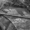 |
On-line Digital Images |
SC 1005320 |
Oblique aerial view centred on the cropmarks of the unenclosed settlement, ring ditches, pits, possible souterrain and rig at Dryleys and Dubton, looking to the NNE. |
29/7/1983 |
Item Level |
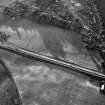 |
On-line Digital Images |
SC 1005321 |
Oblique aerial view centred on the cropmarks of the unenclosed settlement, ring ditches, pits, possible souterrain and rig at Dryleys and Dubton, looking to the NNW. |
29/7/1983 |
Item Level |
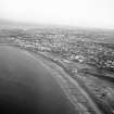 |
On-line Digital Images |
SC 1005322 |
Oblique aerial view centred on Aberdeen beach, groynes and amusement park, looking to the S. |
29/7/1983 |
Item Level |


