551 7224/8/11
Description Aerial photographic sortie 1983/11
Collection Records of Aberdeen Aerial Surveys, Aberdeen, Scotland
Catalogue Number 551 7224/8/11
Category All Other
Accession Number 2005/218
Permalink http://canmore.org.uk/collection/1336509
Collection Hierarchy - Sub-Group Level
Collection Level (551 193) Records of Aberdeen Aerial Surveys, Aberdeen, Scotland
> Group Level (551 193/8) Aerial Photographic Survey 1983
>> Sub-Group Level (551 7224/8/11) Aerial photographic sortie 1983/11
| Preview | Category | Catalogue Number | Title | Date | Level |
|---|---|---|---|---|---|
 |
On-line Digital Images | SC 1005219 | Oblique aerial view centred on the cropmarks of the unenclosed settlement at Wester Sinnahard, looking to the SSE. | 27/7/1983 | Item Level |
 |
On-line Digital Images | SC 1005220 | Oblique aerial view centred on the cropmarks of the unenclosed settlement at Wester Sinnahard, looking to the ESE. | 27/7/1983 | Item Level |
 |
On-line Digital Images | SC 1005222 | Oblique aerial view centred on the cropmarks of a possible enclosure at Linnorie, Huntly, looking to the SSE. | 27/7/1983 | Item Level |
 |
On-line Digital Images | SC 1005225 | Unidentified | 27/7/1983 | Item Level |
 |
On-line Digital Images | SC 1005227 | Oblique aerial view centred on the cropmarks of the palisaded enclosure at Colpy with the farmstead at Waulkmill adjacent, looking to the WSW. | 27/7/1983 | Item Level |
 |
On-line Digital Images | SC 1005228 | Oblique aerial view centred on the cropmarks of the palisaded enclosure at Colpy with the farmstead at Waulkmill adjacent, looking to the SW. | 27/7/1983 | Item Level |
 |
On-line Digital Images | SC 1005229 | Oblique aerial view centred on the cropmarks of the palisaded enclosure at Colpy with the farmstead at Waulkmill adjacent, looking to the SW. | 27/7/1983 | Item Level |
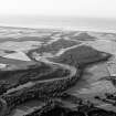 |
On-line Digital Images | SC 1005237 | General oblique aerial view centred on the River Spey, looking to the N. | 27/7/1983 | Item Level |
 |
On-line Digital Images | SC 1005239 | General oblique aerial view centred on the River Spey, looking to the N. | 27/7/1983 | Item Level |
 |
On-line Digital Images | SC 1005240 | Unidentified oblique aerial view (A.A.S 1983). | 27/7/1983 | Item Level |
 |
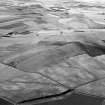
On-line Digital Images | SC 1005241 | Oblique aerial view centred on the remains of the fort at Hill of Newleslie, looking to the NE. | 27/7/1983 | Item Level |
 |
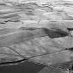
On-line Digital Images | SC 1005243 | Oblique aerial view centred on the remains of the fort at Hill of Newleslie, looking to the ENE. | 27/7/1983 | Item Level |
 |
On-line Digital Images | SC 1005244 | Oblique aerial view centred on the remains of the fort at Hill of Newleslie, looking to the NE. | 27/7/1983 | Item Level |
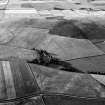 |
On-line Digital Images | SC 1005246 | Oblique aerial view centred on the cropmarks of the unenclosed settlement and ring ditches at Littlemill with the farmstead at Cotetown adjacent, looking to the NE. | 27/7/1983 | Item Level |
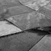 |
On-line Digital Images | SC 1005247 | Oblique aerial view centred on the cropmarks of the unenclosed settlement and ring ditches at Littlemill with the farmstead at Cotetown adjacent, looking to the SW. | 27/7/1983 | Item Level |
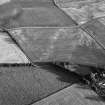 |
On-line Digital Images | SC 1005248 | Oblique aerial view centred on the cropmarks of the unenclosed settlement and ring ditches at Littlemill with the farmstead at Cotetown adjacent, looking to the SW. | 27/7/1983 | Item Level |
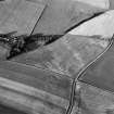 |
On-line Digital Images | SC 1005249 | Oblique aerial view centred on the cropmarks of the unenclosed settlement and ring ditches at Littlemill with the farmstead at Cotetown adjacent, looking to the ENE. | 27/7/1983 | Item Level |
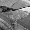 |
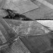
On-line Digital Images | SC 1005250 | Oblique aerial view centred on the cropmarks of the unenclosed settlement and ring ditches at Littlemill with the farmstead at Cotetown adjacent, looking to the NE. | 27/7/1983 | Item Level |
 |
On-line Digital Images | SC 1005251 | Oblique aerial view centred on the cropmarks of the unenclosed settlement and ring ditches at Littlemill with the farmstead at Cotetown adjacent, looking to the NNE. | 27/7/1983 | Item Level |
 |
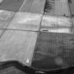
On-line Digital Images | SC 1005254 | General oblique aerial view centred on the cropmarks of a palisaded enclosure, ring ditches, field system and pits at Wester Fintray, looking to the NW. | 27/7/1983 | Item Level |
 |
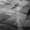
On-line Digital Images | SC 1005255 | Oblique aerial view centred on the cropmarks of the palisaded enclosure, pits and rig at Suttie, looking to the NNW. | 27/7/1983 | Item Level |
 |
On-line Digital Images | SC 1005256 | Oblique aerial view centred on the cropmarks of the palisaded enclosure, pits and rig at Suttie, looking to the NNW. | 27/7/1983 | Item Level |
 |
On-line Digital Images | SC 1005259 | General oblique aerial view centred on the cropmarks of the barrow at Boat of Hatton with the burial ground and Hatton Bridge adjacent, looking to the NNE. | 27/7/1983 | Item Level |
 |
On-line Digital Images | SC 1005260 | Oblique aerial view centred on the cropmarks of the roundhouses, souterrains, pits and rig at Hatton of Fintray, looking to the WSW. | 27/7/1983 | Item Level |


