551 7224/8/9
Description Aerial photographic sortie 1983/9
Collection Records of Aberdeen Aerial Surveys, Aberdeen, Scotland
Catalogue Number 551 7224/8/9
Category All Other
Accession Number 2005/218
Permalink http://canmore.org.uk/collection/1336507
Collection Hierarchy - Sub-Group Level
Collection Level (551 193) Records of Aberdeen Aerial Surveys, Aberdeen, Scotland
> Group Level (551 193/8) Aerial Photographic Survey 1983
>> Sub-Group Level (551 7224/8/9) Aerial photographic sortie 1983/9
| Preview | Category | Catalogue Number | Title | Date | Level |
|---|---|---|---|---|---|
 |
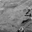
On-line Digital Images | SC 1004000 | Oblique aerial view centred on the cropmarks of an enclosure, ring ditches, field system and pits at Wester Fintray, looking to the NNE. | Item Level | |
 |
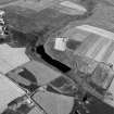
On-line Digital Images | SC 1004001 | Oblique aerial view centred on the cropmarks of an enclosure, ring ditches, field system and pits at Wester Fintray, looking to the NNE. | Item Level | |
 |
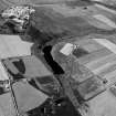
On-line Digital Images | SC 1004002 | General oblique aerial view centred on the farmstead at Wester Fintray, looking to the NE. | Item Level | |
 |
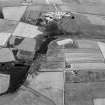
On-line Digital Images | SC 1004003 | Oblique aerial view centred on the cropmarks of an enclosure, ring ditches, field system and pits at Wester Fintray, looking to the NNW. | Item Level | |
 |
On-line Digital Images | SC 1004004 | Oblique aerial view centred on the cropmarks of the palisaded enclosure at Suttie with a ring ditch adjacent, looking to the NW. | Item Level | |
 |
On-line Digital Images | SC 1004005 | Oblique aerial view centred on the cropmarks of the barrow at Boat of Hatton with the burial ground and Hatton of Fintray adjacent, looking to the NE. | 21/7/1983 | Item Level |
 |
On-line Digital Images | SC 1004006 | Oblique aerial view centred on the cropmarks of the barrow at Boat of Hatton with the burial ground and Hatton of Fintray adjacent, looking to the NNE. | 21/7/1983 | Item Level |
 |
On-line Digital Images | SC 1004007 | Oblique aerial view centred on the cropmarks of the rig at Boat of Hatton with the burial ground and Hatton of Fintray adjacent, looking to the NNE. | 21/7/1983 | Item Level |
 |
On-line Digital Images | SC 1004008 | Oblique aerial view centred on the cropmarks of the barrow, rig and pits at Boat of Hatton with the burial ground adjacent, looking to the NNW. | 21/7/1983 | Item Level |
 |
On-line Digital Images | SC 1004009 | Oblique aerial view centred on the cropmarks of the roundhouses, souterrains, pits and rig at Hatton of Fintray, looking to the NNW. | 21/7/1983 | Item Level |
 |
On-line Digital Images | SC 1004010 | Oblique aerial view centred on the cropmarks of the roundhouses, souterrains, pits and rig at Hatton of Fintray with the village adjacent, looking to the NNW. | 21/7/1983 | Item Level |
 |
On-line Digital Images | SC 1004011 | Oblique aerial view centred on the cropmarks of the roundhouses, souterrains, pits and rig at Hatton of Fintray, looking to the NNW. | 21/7/1983 | Item Level |
 |
On-line Digital Images | SC 1003852 | General oblique aerial view centred on the remains of the barrow at Bairnie Hillock, looking to the SSE. | 21/7/1983 | Item Level |
 |
On-line Digital Images | SC 1003853 | Oblique aerial view centred on the Sands of Forvie, looking to the WNW. | 21/7/1983 | Item Level |
 |
On-line Digital Images | SC 1003858 | Oblique aerial view centred on the Sands of Forvie, looking to the N. | 21/7/1983 | Item Level |
 |
On-line Digital Images | SC 1003859 | Oblique aerial view centred on Cruden Bay and Port Errol harbour, looking to the ENE. | 21/7/1983 | Item Level |
 |
On-line Digital Images | SC 1003860 | General oblique aerial view centred on Den of Boddam reservoir, flint mines and lithic working site, looking to the NE. | 21/7/1983 | Item Level |
 |
On-line Digital Images | SC 1003861 | Oblique aerial view centred on the Den of Boddam reservoir, flint mines and lithic working site with RAF Buchan radar station adjacent, looking to the WSW. | 21/7/1983 | Item Level |
 |
On-line Digital Images | SC 1003862 | Oblique aerial view centred on the Den of Boddam reservoir, flint mines and lithic working site with RAF Buchan radar station adjacent, looking to the SSW. | 21/7/1983 | Item Level |
 |
On-line Digital Images | SC 1003863 | Oblique aerial view centred on the Den of Boddam reservoir, flint mines and lithic working site with RAF Buchan radar station adjacent, looking to the SSW. | 21/7/1983 | Item Level |
 |
On-line Digital Images | SC 1003869 | General oblique aerial view centred on Peterhead and Sandford Bay, looking to the ENE. | 21/7/1983 | Item Level |
 |
On-line Digital Images | SC 1003870 | General oblique aerial view centred on Annachie Burn with the St Fergus Gas Terminal adjacent, looking to the WNW. | 21/7/1983 | Item Level |
 |
On-line Digital Images | SC 1003871 | General oblique aerial view centred on Annachie Burn with the St Fergus Gas Terminal adjacent, looking to the W. | 21/7/1983 | Item Level |
 |
On-line Digital Images | SC 1003872 | General oblique aerial view centred on Annachie Burn with the St Fergus Gas Terminal adjacent, looking to the WSW. | 21/7/1983 | Item Level |


