 |
On-line Digital Images |
SC 1001908 |
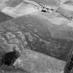
Oblique aerial view centred on the cropmarks of a possible palisaded enclosure, ring ditches, souterrains and rig, looking to the ESE.
|
20/7/1983 |
Item Level |
 |
On-line Digital Images |
SC 1001909 |
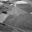
Oblique aerial view centred on the cropmarks of a possible palisaded enclosure, ring ditches, souterrains and rig, looking to the NNW.
|
20/7/1983 |
Item Level |
 |
On-line Digital Images |
SC 1001910 |
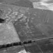
Oblique aerial view centred on the cropmarks of a possible palisaded enclosure, ring ditches, souterrains and rig, looking to the NNE.
|
20/7/1983 |
Item Level |
 |
On-line Digital Images |
SC 1001911 |
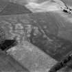
Oblique aerial view centred on the cropmarks of a possible palisaded enclosure, ring ditches, souterrains and rig, looking to the NE.
|
20/7/1983 |
Item Level |
 |
On-line Digital Images |
SC 1001912 |
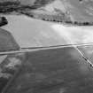
Oblique aerial view centred on the cropmarks of the circular enclosure at Barflat with the cropmarks of the possible square barrows adjacent, looking to the ESE.
|
20/7/1983 |
Item Level |
 |
On-line Digital Images |
SC 1001913 |
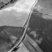
Oblique aerial view centred on the cropmarks of the circular enclosure at Barflat with the cropmarks of the possible square barrows adjacent, looking to the SSW.
|
20/7/1983 |
Item Level |
 |
On-line Digital Images |
SC 1001914 |
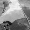
Oblique aerial view centred on the cropmarks of the circular enclosure at Barflat with the cropmarks of the possible square barrows adjacent, looking to the S.
|
20/7/1983 |
Item Level |
 |
On-line Digital Images |
SC 1001915 |
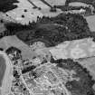
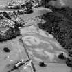
Oblique aerial view centred on the cropmarks of the palisaded enclosure, linear features, pits and rig at Heogan and East Mains of Aboyne, looking to the NNE.
|
20/7/1983 |
Item Level |
 |
On-line Digital Images |
SC 1001916 |
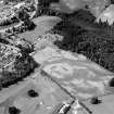
Oblique aerial view centred on the cropmarks of the palisaded enclosure, linear features, pits and rig at Heogan and East Mains of Aboyne, looking to the SSW.
|
20/7/1983 |
Item Level |
 |
On-line Digital Images |
SC 1001917 |
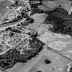
Oblique aerial view centred on the cropmarks of the palisaded enclosure, linear features, pits and rig at Heogan and East Mains of Aboyne, looking to the SSW.
|
20/7/1983 |
Item Level |
 |
On-line Digital Images |
SC 1001918 |
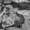
Oblique aerial view centred on the cropmarks of the palisaded enclosure, linear features, pits and rig at Heogan and East Mains of Aboyne, looking to the SW.
|
20/7/1983 |
Item Level |
 |
On-line Digital Images |
SC 1001919 |
Oblique aerial view centred on the cropmarks of the palisaded enclosure, linear features, pits and rig at Heogan and East Mains of Aboyne, looking to the W.
|
20/7/1983 |
Item Level |
 |
On-line Digital Images |
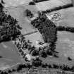
SC 1001920 |
Oblique aerial view centred on Aboyne Castle and Policies, looking to the S.
|
20/7/1983 |
Item Level |
 |
On-line Digital Images |
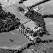
SC 1001921 |
Oblique aerial view centred on Aboyne Castle and Policies, looking to the SW.
|
20/7/1983 |
Item Level |
 |
On-line Digital Images |
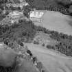
SC 1001922 |
Oblique aerial view centred on the cropmarks of the pit alignment and timber hall with Crathes Castle and gardens adjacent, looking to the NW.
|
|
Item Level |
 |
On-line Digital Images |
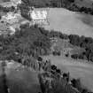
SC 1001923 |
Oblique aerial view centred on the cropmarks of the pit alignment and timber hall with Crathes Castle and gardens adjacent, looking to the NNW.
|
|
Item Level |
 |
On-line Digital Images |
SC 1003567 |
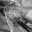
Oblique aerial view centred on cropmarks of a possible unenclosed settlement, enclosures and field boundary, looking to the NNW. |
20/7/1983 |
Item Level |
 |
On-line Digital Images |
SC 1003568 |
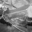
Oblique aerial view centred on cropmarks of a possible unenclosed settlement, enclosures and field boundary, looking to the ENE. |
20/7/1983 |
Item Level |
 |
On-line Digital Images |
SC 1003569 |
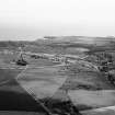
General oblique aerial view of Stonehaven, looking to the ESE. |
20/7/1983 |
Item Level |
 |
On-line Digital Images |
SC 1003570 |
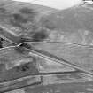
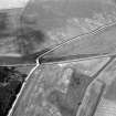
Oblique aerial view centred on the cropmarks of field boundaries and an enclosure at Pitdrichie, looking to the SSW. |
20/7/1983 |
Item Level |
 |
On-line Digital Images |
SC 1003571 |
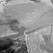
Oblique aerial view centred on the cropmarks of field boundaries and an enclosure at Pitdrichie, looking to the S. |
20/7/1983 |
Item Level |
 |
On-line Digital Images |
SC 1003572 |
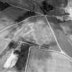
Oblique aerial view centred on the cropmarks of field boundaries and an enclosure at Pitdrichie, looking to the W. |
20/7/1983 |
Item Level |
 |
On-line Digital Images |
SC 1003573 |
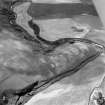
Oblique aerial view centred on the cropmarks of the unenclosed settlement, enclosure and field boundary at Pitdrichie, looking to the NW. |
20/7/1983 |
Item Level |
 |
On-line Digital Images |
SC 1003574 |
Oblique aerial view centred on the remains of a pit alignment, rig and enclosures at Corbie's Pot, looking to the SSW. |
20/7/1983 |
Item Level |


