 |
On-line Digital Images |
SC 1013437 |
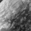
Oblique aerial view centred on the cropmarks of the unenclosed settlement, pit enclosure, roundhouses, souterrain and timber hall at Chapelton and Boysack, looking to the NW. |
5/7/1982 |
Item Level |
 |
On-line Digital Images |
SC 1013438 |
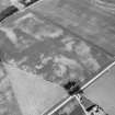
Oblique aerial view centred on the cropmarks of the unenclosed settlement, pit enclosure, roundhouses, souterrain and timber hall at Chapelton and Boysack, looking to the WNW. |
5/7/1982 |
Item Level |
 |
On-line Digital Images |
SC 1013439 |
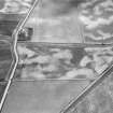
Oblique aerial view centred on the cropmarks of the ring ditches, pits and rig at Chapelton, looking to the SW. |
5/7/1982 |
Item Level |
 |
On-line Digital Images |
SC 1013440 |
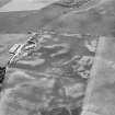
Oblique aerial view centred on the cropmarks of the linear features, pits and rig at Chapelton, looking to the NW. |
5/7/1982 |
Item Level |
 |
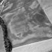
On-line Digital Images |
SC 1013441 |
Oblique aerial view centred on the cropmarks of the unenclosed settlement, roundhouses and field boundary at Templeton, with the farmhouse adjacent, looking to the W. |
5/7/1982 |
Item Level |
 |
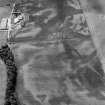
On-line Digital Images |
SC 1013442 |
Oblique aerial view centred on the cropmarks of the unenclosed settlement, roundhouses and field boundary at Templeton, with the farmhouse adjacent, looking to the W. |
5/7/1982 |
Item Level |
 |
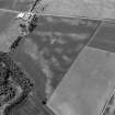
On-line Digital Images |
SC 1013443 |
Oblique aerial view centred on the cropmarks of the unenclosed settlement, roundhouses and field boundary at Templeton, with the farmhouse adjacent, looking to the W. |
5/7/1982 |
Item Level |
 |
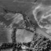
On-line Digital Images |
SC 1013444 |
Oblique aerial view centred on the cropmarks of the unenclosed settlement, roundhouse, pits and rig at Leys of Boysack, with the farmhouse adjacent, looking to the NW. |
5/7/1982 |
Item Level |
 |
On-line Digital Images |
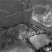
SC 1013446 |
Oblique aerial view centred on the cropmarks of the enclosure, souterrain, ring ditches, pit alignment and rig at Newton, looking to the NW. |
5/7/1982 |
Item Level |
 |
On-line Digital Images |
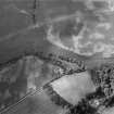
SC 1013448 |
Oblique aerial view centred on the cropmarks of the enclosure, souterrain, ring ditches, pit alignment and rig at Newton, looking to the WNW. |
5/7/1982 |
Item Level |
 |
On-line Digital Images |
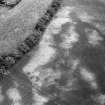
SC 1013449 |
Oblique aerial view centred on the cropmarks of the enclosure, souterrain, ring ditches, pit alignment and rig at Newton, looking to the NNE. |
5/7/1982 |
Item Level |
 |
On-line Digital Images |
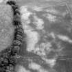
SC 1013310 |
Oblique aerial view centred on the cropmarks of the possible unenclosed setllement, ring ditch, pits and rig at Whiteriggs and Leithfield, looking to the ESE. |
5/7/1982 |
Item Level |
 |
On-line Digital Images |
SC 1013311 |
Oblique aerial view centred on the cropmarks of the possible unenclosed setllement, ring ditch, pits and rig at Whiteriggs and Leithfield, looking to the SE. |
5/7/1982 |
Item Level |
 |
On-line Digital Images |
SC 1013312 |
Oblique aerial view centred on the cropmarks of the possible unenclosed setllement, ring ditch, pits and rig at Whiteriggs and Leithfield, looking to the S. |
5/7/1982 |
Item Level |
 |
On-line Digital Images |
SC 1013313 |
Oblique aerial view centred on the cropmarks of the unenclosed settlement, enclosure and pits at Monboddo House, looking to the NNE. |
5/7/1982 |
Item Level |
 |
On-line Digital Images |
SC 1013314 |
Oblique aerial view centred on the cropmarks of the unenclosed settlement, enclosure and pits at Monboddo House, looking to the ENE. |
5/7/1982 |
Item Level |
 |
On-line Digital Images |
SC 1013316 |
Oblique aerial view centred on the cropmarks of the unenclosed settlement, enclosure and pits at Monboddo House, looking to the ESE. |
5/7/1982 |
Item Level |
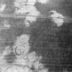 |
On-line Digital Images |
SC 1013317 |
Oblique aerial view centred on the cropmarks of the unenclosed settlement, ring ditch, souterrains and pits at Burnhead of Monboddo, looking to the ENE. |
5/7/1982 |
Item Level |
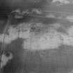 |
On-line Digital Images |
SC 1013318 |
Oblique aerial view centred on the cropmarks of the unenclosed settlement, ring ditch, souterrains and pits at Burnhead of Monboddo, looking to the NNW. |
5/7/1982 |
Item Level |
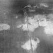 |
On-line Digital Images |
SC 1013319 |
Oblique aerial view centred on the cropmarks of the unenclosed settlement, ring ditch, souterrains and pits at Burnhead of Monboddo, looking to the NNW. |
5/7/1982 |
Item Level |
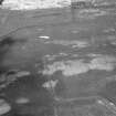 |
On-line Digital Images |
SC 1013320 |
Oblique aerial view centred on the cropmarks of the unenclosed settlement, ring ditch, souterrains and pits at Burnhead of Monboddo, looking to the NNW. |
5/7/1982 |
Item Level |
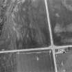 |
On-line Digital Images |
SC 1013322 |
Oblique aerial view centred on the cropmarks of a ring ditch, pits and rig and Cairnton Cottages, looking to the NNW. |
5/7/1982 |
Item Level |
 |
On-line Digital Images |
SC 1013323 |
Oblique aerial view centred on the cropmarks of the souterrains and rig at Upper Powburn, looking to the NW. |
5/7/1982 |
Item Level |
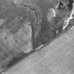 |
On-line Digital Images |
SC 1013325 |
Oblique aerial view centred on the cropmarks of the pit circles at Keilburn, looking to the N. |
5/7/1982 |
Item Level |


