 |
On-line Digital Images |
SC 1012111 |
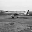
General view of Cessna 150 at Fordoun airfield. |
11/8/1979 |
Item Level |
 |
On-line Digital Images |
SC 1012115 |
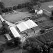
Oblique aerial view centred on Gallery House and gardens with cropmarks adjacent, looking to the SSW. |
11/8/1979 |
Item Level |
 |
On-line Digital Images |
SC 1012116 |
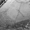
Oblique aerial view centred on the cropmarks of an enclosure and rig at Gallery, looking to the SW. |
11/8/1979 |
Item Level |
 |
On-line Digital Images |
SC 1012117 |
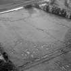
Oblique aerial view centred on the cropmarks of an enclosure and rig at Gallery, looking to the WNW. |
11/8/1979 |
Item Level |
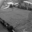 |
On-line Digital Images |
SC 1012118 |
Oblique aerial view centred on the cropmarks of an enclosure and rig at Gallery, looking to the WNW. |
11/8/1979 |
Item Level |
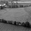 |
On-line Digital Images |
SC 1012119 |
Oblique aerial view centred on the cropmarks of an enclosure and rig at Gallery, looking to the NW. |
11/8/1979 |
Item Level |
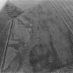 |
On-line Digital Images |
SC 1012120 |
Oblique aerial view centred on the cropmarks of the unenclosed settlement, ring ditches, souterrains and rig at Westside, looking to the WNW. |
11/8/1979 |
Item Level |
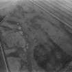 |
On-line Digital Images |
SC 1012121 |
Oblique aerial view centred on the cropmarks of the unenclosed settlement, ring ditches, souterrains and rig at Westside, looking to the NW. |
11/8/1979 |
Item Level |
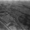 |
On-line Digital Images |
SC 1012122 |
Oblique aerial view centred on the cropmarks of the unenclosed settlement, ring ditches, souterrains and rig at Westside, looking to the NW. |
11/8/1979 |
Item Level |
 |
On-line Digital Images |
SC 1012123 |
Unidentified oblique aerial view (A.A.S 1979) |
8/1979 |
Item Level |
 |
On-line Digital Images |
SC 1012124 |
Unidentified oblique aerial view (A.A.S 1979) |
8/1979 |
Item Level |
 |
On-line Digital Images |
SC 1012125 |
Unidentified oblique aerial view (A.A.S 1979) |
8/1979 |
Item Level |
 |
On-line Digital Images |
SC 1012127 |
Oblique aerial view centred on the cropmarks of the unenclosed settlement, ring ditches and rig at Dunlappie, looking to the WSW. |
11/8/1979 |
Item Level |
 |
On-line Digital Images |
SC 1012128 |
Oblique aerial view centred on the cropmarks of the unenclosed settlement, ring ditches and rig at Dunlappie, looking to the WNW. |
8/1979 |
Item Level |
 |
On-line Digital Images |
SC 1012129 |
Oblique aerial view centred on the cropmarks of the unenclosed settlement, ring ditches and rig at Dunlappie, looking to the WNW. |
11/8/1979 |
Item Level |
 |
On-line Digital Images |
SC 1012131 |
Oblique aerial view centred on the cropmarks of a possible enclosure at Woodmyre, looking to the NNW. |
8/1979 |
Item Level |
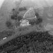 |
On-line Digital Images |
SC 1012132 |
Oblique aerial view centred on the remains of Edzell Castle with the formal gardens adjacent, looking to the NE. |
11/8/1979 |
Item Level |
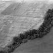 |
On-line Digital Images |
SC 1012133 |
Oblique aerial view centred on the cropmarks of the enclosed settlement at Wellford, looking to the NE. |
11/8/1979 |
Item Level |
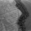 |
On-line Digital Images |
SC 1012134 |
Oblique aerial view centred on the cropmarks of the enclosed settlement at Wellford, looking to the ESE. |
11/8/1979 |
Item Level |
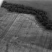 |
On-line Digital Images |
SC 1012135 |
Oblique aerial view centred on the cropmarks of the enclosed settlement at Wellford, looking to the SSE. |
11/8/1979 |
Item Level |
 |
On-line Digital Images |
SC 1012136 |
Oblique aerial view centred on the cropmarks of the ring ditch at Noranside, looking to the SE. |
11/8/1979 |
Item Level |
 |
On-line Digital Images |
SC 1012137 |
Oblique aerial view centred on the cropmarks of the ring ditch at Noranside, looking to the SSE. |
11/8/1979 |
Item Level |
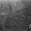 |
On-line Digital Images |
SC 1012139 |
Oblique aerial view centred on the cropmarks of the moated site at Hallyards, looking to the ENE. |
11/8/1979 |
Item Level |
 |
On-line Digital Images |
SC 1012140 |
Oblique aerial view centred on the cropmarks of ring ditches at Dubton, looking to the NNW. |
11/8/1979 |
Item Level |


