551 178/2/19
Description Sortie 2009/19
Collection RCAHMS Aerial Photography Digital
Catalogue Number 551 178/2/19
Category All Other
Permalink http://canmore.org.uk/collection/1237285
Collection Hierarchy - Sub-Group Level
Collection Level (551 178) RCAHMS Aerial Photography Digital
> Sub-Group Level (551 178/2) 2009 Photographs
>> Sub-Group Level (551 178/2/19) Sortie 2009/19
| Preview | Category | Catalogue Number | Title | Date | Level |
|---|---|---|---|---|---|
 |
On-line Digital Images | DP 080209 | Oblique aerial view centred on the remains of the rig and the township buildings at Point and Dalvaich, taken from the SSE. | 29/5/2009 | Item Level |
 |
On-line Digital Images | DP 080210 | Oblique aerial view centred on the remains of the rig and the township buildings at Dalvaich, taken from the E. | 29/5/2009 | Item Level |
 |
On-line Digital Images | DP 080211 | Oblique aerial view centred on the remains of the rig and the township buildings at Dalvaich, taken from the E. | 29/5/2009 | Item Level |
 |
On-line Digital Images | DP 080212 | Oblique aerial view centred on the remains of the rig and the township buildings at Dalvaich, taken from the ENE. | 29/5/2009 | Item Level |
 |
On-line Digital Images | DP 080213 | Oblique aerial view centred on the remains of the rig and the township buildings at Dalvaich, taken from the NE. | 29/5/2009 | Item Level |
 |
On-line Digital Images | DP 080214 | Oblique aerial view centred on the remains of the hut-circles and field system on Balnacoil Hill, taken from the NNW. | 29/5/2009 | Item Level |
 |
On-line Digital Images | DP 080215 | Oblique aerial view centred on the remains of the hut-circles and field system on Balnacoil Hill, taken from the W. | 29/5/2009 | Item Level |
 |
On-line Digital Images | DP 080216 | Oblique aerial view centred on the remains of the hut-circles and field system on Balnacoil Hill, taken from the W. | 29/5/2009 | Item Level |
 |
On-line Digital Images | DP 080217 | Oblique aerial view of the remains of the rig on the flood plain of the River Brora, taken from the SW. | 29/5/2009 | Item Level |
 |
On-line Digital Images | DP 080218 | Oblique aerial view of the remains of the rig on the flood plain of the River Brora, taken from the SW. | 29/5/2009 | Item Level |
 |
On-line Digital Images | DP 080220 | Oblique aerial view of the remains of the rig on the flood plain of the River Brora and the remains of the township buildings and possible henge, taken from the S. | 29/5/2009 | Item Level |
 |
On-line Digital Images | DP 080221 | Oblique aerial view of the remains of the rig on the flood plain of the River Brora and the remains of the township buildings, taken from the S. | 29/5/2009 | Item Level |
 |
On-line Digital Images | DP 080222 | Oblique aerial view of the remains of the broch, township buildings, rig and hut-circle at Kilbraur, taken from the E. | 29/5/2009 | Item Level |
 |
On-line Digital Images | DP 080223 | Oblique aerial view of the remains of the rig and furrow on the flood plain of the River Brora, taken from the E. | 29/5/2009 | Item Level |
 |
On-line Digital Images | DP 080224 | Oblique aerial view of the remains of the rig on the flood plain of the River Brora, taken from the ENE. | 29/5/2009 | Item Level |
 |
On-line Digital Images | DP 080225 | Oblique aerial view of the remains of the rig on the flood plain of the River Brora, taken from the NE. | 29/5/2009 | Item Level |
 |
On-line Digital Images | DP 080226 | Oblique aerial view of the remains of the hut-circles and small cairns, taken from the NW. | 29/5/2009 | Item Level |
 |
On-line Digital Images | DP 080227 | Oblique aerial view of the remains of the broch, township buildings, rig and hut-circle at Kilbraur, taken from the SW. | 29/5/2009 | Item Level |
 |
On-line Digital Images | DP 080228 | Oblique aerial view of the remains of the broch, township buildings, rig and hut-circle at Kilbraur, taken from the SW. | 29/5/2009 | Item Level |
 |
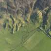
On-line Digital Images | DP 080229 | Oblique aerial view of the remains of the broch, township buildings, rig and hut-circle at Kilbraur, taken from the SSW. | 29/5/2009 | Item Level |
 |
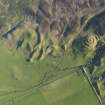
On-line Digital Images | DP 080230 | Oblique aerial view of the remains of the broch, township buildings, rig and hut-circle at Kilbraur, taken from the NE. | 29/5/2009 | Item Level |
 |
On-line Digital Images | DP 080231 | Oblique aerial view of the remains of the broch, township buildings, rig and hut-circle at Kilbraur, taken from the NNE. | 29/5/2009 | Item Level |
 |
On-line Digital Images | DP 080232 | Oblique aerial view of the remains of the hut-circles and small cairns, taken from the SW. | 29/5/2009 | Item Level |
 |
On-line Digital Images | DP 080233 | Oblique aerial view of the remains of the hut-circles and small cairns, taken from the SSW. | 29/5/2009 | Item Level |


