|
Digital Files (Non-image) |
TM 000976 |
GPS recorded flight path and map for Sortie 2009/19 |
29/5/2009 |
Item Level |
 |
On-line Digital Images |
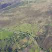
DP 080319 |
Oblique aerial view of the remains of the hut-circles, field banks and clearance cairns at Achinduich, taken from the W. |
29/5/2009 |
Item Level |
 |
On-line Digital Images |
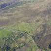
DP 080320 |
Oblique aerial view of the remains of the hut-circles, field banks and clearance cairns at Achinduich, taken from the W. |
29/5/2009 |
Item Level |
 |
On-line Digital Images |
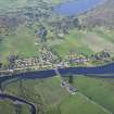
DP 080321 |
General oblique aerial view of Bonar Bridge with Migdale beyond, taken from the W. |
29/5/2009 |
Item Level |
 |
On-line Digital Images |
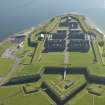
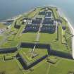
DP 080087 |
Oblique aerial view of Fort George, taken from the ENE. |
29/5/2009 |
Item Level |
 |
On-line Digital Images |
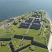
DP 080088 |
Oblique aerial view of Fort George, taken from the NE. |
29/5/2009 |
Item Level |
 |
On-line Digital Images |
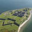
DP 080089 |
Oblique aerial view of Fort George, taken from the NNE. |
29/5/2009 |
Item Level |
 |
On-line Digital Images |
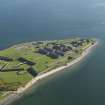
DP 080090 |
Oblique aerial view of Fort George, taken from the NNE. |
29/5/2009 |
Item Level |
 |
On-line Digital Images |
DP 080091 |
Oblique aerial view of Fort George, taken from the NNE. |
29/5/2009 |
Item Level |
 |
On-line Digital Images |
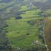
DP 080092 |
General oblique aerial view of the crofting township of Rearquhar, taken from the ESE. |
29/5/2009 |
Item Level |
 |
On-line Digital Images |
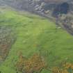
DP 080093 |
Oblique aerial view of the remains of the hut-circles, field system and cairns, taken from the SSE. |
29/5/2009 |
Item Level |
 |
On-line Digital Images |
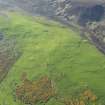
DP 080094 |
Oblique aerial view of the remains of the hut-circles, field system and cairns, taken from the SE. |
29/5/2009 |
Item Level |
 |
On-line Digital Images |
DP 080095 |
General oblique aerial view of the remains of the hut-circles, field system and cairns, taken from the SE. |
29/5/2009 |
Item Level |
 |
On-line Digital Images |
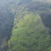
DP 080096 |
General oblique aerial view of the remains of the hut-circles, field system and cairns, taken from the SE. |
29/5/2009 |
Item Level |
 |
On-line Digital Images |
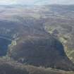
DP 080097 |
General oblique aerial view of the remains of the trackways, taken from the SSE. |
29/5/2009 |
Item Level |
 |
On-line Digital Images |
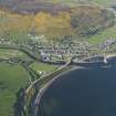
DP 080098 |
General oblique aerial view of Helmsdale, taken from the SW. |
29/5/2009 |
Item Level |
 |
On-line Digital Images |
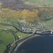
DP 080099 |
General oblique aerial view of Helmsdale, taken from the SW. |
29/5/2009 |
Item Level |
 |
On-line Digital Images |
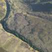
DP 080100 |
Oblique aerial view of the Caen Burn and the remains of the hut-circles and small cairns with the township buildings beyond, taken from the NNE. |
29/5/2009 |
Item Level |
 |
On-line Digital Images |
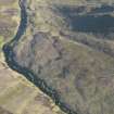
DP 080101 |
Oblique aerial view of the Caen Burn and the remains of the hut-circles and small cairns with the township buildings beyond, taken from the NNE. |
29/5/2009 |
Item Level |
 |
On-line Digital Images |
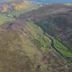
DP 080102 |
General oblique aerial view looking along the Strath of Kildonan down the River Helmsdale towards Helmsdale and the North Sea, taken from the NW. |
29/5/2009 |
Item Level |
 |
On-line Digital Images |
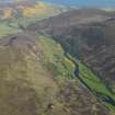
DP 080103 |
General oblique aerial view looking along the Strath of Kildonan down the River Helmsdale towards Helmsdale and the North Sea, taken from the NW. |
29/5/2009 |
Item Level |
 |
On-line Digital Images |
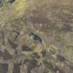
DP 080104 |
Oblique aerial view centred on Kilphedir Broch with the small cairns and hut-circles adjacent, taken from the SSW. |
29/5/2009 |
Item Level |
 |
On-line Digital Images |
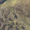
DP 080105 |
Oblique aerial view centred on Kilphedir Broch with the small cairns and hut-circles adjacent, taken from the S. |
29/5/2009 |
Item Level |
 |
On-line Digital Images |
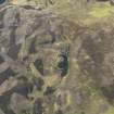
DP 080106 |
Oblique aerial view centred on Kilphedir Broch with the small cairns and hut-circles adjacent, taken from the SSE. |
29/5/2009 |
Item Level |


