|
363325 |
Creag Liath, Dall |
Peat Stand (Pre-improvement), Shieling Hut(S) (Pre-improvement) |
NN63NE 223 |
|
|
363439 |
Cowal, Achanelid |
Archaeological Landscape (Period Unassigned) |
NS08NW 36 |
|
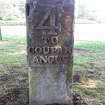 |
363696 |
Blairgowrie |
Milestone (19th Century) |
NO14SE 168 |
|
|
364066 |
Edinburgh, Antigua Street |
Subterranean Structure (20th Century) |
NT27SE 6349 |
|
|
367585 |
Cowdenknowes Mains |
Handle (Copper Alloy)(Iron Age) |
NT53NE 159 |
|
|
367766 |
Cancelled |
No Class (Period Unassigned) |
NG53NE 223 |
|
|
367856 |
Tomnarroch Burn |
Building(S) (Period Unassigned)(Possible), Farmstead (Period Unassigned)(Possible), Turf Enclosure (Period Unassigned) |
NH94SE 39 |
|
 |
367857 |
Ardersier |
No Class (Event) (Period Unassigned) |
NH75SE 87 |
|
|
367907 |
Strathban |
Building (Period Unassigned) |
NH26SW 6 |
|
|
369377 |
Erskine, Barhill Plantation |
Underpass (19th Century) |
NS47SE 386 |
|
 |
370804 |
Lewis, Loch Bhorgastail |
Wall (Period Unknown) |
NB24SW 88 |
|
|
371320 |
Hill Of Fearn |
No Class (Event) (Period Unassigned) |
NH87NW 46 |
|
|
371370 |
Wilkhaven Muir |
Bombing Range (Second World War) (1945) |
NH98NW 33 |
|
|
371678 |
Killin, Larachbeag, Station House |
Station Masters House (19th Century) |
NN53SE 121 |
|
|
371679 |
Killin, Main Street, Dreadnought Place |
Tenement (19th Century) (1898) |
NN53SE 122 |
|
|
371974 |
Rosyth, Hms Caledonia, Figurehead Of Admiral Duncan |
Figurehead (19th Century) (1810) |
NT08SE 50.01 |
|
|
371975 |
Glenmore |
Farmstead (18th Century) - (19th Century) |
NM81SW 30 |
|
|
371980 |
Dumfries, Bankend Road, Crichton Royal Hospital, Boundary Walls |
Boundary Wall (19th Century) |
NX97SE 55.25 |
|
 |
372123 |
Glasgow, 74-142 Kilmarnock Road, Shawlands Arcade |
Shopping Arcade (20th Century) |
NS56SE 2382 |
|
|
372124 |
Stewarton, 16-20 Lainshaw Street |
Commercial Premises (19th Century) |
NS44NW 169 |
|
|
372283 |
Cawdor, Cone Kiln |
Kiln (20th Century) (1921) |
NH85SW 104 |
|
|
372285 |
Kelburn Castle, Gamekeeper's Cottage |
Gamekeepers House (19th Century) (1870) |
NS25NW 22.24 |
|
|
372351 |
Trochry Hill |
Field Boundary (Period Unassigned), Track(S) (19th Century) |
NN93NE 73 |
|
|
372482 |
Lower Kilchattan |
No Class (Event) (Period Unassigned) |
NR39NE 83 |
|


