
Pricing Change
New pricing for orders of material from this site will come into place shortly. Charges for supply of digital images, digitisation on demand, prints and licensing will be altered.
Upcoming Maintenance
Please be advised that this website will undergo scheduled maintenance on the following dates:
Thursday, 9 January: 11:00 AM - 3:00 PM
Thursday, 23 January: 11:00 AM - 3:00 PM
Thursday, 30 January: 11:00 AM - 3:00 PM
During these times, some functionality such as image purchasing may be temporarily unavailable. We apologise for any inconvenience this may cause.
Birrens


Temporary Camp (Roman)
Site Name Birrens
Classification Temporary Camp (Roman)
Alternative Name(s) Mein Water
Canmore ID 67103
Site Number NY27NW 5
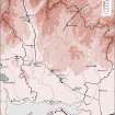
NGR NY 22462 75028
NGR Description Centred NY 22462 75028
Datum OSGB36 - NGR
Permalink http://canmore.org.uk/site/67103


- Council Dumfries And Galloway
- Parish Middlebie
- Former Region Dumfries And Galloway
- Former District Annandale And Eskdale
- Former County Dumfries-shire
NY27NW 5 2245 7502
Not to be confused with Birrens Roman fort (NY 219 751), for which see NY27NW 4.00.
(NY 2245 7502) Crop mark of Roman camp.
Information from J K St Joseph letter 3 February 1954,
There are no surface indications of this camp, which is situated on relatively flat ground above the haugh of the Mein Water.
Visited by OS (RD) 19 October 1967.
Note (1997)
NY 2245 7502 NY27NW 5
Listed as temporary camp.
RCAHMS 1997.
Publication Account (17 December 2011)
There is a small cluster of camps at Birrens and Broadlea, close to the Roman fort at Birrens, on fairly level ground in a landscape dominated by Burnswark hill to the northwest. A further two camps lie about 1.5km to the northwest at Middlebie Hill.
One camp (I, not shown on illus 86), a ‘Flavian enclosure’, was recorded under the fort at Birrens during excavations in the 1960s (Robertson 1975: 73–5, fig 19). It was apparently filled in before the construction of the Hadrianic fort on the site, and finds from the ditch silting included glass and pottery, all dating to the late 1st century ad (Robertson 1975: 75). The ditch was at least 71m by 21m and measured 2.1m in width and 0.9m in depth (Robertson 1975: 73).
Three other small camps and a possible fortlet were recorded south and east of the fort (across the Mein Water,also see Broadlea), along with a possible fourth camp to the north-west (camp III ), although this may be one of the annexes to the forts (St Joseph 1951: 57–8).
Camp II was discovered in 1948 as a cropmark by St Joseph from the air (1951a: 57–8) lying to the ESE of the fort across the Mein Water. It measures 341m from ENE to WSW by 245m transversely, enclosing 8.3ha (20.6 acres). A titulus is visible close to the centre of the WSW side but none is recorded from the other sides. A linear cropmark with a rounded corner within its interior could represent a further camp, but the evidence is inconclusive.
Camp III consists of the cropmark of a rounded corner and stretches of two adjacent sides just to the north-west of the fort, and was recorded in the 1940s by St Joseph. At least 85m of the south-west side and 25m of the northeast are known, and the site is probably either the remains of a temporary camp or of an annexe to the fort (St Joseph 1951a: 57).
R H Jones 2011
Aerial Photographic Transcription (19 October 2012)
An interpretative transcription, or mapping, of information on oblique aerial photographs was produced on 19 October 2012.

