
Pricing Change
New pricing for orders of material from this site will come into place shortly. Charges for supply of digital images, digitisation on demand, prints and licensing will be altered.
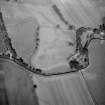
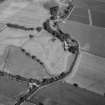
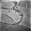
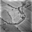
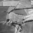
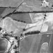
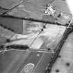
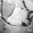
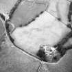
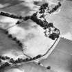
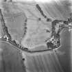
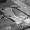
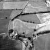
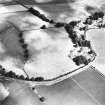
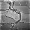
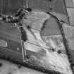
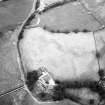
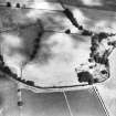
West Gallaberry


Enclosure (Period Unassigned), Linear Feature(S) (Period Unassigned), Promontory Fort (Period Unassigned)(Possible)
Site Name West Gallaberry
Classification Enclosure (Period Unassigned), Linear Feature(S) (Period Unassigned), Promontory Fort (Period Unassigned)(Possible)
Canmore ID 65854
Site Number NX98SE 45
NGR NX 96289 82734
Datum OSGB36 - NGR
Permalink http://canmore.org.uk/site/65854


- Council Dumfries And Galloway
- Parish Kirkmahoe
- Former Region Dumfries And Galloway
- Former District Nithsdale
- Former County Dumfries-shire
Aerial Photographic Transcription (8 June 2012)

