Scheduled Maintenance
Please be advised that this website will undergo scheduled maintenance on the following dates: •
Tuesday 3rd December 11:00-15:00
During these times, some services may be temporarily unavailable. We apologise for any inconvenience this may cause.
Fir Island
Fortified Island (Period Unassigned)(Possible), Smithy (Period Unassigned)
Site Name Fir Island
Classification Fortified Island (Period Unassigned)(Possible), Smithy (Period Unassigned)
Alternative Name(s) Carlingwark Loch
Canmore ID 64675
Site Number NX76SE 9
NGR NX 7629 6093
Datum OSGB36 - NGR
Permalink http://canmore.org.uk/site/64675
- Council Dumfries And Galloway
- Parish Kelton
- Former Region Dumfries And Galloway
- Former District Stewartry
- Former County Kirkcudbrightshire
NX76SE 9 7629 6093.
(NX 7631 6095) Smithy (NR) (Site of) Fir Island (NAT)
OS 6" map (1946)
(NX 7629 6093) Smithy (NR) (Site of)
OS 6" map (1853)
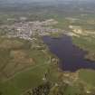
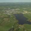
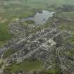
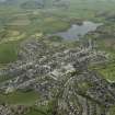
At the south end of Carlingwark Loch there is an island, Fir Island, on the south of which are the remains of an iron forge, reputedly used for shoeing the cavalry horses of Edward I in AD 1300.
Name Book 1847
In Carlingwark Loch there were four fortified islands, two of them artificially constructed of oak piles. One of the natural islands near the south end of the loch - Fir Island - was surrounded by a stone rampart, and joined to the shore by a conservancy of oak piles and stones.
J Stuart 1875; OSA 1794 (T Halliday)
No remains of a forge were found at either of the sitings given by the OS 6" maps nor any part of the island. No trace was found of the building, rampart, and causeway mentioned by Stuart, but it is possible that snow and ice, which was abundant at the time of inspection, may have concealed some features.
In favour of the siting for the forge; it was noted that it is on a fairly level area measuring about 27.0m north-south by 19.0m east-west on the highest part of the island, and would be less liable to flooding than the position given by OS 6" (1853).
Visited by OS (RDL) 13 February 1963.


