
Pibble Hill


Mine Workings (Period Unassigned)
Site Name Pibble Hill
Classification Mine Workings (Period Unassigned)
Alternative Name(s) Pibble, Lead Mines; Pibble Mine Complex
Canmore ID 72077
Site Number NX56SW 2
NGR NX 5280 6045
NGR Description Centred NX 5280 6045
Datum OSGB36 - NGR
Permalink http://canmore.org.uk/site/72077


- Council Dumfries And Galloway
- Parish Kirkmabreck
- Former Region Dumfries And Galloway
- Former District Wigtown
- Former County Kirkcudbrightshire
NX56SW 2.00 centred 5280 6045
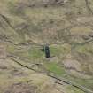
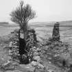
NX56SW 2.01 5255 6069 beam engine house
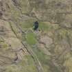
NX56SW 2.02 5235 6084 crushing plant
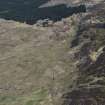
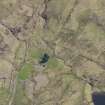
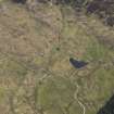
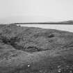
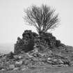
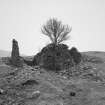
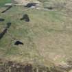
The Pibble Mine complex is of considerable importance as a very well preserved mining landscape, with parts possibly dating to before the 17th century. Few such mine complexes survive in such good condition. The mines are almost certainly multi-period, although this is difficult to ascertain due to the use of similar technological techniques being employed through time. The mines were used to extract lead, copper and zinc, mainly from one primary vein which runs NW-SE under Pibble Hill. Only the general outline of the area was noted but within it were six worked areas. Three consist of open horizontal adits with associated spoil heaps, whilst two others have horizontal shafts.
A further area of workings consisted of vertical shafts, some as much as 200-300ft deep. Further adits and horizontal shafts were noted.
EUCFA 1990.
Desk-based assessments and surveys were carried out between October and December 2002 at three metal mining sites in Galloway. [see NX37SE 12 and NX59SW 1 also]
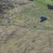
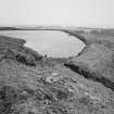
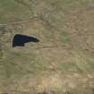
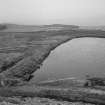
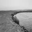
NX 528 604 Pibble Mine, near Creetown. This is a Scheduled mid-19th-century copper/lead mine with a well-preserved set of mining remains. These include drainage adits, shafts, a Cornish engine pumping house, and the remains of a water-powered ore crushing mill. Water supply to these features was via a large reservoir and system of lades.
Report lodged with Dumfries and Galloway SMR and the NMRS.
Sponsors: HS, Dumfries and Galloway Council.
M Cressey and K Hicks 2003

