Scheduled Maintenance
Please be advised that this website will undergo scheduled maintenance on the following dates: •
Tuesday 3rd December 11:00-15:00
During these times, some services may be temporarily unavailable. We apologise for any inconvenience this may cause.
'King's Cairn', Kirriemore
Chambered Cairn (Neolithic)
Site Name 'King's Cairn', Kirriemore
Classification Chambered Cairn (Neolithic)
Canmore ID 63043
Site Number NX38NE 3
NGR NX 3773 8544
Datum OSGB36 - NGR
Permalink http://canmore.org.uk/site/63043
- Council Dumfries And Galloway
- Parish Minnigaff
- Former Region Dumfries And Galloway
- Former District Wigtown
- Former County Kirkcudbrightshire
NX38NE 3 3773 8544.
(NX 3773 8544) King's Cairn (NR)
OS 6" map (1957)
A large circular cairn, situated on the farm of Kirriemore, about 100ft in diameter; the stones on the centre rise to a height of about 15 feet, on the top of which is a rudely constructed shepherds pile, raised to a height of about 4 feet. No information can be obtained in the locality respecting it either to its erection or derivation of name, with the exception of what the Messrs McMillan say: 'It is traditionally supposed to be the burial place of some chieftain or notable person'. Similar ones have been opened up in the vicinity and graves exposed in which human bones have been found.
Name Book 1849
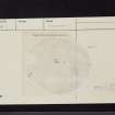
King's Cairn is the mutilated but still impressive remnant of a magnificent chambered round cairn of the Bargrennan group. Slightly oval in plan and measuring 97' by 116' the cairn is composed of very small stones bare of vegetation except at the edge. It still stands c 10' high towards the south where the ground is lowest but is only 3' high on the north. The edges rise steeply to the almost flat centre, 47' in diameter and sloping gently towards the west. On the NNW the cairn has been robbed to ground level, and on the west two slabs project from the edge. Steep-sided robber hollows occur in the centre and towards the SE, three of them exposing parts of the chamber and passage, the chamber having been entered from the SE.
A S Henshall 1972, visited 1962
King's Cairn is as described by the previous authority.
Surveyed at 1:10 000.
Visited by OS (JP) 7 June 1976


