
Drumflower


Archaeological Landscape (Prehistoric)
Site Name Drumflower
Classification Archaeological Landscape (Prehistoric)
Alternative Name(s) Drumflower Bridge
Canmore ID 61234
Site Number NX15NW 25
NGR NX 14356 57848
NGR Description Centre
Datum OSGB36 - NGR
Permalink http://canmore.org.uk/site/61234


- Council Dumfries And Galloway
- Parish Old Luce
- Former Region Dumfries And Galloway
- Former District Wigtown
- Former County Wigtownshire
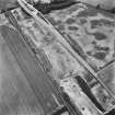
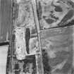
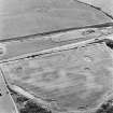
NX15NW 25.00 143 578
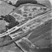
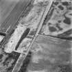
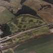
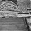
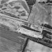
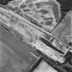
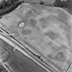
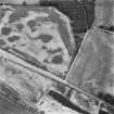
NX15NW 25.01 NX 1433 5786 Palisaded enclosure
NX15NW 25.02 NX 1439 5782 Palisaded enclosure
See also NX15NW 26.
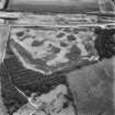
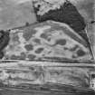
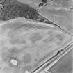
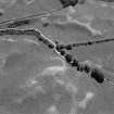
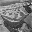
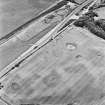
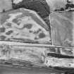
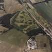
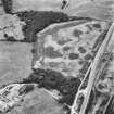
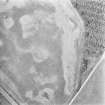
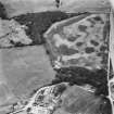
Air photography has revealed the cropmarks of an oval enclosure 370m ESE of Drumflower; it measures about 46m by 43m within a palisade trench or narrow ditch.
RCAHMS 1987.
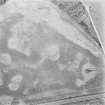
Aerial Photographic Transcription (3 December 1992 - 10 December 1992)
An aerial transcription was produced from oblique aerial photographs. Information from Historic Environment Scotland (BM) 31 March 2017.
Note (23 August 2022)
The location, classification and period of this site have been reviewed and changed from PALISADED ENCLOSURE(S) (PERIOD UNASSIGNED).

