Scheduled Maintenance
Please be advised that this website will undergo scheduled maintenance on the following dates: •
Tuesday 3rd December 11:00-15:00
During these times, some services may be temporarily unavailable. We apologise for any inconvenience this may cause.
Cairnryan Harbour, Cairnryan Military Railway, Port Number Two
Harbour (20th Century), Railway Siding(S) (20th Century), Ship Breaking Yard (20th Century)
Site Name Cairnryan Harbour, Cairnryan Military Railway, Port Number Two
Classification Harbour (20th Century), Railway Siding(S) (20th Century), Ship Breaking Yard (20th Century)
Canmore ID 60648
Site Number NX06NE 11
NGR NX 0721 6735
NGR Description From NX 0787 6500 to c.NX 0592 6995
Datum OSGB36 - NGR
Permalink http://canmore.org.uk/site/60648
- Council Dumfries And Galloway
- Parish Inch
- Former Region Dumfries And Galloway
- Former District Wigtown
- Former County Wigtownshire
NX06NE 11.00 0787 6500 to c. 0592 6995
Continues onto map sheet NX06SE
NX06NE 11.01 Centred NX 0715 6734 Harbour; Transit Shed; Railway Sidings
NX06NE 11.02 Centred NX 0735 6738 Military Camp
NX06NE 11.03 From NX 0786 6500 to NX 0592 7000 Railway
NX06NE 11.04 NX 0633 6864 Military Headquarters
NX06NE 11.05 Centred NX 0795 6607 Military Camp
NX06NE 11.06 Centred NX 0760 6658 Military Camp
NX06NE 11.07 Centred NX 0763 6674 Military Camp (huts)
NX06NE 11.08 Centred NX 0768 6529 Railway Yard; (Railway Engine Shed)
NX06NE 11.09 Centred NX 05873 69752 Fabrication Yard; Railway Yard
NX06NE 11.10 Centred NX 0628 6909 Military Camp
NX06NE 11.11 Centred NX 0660 6880 Military Camp
NX06NE 11.12 c.NX 0619 6891 Shed; Building
NX06NE 11.13 NX 06708 68453 Building; Huts
NX06NE 11.14 Centred NX 0730 6792 Military camp
NX06NE 11.15 Nx 07689 66141 Building; Hotel
NX06NE 11.16 From NX 06174 68575 to NX 06540 67985 Pier
See also NX06SE 94.00
Long a popular port for the cattle trade, little was done to improve this harbour until the early 19th century, when a small quay was built. Little remains of the original pier, following the extensive alterations made at Cairnryan during World War 2.
I Donnachie 1971; A Graham 1979
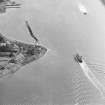
Work proceeded on the new port facilities at Cairnryan in November 1941, which included a connecting railway to the main line at Cairnryan Junction (NX 0850 6000). The War Office had sanctioned this construction work and that at Faslane as a result of air raids on the west coast ports. The construction works also included a hutted camp at Drummucklock (NX06NE 11.05) to provide billets for men engaged on the construction of the railway; a breakwater at Claddyburn to form a large pond enclosing the piles for a lighterage wharf with two further breakwaters (NX06NE 11.01); with a further camp at Claddyburn (NX06NE 11.02) and a Headquarters Building for port operations at Cairnryan (NX06NE 11.04).
The deep water quays were not available for traffic until early 1943, but the railway was operational by the end of 1942 (NX06NE11.03 and NX06SE 94.00)
With a decline in military traffic, the facilties at the port were reduced, and by 1960 the jetty at Lighterage and the North Deep had been demolished. In 1959 the port was sold off to a firm of shipbreakers, (Pounds, Shipowners and Shipbreakers) Ltd of Portsmouth. Although limited use was being made of the railway as late as 1973, the mainline to Cairnryan Junction (NX06SE 94.00) had become derelict, with parts of it being dismantled in 1968. The OS map of 1963 still depicts the full railway system (OS 1:10560 map, 1963)
M Christensen 1995 (two parts).
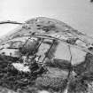
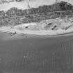
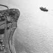
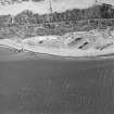
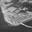
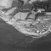
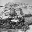
The deep water quay which runs from NX 06177 68566 to NX 06539 67984 is still extant. Large dumps of hard-core have been dumped along its length and is now in a fairly derelict state with some sections beginning to collapse. The travelling cranes and all equipment have been removed. Much of the port and adjoining military camps are visible on postwar vertical air photographs (106G/UK987, 3136-3140, flown 9 November 1945).
The North Transit Shed has been recorded under NX06NE 11.12.
Visited by RCAHMS (DE), March 2004
Part of the installations are visibel on RAF WW II vertical air photographs (D309, 5172-5183, flown 4 July 1941), which show some of the accommodation camps, wharves and toher structures.
Information from RCAHMS (DE), April 2006


