Pricing Change
New pricing for orders of material from this site will come into place shortly. Charges for supply of digital images, digitisation on demand, prints and licensing will be altered.
Upcoming Maintenance
Please be advised that this website will undergo scheduled maintenance on the following dates:
Thursday, 9 January: 11:00 AM - 3:00 PM
Thursday, 23 January: 11:00 AM - 3:00 PM
Thursday, 30 January: 11:00 AM - 3:00 PM
During these times, some functionality such as image purchasing may be temporarily unavailable. We apologise for any inconvenience this may cause.
Coldingham Church
Boundary Wall(S) (Period Unassigned), Church (Period Unassigned), Priory (Medieval)
Site Name Coldingham Church
Classification Boundary Wall(S) (Period Unassigned), Church (Period Unassigned), Priory (Medieval)
Alternative Name(s) Coldingham Priory Church; Coldingham Priory, Claustral Remains; Coldingham Benedictine Priory
Canmore ID 60143
Site Number NT96NW 11
NGR NT 90394 65949
Datum OSGB36 - NGR
Permalink http://canmore.org.uk/site/60143
First 100 images shown. See the Collections panel (below) for a link to all digital images.
- Council Scottish Borders, The
- Parish Coldingham
- Former Region Borders
- Former District Berwickshire
- Former County Berwickshire
NT96NW 11.00 90394 65949
NT96NW 11.01 NT 904 559 Coin hoard
NT96NW 11.02 NT 90500 65962 Manse
NT96NW 11.03 NT 9042 6604 Excavation
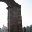
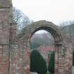
NT96NW 11.04 NT 90372 65941 Transept Arch
NT96NW 11.05 NT 90315 65975 Hearse House and Grave Digger's Store
NT96NW 11.06 NT 90358 65969 Churchyard
NT96NW 11.07 NT 90313 65968 Gate Piers and Gates
(NT 9040 6593) Ch and rems of (NAT)
Priory (NR) (Benedictine)
OS 1:10,000 map, (1976).
For bronze terret held in the vestry, see NT96SW 19.
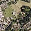
Coldingham Priory church is said to have been originally cruicform on plan, consisting of an aisleless choir and sanctuary, a nave with aisles, N and S transepts with E chapel-aisles, and a tower 90ft high over the crossing.
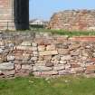
The existing remains are the N and E walls of the choir and sanctuary and a few fragments of the S transept with indications of an E aisle. Nothing survives of the conventual buildings apart from a large rectangular structure, known locally as 'Edgar's Walls', which may have been the refectory (see RCAHMS 1915 plan, fig.30). In 1662 the S and W walls of the choir were reconstructed and that part of the church adapted for use as a place of worship; it was again repaired in 1854-5, when the S porch was added.
D MacGibbon and T Ross 1896; RCAHMS 1915, visited 1914.
About 1098, King Edgar granted the shire of Coldingham to the (Benedictine) monks of Durham and a church, not yet monastic, was built, and dedicated about 1100. Only the church of Coldingham is mentioned in 1127, but in 1139 and again in 1140-1, charters refer to the monks serving the church of St Mary and St Cuthbert of Coldingham. The first prior of Coldingham is recorded about 1174, but the priory was obviously founded before this date. In 1215/6 the priory was plundered by King John's forces. During the Anglo-Scottish wars of the early 14th century, the monks were compelled to abandon Coldingham for a time. An abortive attempt was made to erect the priory into a collegiate church in the mid-15th century. In the 16th century, the priory suffered severely during invasions and was garrisoned both by Scottish and English forces. It was finally dissolved in 1606, and in 1650 most of the remaining buildings were destroyed by Cromwell.
I B Cowan and D E Easson 1976; Information from Laurie Pettitt to HES 12 March 2018.
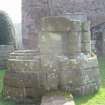
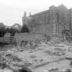
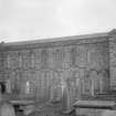
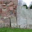
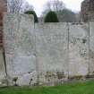
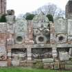
The fragmentary remains are as described. The N and E walls of the church (which is still in use) are in a considerably restored condition and not very impressive. No Norman foundations are visible on the ground, nor are any of the nave and aisles. The remaining wall of the refectory is in a crumbling condition. There is a well in the garden just S of the church porch. A number of early grave slabs were also noted.
Visited by OS (JLD) 1 November 1954.
No change.
Visited by OS (WDJ) 26 January 1966.
Recent excavations have located a cemetery and two long cists, and finds from the excavations include a cross- head, possibly of 11th or 12th century date.
H Clarke 1969; G A Elliot and T D Thomson 1970; D Noble 1971; T D Thomson 1971; D Noble 1973; T D Thomson 1973; D Noble 1976; RCAHMS 1980, visited 1979.
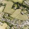
Photographed by the RCAHM in 1980.
RCAHMS AP catalogue.
NT 904 659 A survey recording the location of previous archaeological excavations at Coldingham Priory was undertaken ahead of a proposed programme of works to develop the immediate area into a tourist attraction for the 900th anniversary of the priory in 1998.
The extent and location of the original excavation trenches and major features were recorded. These included three walls which appear to be post-medieval in date, and a possible medieval foundation raft. Three sections were also recorded prior to the infilling of the trench.
Sponsor: Scottish Borders Council.
S Bain 1998
NT 905 661 An archaeological watching brief was undertaken in August and September 2001 on a small site close to the remains of Coldingham Priory (NMRS NT96NW 11.00), on the site of a former garage and filling station destined for redevelopment for housing. Several short stretches of walling were located which related to buildings previously occupying the site. Parts of a smithy shown on the OS 1st edition map of 1857 were recorded together with associated garden walling. A narrow and shallow ditch on a different alignment to the structural building remains was also recorded. The most significant archaeological feature located was a broad ditch 2.5-3m wide and 1-1.5m deep, aligned E-W across the centre of the site, with a presumed break in its length towards the eastern half of the site. This may relate to the priory vallum.
Report to be lodged with the NMRS.
Sponsor: Berwickshire Housing Association.
G Mudie 2001.
Scheduled as Coldingham Priory, claustral remains.
Information from Historic Scotland, scheduling document dated 21 May 2002.
NT96NW 11.00 90394 65949
NT96NW 11.01 NT 904 559 Coin hoard
NT96NW 11.02 NT 90500 65962 Manse
NT96NW 11.03 NT 9042 6604 Excavation
NT96NW 11.04 NT 90372 65941 Transept Arch
NT96NW 11.05 NT 90315 65975 Hearse House and Grave Digger's Store
NT96NW 11.06 NT 90358 65969 Churchyard
NT96NW 11.07 NT 90313 65968 Gate Piers and Gates
NMRS REFERENCE
Architect:
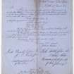
Gordon and Dey, Edinburgh - new furnishings 1854-1855
Wm. I. Gray Architect - Alterations during restoration, 1854 - Rebuilding West and South fronts clearing away surrounding structures, new roofing and refitting interior. In 1855 during this work excavation revealed earlier nunnery buildings.
COLDINGHAM PRIORY DRAWINGS
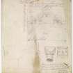
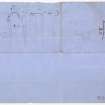
A collection of designs and record drawings executed in connection with the restoration of Coldingham Priory by the architect, Wiliam J Gray of Gray and Paterson 1835-1858. Includes designs for new work in the style of the original and surveys of old work removed during restoration.
Deposited by the Berwickshire Naturalist Club, 1979. Inventory 95
EXTERNAL REFERENCE:
National Archives of Scotland:
See RHP 6506/1-8 Plans R. Matheson and 2 interior prints said to be 1788.
Non-Guardianship Sites Plan Collection, DC23213- DC23321, 1854,1954 & 1923.
Modification (1835 - 1858)
A collection of designs and record drawings executed in connection with the restoration of Coldingham Priory by the architect William J Gray, of Gray and Paterson, 1835-1858 (Jubilee Guide, p15).
Field Visit (April 1914)
74. Coldingham Priory.
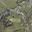
The village and ruined priory of Coldingham are situated in a quiet valley distant about 3 ½ miles by road to the east of Reston Junction and within a mile of the seacoast. The priory church is said to have been originally cruciform on plan consisting of an aisleless choir and sanctuary, a nave with aisles, north and south transepts with east chapel-aisles, and a great tower 90 feet in height over the crossing. The existing remains of this important church are now represented by the north and east walls of the choir and sanctuary and a few fragments of the south transept with indications of an east aisle. Not a vestige of either nave or tower remains. Of the conventual buildings nothing survives but a large rectangular structure at a short distance to the south of the choir, which may have been the refectory; also part of an enclosing wall to the east with indications of a gateway at the north-east angle. The enclosure formed by this wall, the choir, the south transept and the refectory was probably the cemetery, access to which would be gained from the cloister, which lay to the south of the nave, by a slype at the southern end or the south transept. In1662 the south and west walls of the choir were reconstructed and that part of the church was adapted for use as a place of worship. It was again repaired in 1854-55, when the south porch was added and the angle-turrets were raised to their present height.
[For a full architectural description, a historical note and a description of the sculptured stones, see RCAHMS 1915, pp.32-40, figs. 32-40]
RCAHMS 1915, visited April 1914
OS Map: Ber, v. SE
Publication Account (1985)
On a rise above the burn stands one of the most interesting of the smaller Benedictine houses in Scotland. Bede mentions a religious house at Coldingham in the mid 7th century; it was destroyed by the 'Danes' in AD 870 and a new charter granted in 1098 to monks ofSt Cuthbert at Durham by King Edgar of Scotland. This church was dedicated c1100, but there is no suggestion of a priory before 1147. All the priors were English until the late 15th century when the link with Durham was finally broken, but paradoxically, whilst the monks were subject to the English king, the priors were subject to the King of Scotland. The priory was open to 'attack' therefore, in peace or in war! By 1509, it was attached to Dunfermline Abbey; after 1560 and the Reformation, it shared the fate of other religious houses.
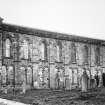
Originally cruciform, with cloisters and domestic buildings adjacent to the south wall, all that remains is the long aisleless choir and sanctuary, now the parish church. Most of the church was rebuilt in 1662 with the porch added in 1854; the north and east walls, though, are largely original.
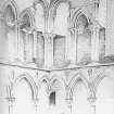
The interior is particularly attractive with strong horizontal lines accentuated by the two-storey division and continuous arcading. The lower storey incorporates an arcade of pointed arches; the upper division, built as a clearstory with lancet-shaped windows, contains a central passage in the thickness of the wall. Outside, the north and east walls are similarly divided with arcadingi and broadly-speaking the style is late Norman/Transitional, probably dating to the early 13th century.
Not far away lie a number of interesting graveslabstwo of them commemorating priors, Radulphus (died c1198) and Ernaldus (died early 13th century). A fine collection of medieval cross-slabs includes some with incised Latin crosses, some with Greek crossesi some displaying incised swords, one also a hunting horn.
Information from 'Exploring Scotland's Heritage: Lothian and Borders', (1985).
Conservation (2008)
NT 9039 6594 The AAM project to develop a community garden (wildlife-friendly with monastic elements such as orchard trees, herbs and historical interpretation) has been in the planning stages for 12 months. It is now linked with the conservation of the Priory ruins. The local authority, Scottish Borders Council, and a charitable trust, Tweed Forum, are combining their efforts with the community group’s AAM project.
Archive: RCAHMS (intended)
Funder: Heritage Lottery Fund, Historic Scotland, Scottish Natural Heritage, Scottish Borders Council and various Charitable Trusts and foundations
Julia Carter (Friends of Coldingham Priory), 2008
Watching Brief (9 February 2009 - 25 November 2010)
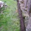
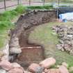
Headland Archaeology conducted a watching brief at Coldingham Priory (a Scheduled Ancient Monument No. 383) during the construction of a communal garden to the south of the scheduled area, and the consolidation of existing ruins within it. The work was jointly commissioned by the Scottish Borders Council, the Tweed Forum, and the Friends of Coldingham Priory, and undertaken in accordance with a Written Scheme of Investigation submitted in order to gain Scheduled Monument consent from Historic Scotland. The watching brief took place over a period of 22 months, and the works were designed so as to minimise any impact on archaeological remains. Ivy and loose stones were removed from the walls of the refectory, cloister, and lapidarium and parts of these walls repointed. A number of architectural stones were recorded within them. The foundations of the refectory, chapter house, south transept, lapidarium, and westwerk, were partially uncovered underneath topsoil during the watching brief, as well as areas of possible paving around the lapidarium and westwerk. Entrance thresholds into the refectory and a previously sub-surface wall (which is likely to represent the eastern wall of the southern transept) were also revealed. A section of ground behind a probable 19th century retaining wall within the cloister was exposed and redeposited graveyard soil overlying the former surface level of the cloister was recorded.
Archive: RCAHMS
Funder: Scottish Borders Council, The Tweed Forum and Friends of Coldingham Priory
Headland Archaeology Ltd 2010
Information also reported in Oasis (headland1-104915) 17 June 2013
Watching Brief (October 2012)
NT 9039 6595 A watching brief in October 2012 observed the construction of a new door in the S elevation and its associated stair and footpath, ground reduction for an upgraded footpath serving the entrance porch, and the excavation of a trench through the S elevation for a new pipe.
A number of pieces of architectural stonework were recovered from the rubble core of the wall during the insertion of the new door. The architectural stone assemblage is varied but is dominated by stonework characterised by a distinctive type of bold carved moulding that can be confidently dated to the Early English Gothic of the late 12th to mid- 13th century. Reused in the construction of the later 17th-century church, these stones were chiefly from large heavily decorated arches and are uniformly of a pink or red sandstone.
Two pieces are of particular interest. The first has a carved human face, representing either a man or a woman, possibly a saint. The face is carved in stylised fashion, although effort has been made to define eyelids and provide texture to the hair. Rising from the right side of the head is the beaded edge of an arch and from the left side of the head a second rolled modelling. It is likely that this carved stone formed part of a door jamb.
The largest of the finds is also of note as it may constitute the partial remains of sedilia (recessed stone seats for clergy which are commonly found in the chancels, or choirs, of churches). The surviving carved cusps are suggestive of trefoil, quartrefoil, or cinqfoil motifs, which is consistent with a 13th-century date.
Other finds, including column shafts, would also fit well with this 12th- to 13th-century period of construction. However, other carved stones that have simpler or differing types of moulding are less easy to date and may point to different construction phases. In addition, there are finds that are clearly of later post-medieval and/or modern date, that were possibly originally associated with graves or grave architecture.
Archive: RCAHMS. Report: Scottish Borders HER (intended)
Funder: Congregational Board of Coldingham and St Abbs
Melanie Johnson and Adam Jackson, CFA Archaeology Ltd, 2013
(Source: DES)
Sbc Note
Visibility: Upstanding building, which may not be intact.
Information from Scottish Borders Council


