
Pricing Change
New pricing for orders of material from this site will come into place shortly. Charges for supply of digital images, digitisation on demand, prints and licensing will be altered.
Preston Mains


Field Boundary(S) (Post Medieval)
Site Name Preston Mains
Classification Field Boundary(S) (Post Medieval)
Canmore ID 142646
Site Number NT57NE 101
NGR NT 59704 78093
NGR Description Centre
Datum OSGB36 - NGR
Permalink http://canmore.org.uk/site/142646


- Council East Lothian
- Parish Prestonkirk
- Former Region Lothian
- Former District East Lothian
- Former County East Lothian
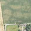
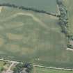
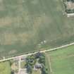
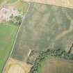
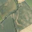
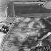
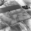
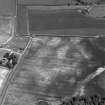
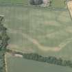
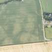
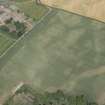
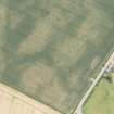
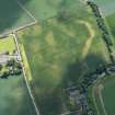
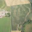
NT57NE 101 from 5976 7827 to 5974 7795.
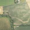
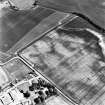
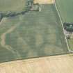
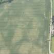
A linear cropmark has been identified from air photographs (RCAHMSAP 1995) 70m SSW of Preston Mains farmsteading. It is visible from NT c.5975 7817 to NT c.5974 7795, running in a N - S direction for a distance of approximately 235m. It intersects the cropmark of a possible cursus monument (NT57NE 29).
Information from RCAHMS (KB) 6 April 1999
Note (7 June 2023)
The location, classification and period of this site have been reviewed and changed from LINEAR FEATURE (PERIOD UNASSIGNED).

