Pricing Change
New pricing for orders of material from this site will come into place shortly. Charges for supply of digital images, digitisation on demand, prints and licensing will be altered.
Upcoming Maintenance
Please be advised that this website will undergo scheduled maintenance on the following dates:
Thursday, 9 January: 11:00 AM - 3:00 PM
Thursday, 23 January: 11:00 AM - 3:00 PM
Thursday, 30 January: 11:00 AM - 3:00 PM
During these times, some functionality such as image purchasing may be temporarily unavailable. We apologise for any inconvenience this may cause.
Keith Marischal
Country House (16th Century)
Site Name Keith Marischal
Classification Country House (16th Century)
Alternative Name(s) Keith House; Keith Marischal House, Garden Walls And Gatepiers; Keith Marischal Policies; Keith House Policies
Canmore ID 54828
Site Number NT46SW 4
NGR NT 44909 64417
Datum OSGB36 - NGR
Permalink http://canmore.org.uk/site/54828
First 100 images shown. See the Collections panel (below) for a link to all digital images.
- Council East Lothian
- Parish Humbie (East Lothian)
- Former Region Lothian
- Former District East Lothian
- Former County East Lothian
NT46SW 4.00 44909 64417
(NT 4491 6442) Keith Marischal (NR)
OS 6" map (1971)
NT46SW 4.01 NT 44861 64343 Steading
NT46SW 4.02 NT 4488 6433 Stables
NT46SW 4.03 NT 44380 64264 North Lodge
NT46SW 4.04 NT 44725 64061 South Lodge
NT46SW 4.05 NT 44887 64333 Dovecot
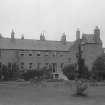
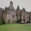
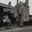
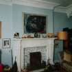
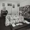
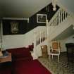
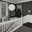
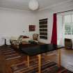
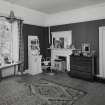
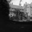
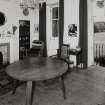
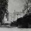
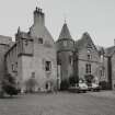
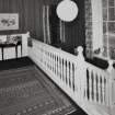
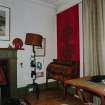
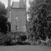
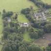
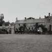
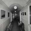
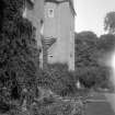
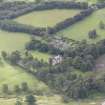
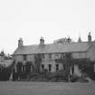
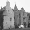
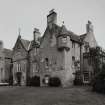
The building as it now stands consists of the original late 16th c L-planned house, to which has been added an L-shaped extension, to form three sides of a square. The hollow of this was filled in towards the end of the 19th c. Almost the entire roof-line was altered at this last period, and the crow-stepping of the gables has disappeared. The original house appears to have been a moderate-sized laird's house on an unusual version of the L-plan, a lofty, square tower projecting at the outer angle of the 'L'. This was reputedly built by George Keith, 5th Earl Marischal, in 1589, though it is possible that he merely added to an earlier house.
N Tranter 1962; D MacGibbon and T Ross 1887; RCAHMS 1924
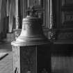
Keith Marischal is generally as described. A bell, dated 1620, is situated over an archway at NT 4490 6431.
Visited by OS (BS) 29 July 1975.
EXTERNAL REFERENCE
Scottish Record Office
Building work at Keith House and Nether Keith. Letter from Alexander Stevens, architect in Edinburgh, to Alexander Williamson, 16 St James Square, Edinburgh. He wishes payment for his work at Keith House and for the new staircase on the front of the house of Nether Keith.
12 April 1791 NRA(S) 888 2084
Keith. Parks and garden of Keith House.
18c-19c NRA(S) 888/2086
Field Visit (25 August 1913)
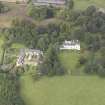
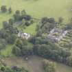
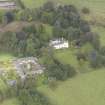
Keith House more usually called Keith Marischal, lies 2 miles west-southwest from Humbie station amid the well-wooded policies of the estate. The structure dates from the end of the 16th century but has been so added to and modernised from time to time that few architectural features of interest remain. Into the north wall of the north-west wing is built a stone bearing beneath an earl's coronet a shield charged with three pallets on a chief-the arms of the Keith family.
Near the angle turret but towards the west a panel, which was removed from Rubislaw, has been inserted. It bears the arms of Sir George Skene of Rubislaw and Fintry and is dated 1688.On the family of Keith see Introd. p. xxi.
RCAHMS 1924, visited 25 August 1913.
Project (17 May 2018 - 18 May 2018)
NT 44909 64417 A geophysical survey was undertaken, 17 – 18 May 2018, within the grounds to the N of Keith Marischal House, to investigate what remains of the lost renaissance palace of the Earls Marischal. The current house is largely a 19th- and early 20th-century construct with a late 16th-century tower incorporated into its SE corner. The first reference to a castle on the site is in 1525, when the castle’s description would suggest a noble residence with an enclosed courtyard. In the mid-18th century the house is recorded as having a courtyard and a large three-storey dining hall opposite. Neither the courtyard nor the dining hall are now in evidence.
The survey area covered c0.2ha and was investigated by resistance and ground penetrating radar. While neither survey method categorically confirmed the layout of the original house, both sets of results have detected anomalies which indicate partial survival of possible structural remains.
Archive: Rose Geophysical Consultants
Funder: Miles Kerr-Peterson funded by Castle Studies Group
Susan Ovenden – Rose Geophysical Consultants
(Source: DES Vol 19)
Ground Penetrating Radar (17 May 2018 - 18 May 2018)
NT 44909 64417 Ground penetrating radar.
Archive: Rose Geophysical Consultants
Funder: Miles Kerr-Peterson funded by Castle Studies Group
Susan Ovenden – Rose Geophysical Consultants
(Source: DES Vol 19)
Resistivity (17 May 2018 - 18 May 2018)
NT 44909 64417 Resistivity.
Archive: Rose Geophysical Consultants
Funder: Miles Kerr-Peterson funded by Castle Studies Group
Susan Ovenden – Rose Geophysical Consultants
(Source: DES Vol 19)


