Pricing Change
New pricing for orders of material from this site will come into place shortly. Charges for supply of digital images, digitisation on demand, prints and licensing will be altered.
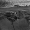
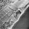
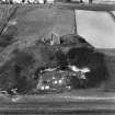
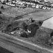
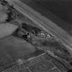
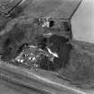
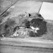
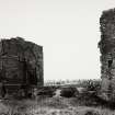
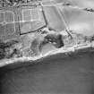
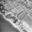
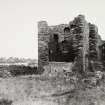
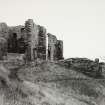
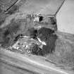
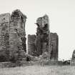
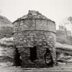
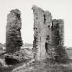
East Wemyss, Macduff's Castle
Tower House (14th Century)
Site Name East Wemyss, Macduff's Castle
Classification Tower House (14th Century)
Alternative Name(s) Kennoway Castle
Canmore ID 53974
Site Number NT39NW 4
NGR NT 34399 97170
Datum OSGB36 - NGR
Permalink http://canmore.org.uk/site/53974
- Council Fife
- Parish Wemyss
- Former Region Fife
- Former District Kirkcaldy
- Former County Fife
NT39NW 4 3440 9717
For 1990 excavation of medieval quarry dumps probably related to construction of Macduff's Castle see NT39NW 3 and NT39NW 6 -11, 13 (East Wemyss Caves). See also walls under NT39NW 27.
(NT 3440 9717) Macduff's Castle (NR) (Ruins)
OS 6" map, (1938)
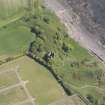
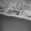
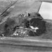
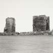
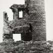
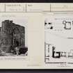
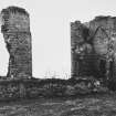
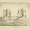
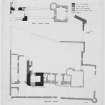
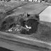
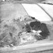
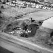
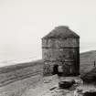
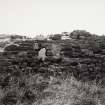
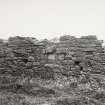
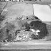
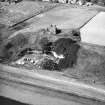
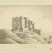
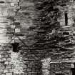
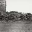
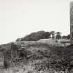
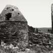
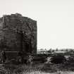
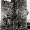
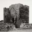
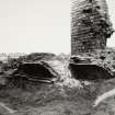
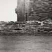
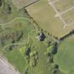
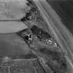
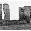
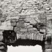
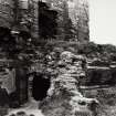
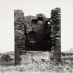
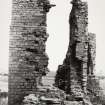
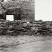
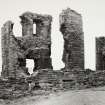
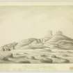
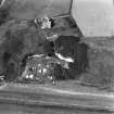
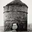
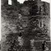
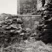
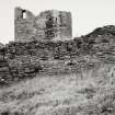
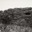
This castle, although associated by tradition with 'Macduff, Thane of Fife', who is believed to have flourished in the second half of the 11th century was probably not begun until near the end of the 14th century. The remains consist of a 14th century tower; possible 15th century remains; a 16th century range of buildings running southward from the tower and terminating in a second tower; and a late 16th century or early 17th century outer wall, looped for guns, surrounding the whole. The western stretch of this outer wall terminated in turrets, only the southern one now remaining. The north stretch is demolished, but foundations of outbuildings that stood against it can still be seen.
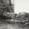
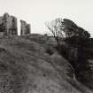
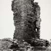
The castle buildings are extremely ruinous.
RCAHMS 1933.
The remains are as described above.
Visited by OS (JFC) 6 October 1954.
Site recorded by Maritime Fife during the Coastal Assessment Survey for Historic Scotland, Kincardine to Fife Ness 1996
Field Visit (13 August 1927)
"Macduff's" Castle.
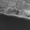
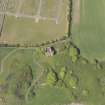
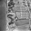
This castle, although associated by tradition with "Macduff, Thane of Fife," who is believed to have flourished in the second half of the 11th century, was probably not begun until near the end of the 14th century, and it includes much building of a later time. It stands on the sea cliff immediately above the "Well" Cave, and less than a quarter of a mile north-east of East Wemyss. The site is level, except on the east where it falls abruptly to the water. The castle buildings, despite a partial restoration of recent years, are extremely ruinous and in parts unsafe, and they still suffer wilful damage at the hands of visitors.
The remains represent an oblong block running north and south having a tower at either end, the whole set within an enclosure which contained subsidiary structures. While the development of the castle has necessarily been from the cliff westwards, the arrangement of the original I4th-century stronghold cannot be determined, since no more has survived than the lower part of its gate-tower on the northwest and a heavy revetment in the cliff immediately above the "Well" Cave. In a second building-period, initiated possibly in the 15th century but mainly dating from the 16th, the entrance was changed. A range of building was run southward from the gate-tower and terminated in a second tower. A new entrance was formed in the centre of this range, and above it lay the hall, a scheme characteristic of the time, whereby the main buildings of the castle were brought together to form the front. Finally, in the late 16th or early 17th century an outer wall, looped for guns, was carried round the whole.
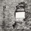
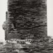
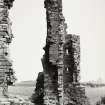
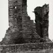
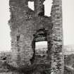
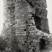
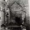
The northern tower is oblong on plan, measuring externally 27 by 34 feet, and is four storeys in height. The masonry is of rubble, built with pinnings. From the second-floor level upwards, the outer faces of the north, west, and south walls are set back, while the north wall is also set back at a lower level. From the ground to half-way up the first floor the masonry seems original. In the west wall, at ground level, the jambs of the entrance archway, which was built up in the 16th century, are just traceable. In the east wall, however, the opening is more clearly marked; the transe has been vaulted, and on the southern side lay a porter's room or guard-chamber, also vaulted. The first floor, which must have been entered from a forestair, was converted into a kitchen in the 15th century. A large window in the east wall, with seats in the embrasure, may occupy the position of the original entrance at this level, while another has been inserted in the west wall in what apparently was once a fireplace. In the north wall an aumbry and sink have been contrived in an older garderobe, and there is an aumbry in the south wall also. Another change, which was apparently effected in the same century, was the insertion of a vault with an entresol floor at springing level, the latter being entered from a mural stair at the south-east angle. Like the first floor, the upperpart of the tower was remodelled internally in the 15th century, and it was again altered in the16th, when an external stair of stone at the north-east angle replaced the original access. Up to the first floor the steps are straight; above that level the stair becomes a turnpike, giving access to the upper floors which had previously been entered from the south-east mural stair. The second floor is even more fragmentary than those below, and the third storey is almost entirely demolished.
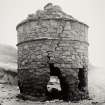
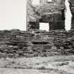
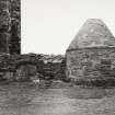
The 16th-century extension along the south front was three storeys in height but is now reduced to the vaulted ground-floor, the chambers of which are entered from a courtyard behind. The upper floors communicated with the towers at either end, and the front wall was surmounted by a parapet with a walk, reached from a door in the southern tower. This tower is built of ashlar but in detail corresponds with its neighbour. It, too, advances from the line of the central range, and the upper parts of the walls are set back. It is oblong on plan with a circular stair-tower projecting from the north-east angle, containing the entrance and serving all floors. The ground floor is inaccessible, but is obviously vaulted. A gunloop of 16th-century type in the north wall flanks the entrance to the courtyard, and on the west appears a vent, the only remnant of a garderobe. There have been two rooms on the first floor, the inner one having a staircase communicating with the floor above and giving access to the battlements of the hall-building. Each of the upper floors has been subdivided. The tower-and therefore also the front range was built after 1530 (cf. HISTORICAL NOTE and No. 543), and at a late date an outbuilding was erected against its east wall.
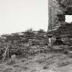
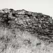
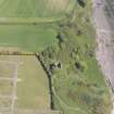
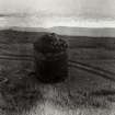
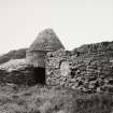
The outer boundary wall runs parallel to the buildings. The western stretch has terminated in turrets, of which the one on the south remains; it is provided with a gunloop on the north and another on the east. The northern stretch is demolished, but foundations of the outbuildings that stood against it can still be seen. The courtyard is full of debris.
HISTORICAL NOTE. This castle was on the lands formerly known as East Wemyss. John de Wemyss flourished in the late 14th century (1). The family then seems to have ended in coheiresses, one of whom apparently married William Livingstone of Drumry, since in February 1493-4, William's son, Robert, received a grant of the lands of East Wemyss with "the house (domo) or fortalice of the same," which his father had resigned (2). A later charter of confirmation to this Robert, now (1508) Sir Robert Livingstone of Drumry, describes the lands of East Wemyss as the third part of "Wemyss-shire" and erects them into a barony (3). The daughter and heiress of Sir Robert married Sir James Hamilton of Finnart and they in 1530 exchanged the lands of East Wemyss with James Colville of Ochiltree for his barony of Ochiltree in Ayrshire (4). The Colvilles held East Wemyss till 1630 when it was sold to John, Lord Wemyss of Elcho, afterwards first Earl of Wemyss (5), who resided there for some time. The second Earl, however, preferred to live at West Wemyss (NT39NW 14) (6). In 1651 he had the lands of East and West Wemyss, with others, united in the barony of Wemyss, with the manor place of Wemyss as principal messuage (7). Fifteen years later his daughter, Lady Jean Wemyss, then Countess of Sutherland, wrote to her father from Dunrobin asking that her children might be allowed to live in the castle of East Wemyss if the plague appeared in Edinburgh, as it was feared it might (8). At that date, therefore, the castle was still habitable; its abandonment and decay must have come later.
RCAHMS 1933, visited 13 August 1927.
(1) Reg. Mag. Sig., i, No. 518. (2) Ibid., s.a., No. 2198. Cf. Wemyss of Wemyss by Sir William Fraser, i, p. 41. (3) Reg. Mag. Sig., s.a., No. 3229. (4) Ibid., s.a., No. 980. (5) Wemyss of Wemyss, i, p. xx. (6) Ibid., p. xxvii. (7) Ibid., p. xxii. (8) Ibid., p. 291.
Field Visit (23 May 1928)
Armorial Panel from Macduff's Castle.
Inserted in the masonry above the western archway of the stable buildings [NT39NW 14.3] at Wemyss Castle is an armorial panel of particular interest from the circumstances attending its discovery. Some years ago when steps were being taken for the conservation of the southern tower of Macduff's Castle [NT39NW 4], the workmen came upon the panel laid face downward in sand beneath the foundation, and an eyewitness relates that the tinctures were then particularly brilliant. But, while the carving is still sharp and well defined, the tinctures have almost entirely disappeared. The shield, supported on the dexter side by a Hercules, and on the sinister by a unicorn gorged, bears: Quarterly, 1st and 4th (argent), a cross moline (sable), for Colville, 2nd and 3rd (gules), a fess cheeky (argent and azure), for Lindsay, the whole being probably for Sir James Colville, who acquired the lands of East Wemyss in 1530. The label beneath the shield does not appear to be inscribed.
RCAHMS 1933, visited 23 May 1928.
Excavation (July 2019)
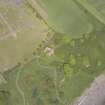
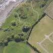
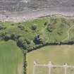
NT 34370 97107 As part of the archaeological excavations at the Wemyss Caves, a test-pitting exercise was undertaken on the long, narrow promontory which runs roughly north-south, immediately to the southwest of Macduff’s Castle. The work was undertaken to test the hypothesis that this promontory may have been the location of a defenced enclosure prior to the construction of Macduff’s Castle. Edinburgh Archaeological Field Society carried out a resistivity survey of the cleared area of the promontory in which the test pits were located.
No evidence of activity or material contemporary with the adjacent MacDuff’s Castle was recovered, suggesting the promontory may have been grazed or wooded during the occupation
of the Castle.
Information from J. Hamblby and E Graham - SCAPE Trust
OASIS ID: thescape1-50452


