Scheduled Maintenance
Please be advised that this website will undergo scheduled maintenance on the following dates: •
Tuesday 3rd December 11:00-15:00
During these times, some services may be temporarily unavailable. We apologise for any inconvenience this may cause.
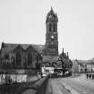
Peebles, Tweed Bridge
Road Bridge (Period Unassigned)
Site Name Peebles, Tweed Bridge
Classification Road Bridge (Period Unassigned)
Alternative Name(s) River Tweed
Canmore ID 51465
Site Number NT24SE 3
NGR NT 25043 40305
Datum OSGB36 - NGR
Permalink http://canmore.org.uk/site/51465
- Council Scottish Borders, The
- Parish Peebles
- Former Region Borders
- Former District Tweeddale
- Former County Peebles-shire
NT24SE 3 25043 40305
Tweed Bridge [NAT]
OS 1:2500 map, 1965.
See also NT24SE 105 (spigot mortar mounting) and NT24SE 106 (road block).
NMRS REFERENCE:
Dates: late 15th. cent.
1834 widened.
1901 widened.
Engineers: John Hisplop, mason - added three additional arches 1799
John and Thomas Smith, Darnick - widened 1834
McTaggart, Cowan and Barker - widened 1897-1900.
(Undated) information in NMRS.
(NT 2504 4029) Tweed Bridge: There is no evidence to indicate when a bridge across the Tweed was first erected at Peebles, but from the time that the burgh records become at all adequate, about the mid-15th c, there are frequent references to the upkeep of a stone bridge on this site.
The oldest portion of the present bridge has been ascribed to c. 1465-70 on the strength of certain references in the burgh records, but these entries could equally well refer to the maintenance or partial reconstruction of an existing bridge as to the erection of a new one. Moreover, the burgh records again become scanty in the first half of the 16th century, during which period the bridge could have been rebuilt or altered. However, the architectural character of the oldest part of the bridge is suggestive of late medieval work, and on these grounds, may tentatively be ascribed to a date in the 15th century.
Burgh records show that constant repairs were carried out on the bridge in the 17th and 18th centuries, and three additional arches, since replaced by a railway bridge, were erected in 1799. The bridge was widened on both sides in 1834, and again widened in 1897-1900.
The main portion of the bridge comprises five segmental arches whose span varies from 38'-42'. The original width was 8', increased in 1834 to 21' and in 1900 to 40'. Very little can now be seen of the fabric of the early bridge.
RCAHMS 1967, visited 1958
No further information.
Visited by OS (EGC) 2 March 1962 and (SFS) 19 September 1974.
(Location cited as NT 251 403). Tweed Bridge, late 15th century, widened 1834 and 1900. 5-span masonry bridge with dolphin lamp standards (from 1900 widening) and the original structure has almost semicircular arches (the widened parts have flatter segmental arches).
J R Hume 1976.
This bridge carries the B7062 public road over the River Tweed to the S of the centre of Peebles (NT24SE 49).
Information from RCAHMS (RJCM), 26 January 2006.
Photographic Record (1896)
Photograph album with views from the Scottish Borders in 1896 including Peebles
Publication Account (2007)
This bridge over the Tweed appears to be a typical ca.1900 masonry structure, with its five arch spans of about 38 ft and parapets surmounted with decorative cast-iron dolphin lamps cast in Glasgow. But, on close inspection of the underside, arches of earlier construction can still be seen. In 1799 one or two arches were added at the south end. These were replaced by the railway overbridge in ca.1863.
The 15th century bridge may have been built by a master mason known as ‘John of Peebles’ and was in the course of erection or undergoing improvement in 1465. It had a clear width of only 8 ft and was widened on both sides in 1834 to 21 ft and again in 1899–1900 to 40 ft, by taking down and rebuilding the east (downstream) fac¸ade. The engineers for this last work, which is still in service, were M’Taggart,
Cowan & Barker, Glasgow. The contractor was a local firm, Dickson & Clyde and the cost about £8000. The cast-iron dolphin lamp standards on the parapets are particularly eye-catching.
Another probably 15th/16th century bridge of similar width and character in the Borders, which has survived
in a more original state, is Canongate Bridge, Jedburgh. It has three segmental arches of 2812 ft span, each supported on four ribs and its use is now restricted to pedestrians.
R Paxton and J Shipway 2007
Reproduced from 'Civil Engineering heritage: Scotland - Lowlands and Borders' with kind permission from Thomas Telford Publishers.
Sbc Note (15 April 2016)
Visibility: Standing structure or monument.
Information from Scottish Borders Council


