Pricing Change
New pricing for orders of material from this site will come into place shortly. Charges for supply of digital images, digitisation on demand, prints and licensing will be altered.
Upcoming Maintenance
Please be advised that this website will undergo scheduled maintenance on the following dates:
Thursday, 9 January: 11:00 AM - 3:00 PM
Thursday, 23 January: 11:00 AM - 3:00 PM
Thursday, 30 January: 11:00 AM - 3:00 PM
During these times, some functionality such as image purchasing may be temporarily unavailable. We apologise for any inconvenience this may cause.
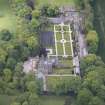
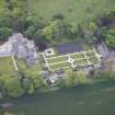
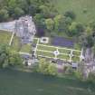
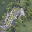
Carlowrie, Main Stable Block
Stable (19th Century)
Site Name Carlowrie, Main Stable Block
Classification Stable (19th Century)
Canmore ID 262428
Site Number NT17SW 52.05
NGR NT 14103 74437
Datum OSGB36 - NGR
Permalink http://canmore.org.uk/site/262428
- Council Edinburgh, City Of
- Parish Kirkliston (City Of Edinburgh/w Lothian)
- Former Region Lothian
- Former District City Of Edinburgh
- Former County West Lothian
Standing Building Recording (20 September 2021 - 28 September 2021)
NT 14104 74434 On 20 September 2021, a Level 2 historic building survey was carried out of the former stable block within the Carlowrie Castle complex in Kirkliston (Canmore ID: 262428) The works were required as part of a planning condition on the renovation of the building into holiday accommodation.
Carlowrie Castle Stables, built in the early 1850s as part of the Carlowrie Castle Estate, are located to the W side of the walled garden and are one of a number of stone-built outbuildings in this area of the castle grounds. Externally, the building has retained its original character and appearance to the exterior, although internally has been much altered in the 20th century, and as part of a previous unfinished development undertaken in 2018.
Following the building survey, a watching brief was undertaken on the 27 and 28 September 2021. This involved the monitoring of ground reduction associated with the construction of a building extension.
The watching brief revealed 0.24m of made ground overlying a deposit of silty sand. No significant archaeological features or material were observed.
Archive: NRHE (intended) Funder: Private individual
Diana Sproat – AOC Archaeology Group
(Source: DES Vol 22)


