Scheduled Maintenance
Please be advised that this website will undergo scheduled maintenance on the following dates: •
Tuesday 3rd December 11:00-15:00
During these times, some services may be temporarily unavailable. We apologise for any inconvenience this may cause.
Castle Campbell
Castle (Medieval)
Site Name Castle Campbell
Classification Castle (Medieval)
Alternative Name(s) Castle Gloom; Castle Glume; Castle Doom
Canmore ID 48229
Site Number NS99NE 2
NGR NS 96128 99300
Datum OSGB36 - NGR
Permalink http://canmore.org.uk/site/48229
First 100 images shown. See the Collections panel (below) for a link to all digital images.
- Council Clackmannan
- Parish Dollar
- Former Region Central
- Former District Clackmannan
- Former County Clackmannanshire
NS99NE 2.00 96128 99300
(NS 9613 9927) Castle Campbell (NR) (Remains of)
OS 6" map, (1948).
NS99NE 2.01 NS c. 96130 99266 Garden
See attached pamphlet.
S Cruden 1953.
The remains of Castle Campbell, maintained by the MoW., are in a good state of preservation.
Visited by OS (JLD), 15 May 1953.
Field Visit (13 June 1928)
Castle Campbell.
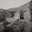
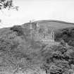
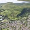
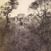
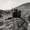
This castle, once known as Castle Gloom, stands nearly a mile north of Dollar on a spur of the Ochils at the head of a deep, densely wooded glen (SC 798520, SC 798524). Its actual site is a rocky mound, rising precipitously from the deep ravines formed by the swift, tumbling burns of "Care" and " Sorrow," which unite below the castle and continue down the glen as the Dollar Burn. Bank Hill and Gloom Hill rise on either side to elevations of 1128 and 727 feet respectively, and behind-that is to the north-are the more considerable heights of Saddle Hill (1633 feet) and Hillfoot Hill (1337 feet). Despite the melancholy sound of so many of the names the castle is a pleasant place, lying open to the sun and having a magnificent outlook southwards over the Forth and the plain beyond and around it.
The mound is less steep on the north, and it is from that side, therefore, that the castle is normally approached. The old way from Dollar was by a track which crosses the shoulder of Gloom Hill and joins a road running through the hills from Glen Devon, just before the latter reaches the castle. The more usual access, however, is by a modern path which runs directly up the glen. Immediately above the meeting of the streams and just beyond the Glencairn Bridge, where the burn of Sorrow is crossed, the cliff forming the southern boundary of the site is rent by a great fissure, called, Kemp's Score or Cutt."* This is mainly a natural formation, but roughly cut steps have been found beneath the debris that now fills it, and it would provide a short but dangerous route to the summit. The path proper keeps the outer side of the ravine and ascends the mound on the north. At the point where it begins to rise, there are re-entrants, which seem to be natural.
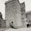
The buildings do not occupy the whole of the available ground on the top. Towards the south there are the remains of a garden with broken ground beyond, and beside "Kemp's Score" is an archway, evidently not of great antiquity and apparently built to shut off a small oval area with almost perpendicular sides. The castle attained its present form by a process of gradual development. The third quarter of the 15th century saw the erection of the oblong tower which stands at the northeastern corner of the present enclosure. It was self-contained but was evidently designed for attachment to a barmkin. Whether any part of the barmkin remains is not quite certain, but the tower itself is structurally the most complete of the castle buildings. In the 16th century the present enclosure was built, and the living accommodation of the castle increased by the provision of ranges of building against its south and east walls. At the close of the 16th or at the beginning of the 17th century the eastern range was altered, an incidental result of the alteration being to improve the means of communication within the tower, while some work was also done on the south range and on the wall of enclosure. To the same period maybe assigned the existing gateway to the courtyard, on the western side of which a one-storeyed building was built against the outside of the wall. Of the last addition, however, few traces have survived.
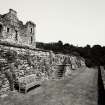
As castle and enclosure extended across the full width of the site, the only access to the garden and the ground beyond it was from within the courtyard through a vaulted transe passing under the southern range. The garden dates from the 16th century. It is equal in width to the enclosure and stretched 22 yards south of the main outer wall. It is now enclosed by a low roughly-built wall, in parts broken and ruinous, which terminates at the south-eastern angle in the remains of a small circular tower of indeterminate date, having a diameter of 8 feet 2 inches within walls 2 feet 3 inches thick.
[see RCAHMS 1933, 321-325, for a full architectural description]
HISTORICAL NOTE. - Castle Campbell, with the kirklands of Dollar, was originally held by the Earl of Argyll in feu-farm from the Bishopric of Dunkeld (1). Before 1490 the castle was called "the Gloume," but in that year Colin, first Earl of Argyll, secured an Act of Parliament changing the name to Castle Campbell (2). In 1645 the Marquis of Montrose, on his way from Fife to Stirling, burnt "the land of Castell Gloum, otherways called Castell Cambell” (3). Bishop Guthry records the burning of the parish of "Dollor" on this occasion by "Maclean and his people" in the service of Montrose, the parish "belonging to the marquis of Argyle" (4). It is usually said that at this time Castle Campbell was burnt, but in neither of these contemporary sources is there a statement to that effect.
RCAHMS 1933, visited 13 June 1928.
(1) Rentale Dunkeldense (S.H.S.), pp. 51-9,341, &c. (2) Acts Parl. Scot., ii, p. 222. (3) Britane's Distemper, by Patrick Gordon, pp.137-8. (4) The Memoirs of Henry Guthry, &c.,2pd ed. 1747, p. 191. Mark Napier in his Life of Montrose, p. 350, affirms the burning of the Castle, but his only reference is to Guthry.
Note (1978)
Castle Campbell NS 961 992 NS99NE 2
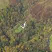
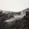
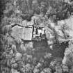
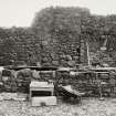
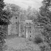
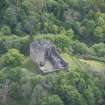
The castle is situated on the top of a rocky mound, at the head of Dollar Glen; the tower dates to the third quarter of the 15th century, the courtyard having been added in the 16th and 17th centuries. The castle mound may be partly artificial and may indeed incorporate the remains of a motte.
RCAHMS 1978
(RCAHMS 1933, pp. 321-5, No.615; Cruden 1953)
Publication Account (1985)
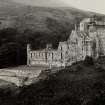
Castle Campbell is tucked away at the head of Dollar Glen and occupies the top of a promontory overlooking the confluence of the Bums of Sorrow and Care. From the 15th to the 17th century it served as the principal lowland seat of the Earls of Argyll; prior to 1490 it was known as Castle Glume, but in that year Colin Campbell, 1st Earl of Argyll, secured an act of Parliament changing its official name to Castle Campbell.
The present buildings date from the later 15th to the 17th century, but charter evidence suggests that there was an earlier castle on the site, and it is possible that the mound on which the tower stands is the remains of a motte and bailey. Like so many castles of the later middle ages, Castle Campbell developed from a relatively simple tower-house to a more complex design. The earliest section of the present castle is a well-preserved oblong tower-house dating to the third quarter of the 15th century. It is offour principal storeys plus a gan-et, and rises within massive walls to an overhanging parapet. The internal arrangements are in keeping with most tower-houses and there is a hall occupying the first floor.
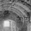
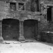
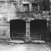
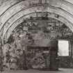
During the later 15th or early 16th century the residential accommodation was augmented by the construction of a south range, which consists of a series of vaulted cellars under a fine first-floor hall (cf Newark Castle, no. 26). In the late 16th or early 17th century a block was added on the east, linking the tower to the south range. An unusual feature of the east range is a double arched arcade, or loggia; this was a detail borrowed from the contemporary continental Renaissance style and was more suited to the sunny south than to the windy climate of Scotland. At about the same time that the east range was added, the courtyard was enclosed within a curtain wall and was provided with a gateway with a covered pend. To the south of the castle, and entered through a pend running beneath the south range, there is a small walled garden.
Information from ‘Exploring Scotland’s Heritage: The Clyde Estuary and Central Region’, (1985).
Test Pit Survey (7 December 2009 - 14 December 2009)
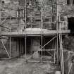
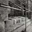
Under the terms of its PIC call-off contract with Historic Scotland, Kirkdale Archaeology was asked to undertake an archaeological watching brief on the excavation of a series of trenches ahead of the erection of a scaffold at Castle Campbell near Dollar in Clackmannanshire. Forty trenches were excavated over a two day period around the W side of the N façade of the Tower, the W side of the S façade of the S Range and the E façade of the Tower, E Range and S Range. Where the ground was level, a simple de-turf or scrape was sufficient to bed the scaffold pads. The trenches ran deeper where the topography sloped i.e. around the area of the potential motte below the Tower, and the ravine falling away from the E façade of the castle. The brief was to dig a depth sufficient to provide a flat platform for each scaffold base - and as such, given the position of the trenches, there was no opportunity to assess the make-up of the mound below the Tower.
The trenches were manually dug by Historic Scotland under archaeological supervision. No archaeological artefacts were recovered.
Information from P Fox, J Godbert, D Murray (Kirkdale Archaeology) 22 March 2010.
Tower
Watching Brief (7 December 2009 - 14 December 2009)
Under the terms of its PIC call-off contract with Historic Scotland, Kirkdale Archaeology was asked to undertake an archaeological watching brief on the excavation of a series of trenches ahead of the erection of a scaffold at Castle Campbell near Dollar in Clackmannanshire. Forty trenches were excavated over a two day period around the W side of the N façade of the Tower, the W side of the S façade of the S Range and the E façade of the Tower, E Range and S Range. Where the ground was level, a simple de-turf or scrape was sufficient to bed the scaffold pads. The trenches ran deeper where the topography sloped i.e. around the area of the potential motte below the Tower, and the ravine falling away from the E façade of the castle. The brief was to dig a depth sufficient to provide a flat platform for each scaffold base - and as such, given the position of the trenches, there was no opportunity to assess the make-up of the mound below the Tower. The Tower is thought to date to the early 15th Century, while the S Range was added around 1500, and the E Range in 1590.
G Ewart 2009
Sponsor: Historic Scotland
Kirkdale Archaeology
Watching Brief (16 April 2010 - 21 April 2010)
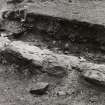
NS 9610 9928 A watching brief was carried out, 16–21 April 2010, during the excavation of two trenches to locate a blockage in a drainpipe in the NW corner of the courtyard. Trench 1 was dug through the N doorway in the W courtyard wall but failed to locate the drainpipe. Trench 2 located the drainpipe and its associated soakaway in the corner of the courtyard. The blockage was removed and the trenches were planned, photographed and their contents recorded.
Archive: RCAHMS (intended)
Funder: Historic Scotland
David Murray – Kirkdale Archaeology
Watching Brief (20 April 2010)
NS 961 993 Two small trenches were excavated on 20 April 2010 to allow the installation of an information sign and the construction of a supporting bank behind it. The trenches were located to the E of the approach road and to the N of the castle. There were no finds or features of archaeological significance.
Archive: RCAHMS (intended)
Funder: Historic Scotland
David Murray – Kirkdale Archaeology
Watching Brief (3 March 2010 - 30 September 2010)
NS 961 992 A programme of monitoring and recording was carried out, 3 March–30 September 2010, during remedial works on the interior of the N elevation in the custodian’s apartments. This recording formed part of ongoing remedial works to weatherproof the existing wall-head and roof structures. The level of recording was directed by Historic Scotland’s programme of repair and consolidation, and was intended to augment existing survey records.
Paul Fox, J Godbert and David Murray 2010
Funder: Historic Scotland
Kirkdale Archaeology
OASIS ID: kirkdale1-249880
Standing Building Recording (16 February 2016 - 24 February 2016)
NS 9613 9928 A standing building survey was carried out, 16–24 February 2016, comprising the production of an annotated measured drawing and feature descriptions of the various components of the external E elevation
of the castle ahead of remedial works to prevent water ingress.
The opportunity to examine the features of the E elevation was a welcome one; this elevation is not directly accessible and can only be examined from a raking angle at the top of a steep slope. The survey provided information about the development and phasing of Castle Campbell. Of
particular interest was the discovery that there is an earlier tower partially preserved within the current one, and that the historical record may allow us to ascertain an accurate date for the earlier tower’s destruction.
Archive: NRHE (intended)
Funder: Historic Environment Scotland
Paul Fox – Kirkdale Archaeology
(Source: DES, Volume 17)
OASIS ID: kirkdale1-280269
Watching Brief (August 2017)
NS 9612 9929 A watching brief was carried out in August 2017 within the scheduled monument of Castle Campbell, as part of the Minor Archaeological Services Call-Off Contract. A small, shallow trench was hand excavated at the site for an interpretation panel. No finds or features of archaeological significance were identified.
Archive: NRHE (intended). Report: Stirling Council Archaeology Service
Funder: Historic Environment Scotland
Hannah Tweedie - CFA Archaeology Ltd
(Source: DES, Volume 18)
OASIS ID: cfaarcha1-295445


