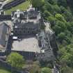
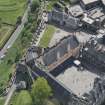
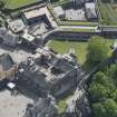
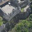
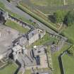
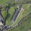
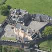
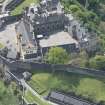
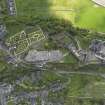
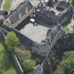
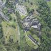
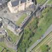
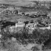
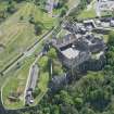
Stirling Castle, Great Hall
Hall (Period Unassigned)
Site Name Stirling Castle, Great Hall
Classification Hall (Period Unassigned)
Alternative Name(s) Old Parliament House; Parliament Hall
Canmore ID 142491
Site Number NS79SE 6.04
NGR NS 79017 94077
Datum OSGB36 - NGR
Permalink http://canmore.org.uk/site/142491
- Council Stirling
- Parish Stirling
- Former Region Central
- Former District Stirling
- Former County Stirlingshire
NS79SE 6.04 79017 94077
NMRS REFERENCE:
Glass transparencies from FC Mears Collection ex EPL.
(Undated) information in NMRS.
Measured Survey (1866 - 1921)
The architect Sir Robert Rowand Anderson, founder of the Edinburgh School of Applied Art, initiated the National Art Survey of Scotland in 1866 to create a library depicting the best examples of Scottish Architecture from which students could take inspiration. Two bursars, selected from the best draughtsmen trained by the school were appointed each year. In 1903 the Edinburgh School of Applied Art joined with the Board of Manufacturer's School of Art to found the Edinburgh College of Art and the bursaries were continued there. The majority of the drawings were made by architectural students between 1895 and 1906.
The National Art Survey of Scotland Collection comprises around 1500 measured survey drawings by a number of different draughtsmen, many of whom later became well known architects, including Ramsay Traquair and Peter Macgregor. They cover a wide range of buildings from across Scotland including castles, tower houses, churches and urban structures, as well as decorative details, plasterwork and furniture.
Excavation (August 1993)
In August 1993 four trenches were excavated by Kirkdale Archaeology on the Eastern side of the Great Hall. Excavations revealed evidence for the work carried our prior to the construction of the Great Hall.
A Radley 1993
Sponsor: Historic Scotland
Kirkdale Archaeology
Excavation (19 December 1994 - 4 October 1995)
NS 7990 940 In advance of the re-roofing of the Chapel Royal, a programme of excavation was mounted over December and January of 1994-5 in the Upper Square and Douglas Gardens within the Castle.
The Upper Square: Two trenches were opened in the Upper Square. The earliest structure found was the SE corner of a stone building. This was formed by a SW-NE wall and its return, extending NW. The SW corner of the same building was seen in the 1994 excavation inside the Chapel Royal. This structure was aligned NE-SW. It measured c13.1m NE-SW and was at least 4m wide, although the northern limit was not seen.
A large amount of charcoal, ash and metalworking debris was recovered in the upper layers associated with the usage of this building, perhaps suggesting that the latest occupation was industrial. However, it may be that the building was originally an earlier version of the Castle Chapel, predating the 15th century Chapel.
The second phase of activity involved the construction of the 15th century Chapel, parts of which were also revealed throughout the trench, showing it to be at least 29m long and some 9m wide, aligned ENE-WSW.
The discovery of drystone structures within the levelling material prior to the construction of the 15th century Chapel suggest that it had two building phases, the first involving a crypt which was filled in at a later date to stabilise the masonry above, probably part of the documented 1505 repairs.
The other major structure studied in the Upper Square was the present Chapel Royal, known to date to 1594. A complete pottery vessel was found standing upright in the construction trench for the S wall of the Chapel. This pot was almost identical to vessels recovered from beneath the floor of Innerpeffray Church in Perthshire, these examples having been dated to the period 1508-1650.
There were at least eighteen different masons-marks noted on and around the string course of the S Chapel wall.
The Douglas Gardens: A total of six trenches were opened in the Douglas Gardens. The earliest remains comprised part of a wall aligned SE-NW, comparable to structures in the Upper Square, and finds recovered from this period of activity seemed to indicate an early-mid 14th century date for its demolition.
Built on top of this early wall was a retaining wall with a bank behind (to the W of) it. This revetment may have incorporated part of the earlier wall, which had by this stage been partially demolished. The bank seems to have stood to a height of c1.3m, and finds from its surface indicate late 15th-early 16th century activity.
G Ewart and A Radley 1995
Sponsor: Historic Scotland
Kirkdale Archaeology
NS 790 940 Fieldwork during summer 1995 concentrated mainly on excavation in the Upper Square, over and immediately adjacent to the late 18th-early 19th century cistern, which lies to the W of the Great Hall Transe. Further work comprised the monitoring of the excavation of a series of 11 small pits to receive information boards. One of these holes, located in the Queen Anne Gardens, revealed a lime-mortared wall, possibly that shown on the 17th century plan by Slezer. The remaining holes revealed little of archaeological significance, aside from levelling material.
The earliest features revealed in the main excavation comprised a series of occupation surfaces, truncated during the construction of the cistern. These deposits were only revealed in a narrow strip, on average 1m in width, but represent a complex series of early medieval occupation horizons. The medieval occupation is most obviously characterised by a hearth-site, which in turn probably relates to a series of crude structural timber settings, and floor surfaces. Overlying this sequence of deposits were tip-lines and courtyard levels associated with the construction, occupation and demolition of the 15th century Chapel Royal.
The Transe wall was built in two phases, the upper section relating to the vaulting-over of the Transe itself during the later 16th century.
The cistern was revealed in its entirety, showing it to be 15.5m long N-S by 4.25m wide, and of high quality sandstone construction. It had been much altered and repaired since its original construction, affecting both its supply and capacity, and access to it. The capacity of the tank was c120m3 (c26,400 gallons), and it was intended to provide water in the event of fire.
G Ewart and P Sharman 1995
Sponsor: Historic Scotland
Kirkdale Archaeology
NS 790 940 Excavation within the Great Hall comprised the recording of a series of cross-walls dating from the later 18th century conversion of the Hall to barrack accomodation. These walls sub-divided the ground floor into four chambers, with two staircases leading to upper floors. The walls themselves were of massive lime-mortar construction, and two of them featured flues serving fireplaces within the vaulted basement.
The Great Hall floor was recorded in detail, and evidence of both its original pattern and its subsequent damage to receive later floor surfaces and modifications to the internal arrangement of the Hall was noted. It appears that the pattern of floor slabs reflected some sub-divisions within the Hall as completed during the early years of the 16th century.
In addition, two trenches were excavated in advance of the re-roofing of the Great Hall. Of these trenches, one lay to the S of the Hall, and contained considerable deposits of charcoal, alongside pottery of 14th and 15th century type. The second trench was cut at the base of the E wall of the Palace. The excavation of this trench was curtailed by the presence of modern services.
G Ewart and A Radley 1995.
Sponsor: Historic Scotland
Kirkdale Archaeology
Excavation (5 September 1994 - 9 December 1994)
Ns 790 940 Excavation in the Chapel Royal and Lion's Den continued in the autumn of 1994 in advance of restoration and renovation. Work in the Lion's Den (the inner quadrangle of the 16th century Palace) revealed evidence of contemporary or later activities associated with the Palace. However, fragments of masonry were found in the extreme SE corner of the area, which relate to earlier 16th century buildings, but which were recycled for use in the present layout (built during the 1540s).
Elsewhere, a substantial retaining wall was found towards the S side of the Lion's Den, which appears to have defined the southern limits of the quadrangle layout. This in turn was probably formal and decorative, possibly some sort of parterre arrangement. The polygonal-shaped building discovered in previous excavations and located towards the middle of the area retained by the low S wall, along with a drain or sump lying towards the NE corner of the area, may have been integral to the formal layout. These were heavily altered and damaged by later occupancy of the Palace block. Certainly the polygonal building was used as a cistern serving 19th century lavatories.
In general the extent of damage to the 16th century layout was such as to have almost entirely removed most features and surfaces predating the extensive pipe laying and resurfacing activities of the 19th and 20th centuries.
In the Chapel Royal, the excavation begun in the summer of 1994 continued to bedrock, removing the remaining tips of debris which had been deposited as levelling for the floor of the Chapel Royal (built in 1594). This exercise resulted in a trench over 5m deep, the lower fills of which contained considerable amounts of firebrick and metal slag, apparently evidence of a demolished forge or foundry. Elsewhere within the Chapel Royal, traces of two earlier structures were found, one of which is assumed to be the late 15th century precursor to the 1594 chapel, and which in turn had truncated a smaller, as yet unidentified rectangular lime mortared stone building.
G Ewart and P Sharman 1995
Sponsor: Historic Scotland
Kirkdale Archaeology
Dendrochronology (1 January 2008)
Dendrochronological analysis of 133 oak timbers and 58 pine timbers from Stirling Castle. Six distinct episodes of building activity were identified. This was a report produced as part of the work at Stirling Castle begun in the mid-2000s, which culminated in the publication of 'With Thy Towers High: The Archaeology of Stirling Castle and Palace' (Historic Scotland, Edinburgh, 2015).
Information from OASIS ID: kirkdale1-504411 (A Crone) 2008
Note (1 January 2008)
A discussion of the various aspects of the Scots royal court in the 16th Century. This was a report produced as part of the work at Stirling Castle begun in the mid-2000s, which culminated in the publication of 'With Thy Towers High: The Archaeology of Stirling Castle and Palace' (Historic Scotland, Edinburgh, 2015).
Information from OASIS ID: kirkdale1-504438 (J Harrison) 2008
Measured Survey
Drawings by J Gillespie in the National Art Survey of Scotland Collection.
Measured Survey
Drawings by George D MacNiven in the National Art Survey of Scotland Collection.


