
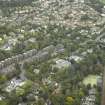
Bearsden


Bath House (Roman), Fort Annexe (Roman), Roman Fort (Roman)
Site Name Bearsden
Classification Bath House (Roman), Fort Annexe (Roman), Roman Fort (Roman)
Alternative Name(s) Antonine Wall; Bearsden Baptist Church
Canmore ID 44532
Site Number NS57SW 3
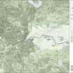
NGR NS 54622 72097
NGR Description Centred NS 54622 72097
Datum OSGB36 - NGR
Permalink http://canmore.org.uk/site/44532


First 100 images shown. See the Collections panel (below) for a link to all digital images.
- Council East Dunbartonshire
- Parish New Kilpatrick (Bearsden And Milngavie)
- Former Region Strathclyde
- Former District Bearsden And Milngavie
- Former County Dunbartonshire
NS57SW 3 centred 54622 72097.
(NS 5455 7206) FORT (R) (site of)
OS 1:10000 map (1973)
No traces can now be seen of the Roman fort at Bearsden; it has long since been built upon. Parts were still extant in the 18th and 19th centuries, the S side and SW angle being best preserved at that time (cf OS 25" 1861).
Excavations by Dr D J Breeze, from 1973 to 1980, have shown that the fort, which was attached to the rear of the Antonine Wall, was 112m N-S by 100m externally and covered an area of 1.12 hectares (2.77 acres). An annexe on the E side measured c 109m N-S by possibly 55m. The ramparts, of turf construction with stone bases, were fronted by a single ditch on the S, triple ditches on the W, and a double line of ditch outside the annexe in the E.
Numerous internal buildings found included barracks, granaries, workshops and officers quarters, while a bath-house and latrine lay in the annexe. Two cobbled foundations W of the fort defences formed part of the civil buildings which are presumably of Roman date. Exploration to the E, W and S of the fort revealed no further trace of civil habitation.
No trace of the putative fortlet was found and no part of the site revealed evidence for more than the Antonine 1 period of occupation although the via principalis had been raised and widened.
Finds included a building stone inscribed to the XX Legion Valeria Victrix, pottery dateable to 142- 158 AD and a group of iron objects. Finds prior to 1946 comprise an intaglio, a second brass of Trajan and a bronze of Constantine I.
G Macdonald 1918; 1934; A S Robertson 1952; D J Breeze 1973; 1975; D R Wilson 1975; R Goodburn 1976; S S Frere 1977; 1978; R Goodman 1979
The N wall of the changing room of the bath-house (under guardianship) was examined. Only one phase of post-holes was found, though there were 2 phases in the S wall and in the gravel floor.
D J Breeze 1982
Local manufacture of pottery suggested; petrological analysis.
D J Breeze 1986
A Magnentius ae (AD 351) was found in the burn, N of the bath-house site.
J D Bateson 1990
A watching-brief on a building site S of Roman Road and c.20m beyond the likely position of the E ditches defending the annexe of the adjacent fort, revealed no structural remains to indicate a civil settlement thereabouts; two worn sherds of Roman pottery were recovered.
L J F Keppie 1994.
NS 545 720 In May 1995, GUARD undertook a resistivity survey across the line of the southern extent of the ditch of the Roman Fort at Bearsden. The intention was to determine whether the ditch had a causeway on the southern side.
Conditions were poor for the survey, the soil being loose and giving very low resistance readings. However, two areas of anomalous readings were encountered, one being interpreted as the excavation trench from the 1980s and the other a possibility for a causeway.
However, in view of the conditions, any interpretation remains tenative.
Sponsor: Historic Scotland.
I Banks 1995.
Geophysical survey of the S defences, in search of evidence for a causeway outside the S gate, was inconclusive.
L J F Keppie 1996
A study of utilitarian pottery from the Antonine Wall has distinguished small numbers of locally made vessels with North African affinities at nine or 10 forts. Similar vessels at Chester and others made by Legio XX at the Holt works depot, one with a potter's graffito in neo-Punic, suggest the presence of North Africans. Detachments sent from Britain to Pius' Mauretanian war of AD 146-9 may have brought North Africans back with them to Britain (possibly including legionary recruits or transfers, and Moorish irregulars or levies). At the western sector of the Antonine Wall, changes in the legionary work-stints may be linked to troop reductions for the war, as the mural barrier and Bearsden and Duntocher fort interiors were still unfinished. After the conflict, Bearsden and Duntocher were each partitioned to make an annexe and their internal buildings re-planned and completed; a programme of annexe construction began at other forts, and secondary alterations were made to many existing fort interiors. All may be connected with changes in units or in the composition of the returning garrisons, now perhaps mixed and augmented with small numbers of North African troops. Possible epigraphic evidence is examined.
V Swan 1999
NS 5455 7206 An archaeological evaluation was undertaken at Bearsden Baptist Church in advance of the construction of a sanctuary building. The proposed development is within a known Roman fort, which formed part of the Antonine Wall system.
The work revealed the archaeological remains of the internal rampart and associated structures, together with evidence for Roman activity within the annexe of the fort. A large number of artefacts were recovered, dominated by pottery sherds.
All archaeological features were recorded. (GUARD 896.2)
Sponsor: Bearsden Baptist Church.
J S Duncan and A Leslie 2002.
Antiquarian Mapping (1793)
William Roy recorded the Fort at Bearsden in his Plan of the Roman Wall, the site is recorded as New Kirkpatrick Fort.
Excavation (1973 - 1980)
No traces can now be seen of the Roman fort at Bearsden; it has long since been built upon. Parts were still extant in the 18th and 19th centuries, the S side and SW angle being best preserved at that time (cf OS 25" 1861).
Excavations by Dr D J Breeze, from 1973 to 1980, have shown that the fort, which was attached to the rear of the Antonine Wall, was 112m N-S by 100m externally and covered an area of 1.12 hectares (2.77 acres). An annexe on the E side measured c 109m N-S by possibly 55m. The ramparts, of turf construction with stone bases, were fronted by a single ditch on the S, triple ditches on the W, and a double line of ditch outside the annexe in the E.
Numerous internal buildings found included barracks, granaries, workshops and officers quarters, while a bath-house and latrine lay in the annexe. Two cobbled foundations W of the fort defences formed part of the civil buildings which are presumably of Roman date. Exploration to the E, W and S of the fort revealed no further trace of civil habitation.
No trace of the putative fortlet was found and no part of the site revealed evidence for more than the Antonine 1 period of occupation although the via principalis had been raised and widened.
Finds included a building stone inscribed to the XX Legion Valeria Victrix, pottery dateable to 142- 158 AD and a group of iron objects. Finds prior to 1946 comprise an intaglio, a second brass of Trajan and a bronze of Constantine I.
G Macdonald 1918; 1934; A S Robertson 1952; D J Breeze 1973; 1975; D R Wilson 1975; R Goodburn 1976; S S Frere 1977; 1978; R Goodman 1979
Field Visit (August 1977)
Bearsden NS 545 720 NS57SW 3
An Antonine Wall fort measuring 117m by 105m over the rampart, occupies an area of 1.2ha. To the E there was an annexe, measuring 117m by 55m (0.6ha), and containing a bath-house.
RCAHMS 1978, visited August 1977
(Breeze 1974; DES, 1974, 80; DES, 1975, 20; DES, 1976, 29; Breeze 1977)
Excavation (1981)
The N wall of the changing room of the bath-house (under guardianship) was examined. Only one phase of post-holes was found, though there were 2 phases in the S wall and in the gravel floor.
D J Breeze 1982
Artefact Recovery (1983 - 1987)
A Magnentius ae (AD 351) was found in the burn, N of the bath-house site.
J D Bateson 1990
Publication Account (1985)
The Antonine Wall fort at Bearsden (also known as New Kilpatrick) was largely obliterated by housing in the last century and was thought to be lost to archaeology, but redevelopment of part of the site in the 1970s gave the opportunity to investigate the remains. The Victorian builders had done far less damage to the fort than had been anticipated, largely because the site was on a slope and much levelling up had been undertaken, thus preserving the Roman remains. Consequently, it was possible to recover much of the plan of the buildings within the fort. The most spectacular find, however, lay in the annexe attached to the east rampart. Here, the excavators uncovered the remains of a bath-house which has proved to be one of the best surviving examples in Scotland. Bath-houses were essential installations at Roman forts, filling a vital role in the social life of the troops rather than simply serving as an ablutions block. They were normally sited outside the fort, well away from the timber buildings, because of the risk of fire from the furnaces. Although the area of the bathhouse was scheduled for building, the developers (Woodblane Developments Ltd) have generously agreed to its preservation.
The bath-house is a long rectangular building with three projecting wings, one on the north and two on the south. The west half which was used for changing and relaxing in, was built of timber, stone only being used where essential in the heated section of the baths on the east. (The position of the timber wall-posts are now indicated by short wooden uprights.) The bathing suite consisted of three elements: a hot, dry room, which projects from the north wall of the main building; a hot steam range, comprising the three rooms (increasing in temperature from west to east) leading directly off the entrance hall with a hot plunge bath opening off the hottest room; a cold plunge bath, which projects from the south wall opposite the hot/dry room. Thus the bather had the choice of a hot/dry bath followed by a cold plunge or he could move progressively through the hot/steam range to a dip in the hot plunge bath before returning to fimsh with a cold plunge. The bath-house was so well-preserved that it retained many interesting constructional details including hypocaust floors and walls, stoke-holes, wall plaster and even the remains of stone benches. Finds from this site are on display in the Hunterian Museum, University of Glasgow.
Information from ‘Exploring Scotland’s Heritage: The Clyde Estuary and Central Region’, (1985).
Publication Account (1986)
Local manufacture of pottery suggested; petrological analysis.
D J Breeze 1986
Watching Brief (1 November 1993)
A watching-brief on a building site S of Roman Road and c.20m beyond the likely position of the E ditches defending the annexe of the adjacent fort, revealed no structural remains to indicate a civil settlement thereabouts; two worn sherds of Roman pottery were recovered.
L J F Keppie 1994.
Resistivity (May 1995)
NS 545 720 In May 1995, GUARD undertook a resistivity survey across the line of the southern extent of the ditch of the Roman Fort at Bearsden. The intention was to determine whether the ditch had a causeway on the southern side.
Conditions were poor for the survey, the soil being loose and giving very low resistance readings. However, two areas of anomalous readings were encountered, one being interpreted as the excavation trench from the 1980s and the other a possibility for a causeway.
However, in view of the conditions, any interpretation remains tentative.
Sponsor: Historic Scotland.
I Banks 1995.
Geophysical survey of the S defences, in search of evidence for a causeway outside the S gate, was inconclusive.
L J F Keppie 1996
Publication Account (1999)
A study of utilitarian pottery from the Antonine Wall has distinguished small numbers of locally made vessels with North African affinities at nine or 10 forts. Similar vessels at Chester and others made by Legio XX at the Holt works depot, one with a potter's graffito in neo-Punic, suggest the presence of North Africans. Detachments sent from Britain to Pius' Mauretanian war of AD 146-9 may have brought North Africans back with them to Britain (possibly including legionary recruits or transfers, and Moorish irregulars or levies). At the western sector of the Antonine Wall, changes in the legionary work-stints may be linked to troop reductions for the war, as the mural barrier and Bearsden and Duntocher fort interiors were still unfinished. After the conflict, Bearsden and Duntocher were each partitioned to make an annexe and their internal buildings re-planned and completed; a programme of annexe construction began at other forts, and secondary alterations were made to many existing fort interiors. All may be connected with changes in units or in the composition of the returning garrisons, now perhaps mixed and augmented with small numbers of North African troops. Possible epigraphic evidence is examined.
V Swan 1999
Excavation (April 2002 - May 2002)
NS 5455 7206 An archaeological evaluation was undertaken at Bearsden Baptist Church in advance of the construction of a sanctuary building. The proposed development is within a known Roman fort, which formed part of the Antonine Wall system.
The work revealed the archaeological remains of the internal rampart and associated structures, together with evidence for Roman activity within the annexe of the fort. A large number of artefacts were recovered, dominated by pottery sherds.
All archaeological features were recorded. (GUARD 896.2)
Sponsor: Bearsden Baptist Church.
J S Duncan and A Leslie 2002.
Aerial Photography (8 September 2006)
RCHAMSAP aerial survey
Photographic Survey (26 June 2007)
Hi-spy photographic survey of the bathhouse at Bearsden
Archaeological Evaluation (28 November 2008 - 19 December 2008)
NS 5463 7203 An evaluation was carried out 28 November–19 December 2008 prior to redevelopment. As the site, a house plot with associated gardens, lies adjacent to the site of the scheduled Roman fort at Bearsden, on land which would have been encompassed by the annexe of the fort, the potential for survival of archaeological remains existed, even though modern (late 19th- and 20th-century) buildings covered most of the area under investigation. The proposed development area also lies within the boundaries of the Antonine Wall World Heritage Site.
Eight trenches were excavated and significant archaeological deposits, in association with Roman artefacts,
were identified in two trenches in the SW corner of the site. No archaeological remains or artefacts were recovered from the other six trenches.
The evidence from the evaluation and the desk-based assessment strongly indicates that remains of the Roman fort annexe survive, but only at the western and southern margins of the proposed development area. In both cases these surviving remains do not extend further E or N than the line of the driveway. The footprint of the former buildings on the site appeared to be devoid of Roman material.
Archive: RCAHMS (intended). Report: RCAHMS and WoSAS SMR
Funder: Allan Water Developments Ltd
Robert Will and Alan Leslie – GUARD
Publication Account (2008)
A 1:25000 scale map of the Antonine Wall was published by RCAHMS in 2008. The map shows the course of the Antonine Wall on a modern map base, including areas where the Wall is in public ownership or care and can be visited. The data had been collated as part of the project to prepare maps for the World Heritage Site nomination bid.
Watching Brief (17 January 2012 - 11 April 2012)
NS 5463 7203 A watching brief was undertaken 17 January – 11 April 2012 during ground-breaking works associated with the construction of a new nursing home. The area was considered sensitive as it lies within the annexe of the Bearsden Roman fort. Deposits relating to the construction and demolition of a Victorian house that previously occupied the site were recorded. Two fragments of pottery, of probable Roman date, were recovered from the topsoil, but any in situ archaeological remains appear to have been destroyed during the construction of the Victorian house.
Archive: RCHAMS (intended)
Funder: Antonine Care Ltd
Alastair Becket, Northlight Heritage
2012
Note (April 2017)
Bathhouses
Roman forts were provided with bathhouses (balnea) for the soldiers. These are often located just outside a fort, in an annexe (enclosed area attached to a fort), or inside but close to the edge. They were away from the main buildings because of the fire risk that they posed. This was because bathhouses had hot rooms heated by a hypocaust system - underfloor heating provided by a furnace.
Bathhouses contained several rooms (Bearsden had eight, Bothwellhaugh seven, Bar Hill around six), which were usually entered in a sequence, the bather returning the same way. Not all rooms were present in every bathhouse, but could include:
* Changing room, where a soldier would remove his clothes (but keep footwear on – the floors could get very hot!)
* Cold room (Frigidarium)
* Cold plunge bath
* Warm rooms (Tepidaria)
* Hot room (Caldarium)
* Hot bath
The furnace room (praefurnium) sat beyond the hot rooms.
Turkish baths are the closest modern-day parallel to Roman bathhouses. We don’t know how often men bathed nor how frequently water was changed in the baths - they were probably used by around 500 men! They used a curved metal blade, known as a strigil, to scrape oil and dirt from the skin in a hot room or after exercise (http://collections.gla.ac.uk/#details=ecatalogue.123109). It is possible that they relaxed and played games in the bathhouses – a gaming board was found in the granary at Bearsden. Excavations in the bathhouse there also found a sandstone head of a goddess (https://vimeo.com/129135972) and a fountainhead with a gaping mouth – all are now on display in the Hunterian Museum.
Excavations in the cold room at Bothwellhaugh revealed an attractive floral drain cover, with the water draining away between the petals. This is now in the Hunterian Museum (http://collections.gla.ac.uk/#details=ecatalogue.125932).
Latrines
And of course, soldiers need to go to the toilet! But this was a communal activity, with toilet blocks seating several soldiers together. A number of latrines have been found in Scotland. At Castlecary, excavations in 1902 revealed the toilet block separate from the bathhouse, but flushed by drains from the fort. These took the sewage through the wall of the fort and outside into the ditches.
At Bearsden, the toilet had nine seats – stone seats with holes have been found, but excavations on Hadrian’s Wall have found wooden seats so they presumably had wooden seats on top – rather warmer to sit on than stone in the winter months! Underneath the seats, the sewage channel was flushed by water from the bathhouse, showing careful and sensible design. Moss was found in the sewage, suggesting that soldiers used this to clean themselves in the toilet. The sewage from the latrine at Bearsden drained through the rampart and into the ditches, where it could still be smelt whilst being excavated almost 2,000 years later.
Dr Rebecca Jones - Head of Archaeology and World Heritage
Watching Brief (25 October 2018)
NS 5462 7208 A watching brief was undertaken in October 2018 during the excavation of a foundation trench for a new interpretation panel. No finds or features of archaeological significance were recorded.
Archive: NRHE (intended). Report: WoSAS
Funder: Historic Environment Scotland
John Musgrove – CFA Archaeology Ltd
(Source: DES Vol 19)

