Following the launch of trove.scot in February 2025 we are now planning the retiral of some of our webservices. Canmore will be switched off on 24th June 2025. Information about the closure can be found on the HES website: Retiral of HES web services | Historic Environment Scotland
Douglasmuir, Starfish
Decoy Site (Second World War)
Site Name Douglasmuir, Starfish
Classification Decoy Site (Second World War)
Alternative Name(s) Clyde Aa Defences; Douglas Muir
Canmore ID 229137
Site Number NS57NW 38
NGR NS 514 753
Datum OSGB36 - NGR
Permalink http://canmore.org.uk/site/229137
- Council East Dunbartonshire
- Parish New Kilpatrick (Bearsden And Milngavie)
- Former Region Strathclyde
- Former District Bearsden And Milngavie
- Former County Dunbartonshire
NS57NW 38.00 514 753
The remains of a WWII Starfish decoy site (SF 13b) are visible at this location on RAF air photographs (106G/UK988: 3423 to 3425) taken on 9 November 1945 and All Scotland Survey air photographs taken in 1988 (51588: 073, 074). An oil ring, firebreak trenches, hardstandings and the sites of basket fire clusters, are scattered across an area measuring 450m N to S and 500m W to E. The control bunker (NS57NW 38.01) is situated 400m NE of the decoy site. NS57NW 17 may be associated with this site.
Information from RCAHMS (KM) 4 December 2002.
The control bunker for a Starfish decoy site (NS57NW 38.00) is situated at this location. It is visible on RAF air photographs taken in 1945 (106G/UK988: 3423 to 3425) and is depicted on the current edition of the OS 1:10,000 scale mapsheet (1979). The bunker appears denuded in All Scotland Survey air photographs taken in 1988 (51588: 073, 074).
Information from RCAHMS (KM) 4 December 2002.
Field Visit (29 May 2018)
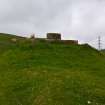
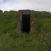
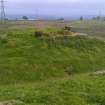
A control shelter (NS57NW 38.1), an oil ring, three small oil pools, a fire-pit enclosure, 25 concrete platforms and a well-engineered metalled service road are all that is now visible of this World War Two Civil Starfish Decoy, which is visible on RAF air photographs (106G/UK/1988.9) taken on 9 November 1945. It was one of 18 decoys that were constructed to protect the industries in the centre of Glasgow and along the banks of the River Clyde from aerial attack by the Luftwaffe during WWII.
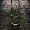
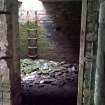
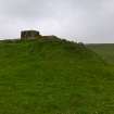
The control shelter (NS51668 75735), which is situated in improved pasture on a SE-facing slope 1.1km WNW of Tambowie, is cut back into the steeply rising slope to its NW and W. It is surrounded on the W, N and NE by a dry grass-grown ditch up to 4.5m broad and 1.8m deep from the ends of which drains carry the water away. The control shelter, itself, measures 8.8m from NNW to SSE by 4.1m transversely, over brick walls 0.35m thick and 2m high, within a grass-grown earthen blast wall up to 3.5m thick and 2.3m high - this cladding being obtained from the material excavated from the ditch. The flat, reinforced concrete roof also retains a turf capping 0.35m thick, while an escape hatch is located in the middle of its SSE edge. The foundations of a brick baffle, measuring 1.8m from NNW to ESE and 0.2m high, are positioned 1.3m from the blast wall at the mid-point of the structure on the ENE – the collapsed brickwork overlying the course of the SE drain from the ditch. This wall shields a canopied entrance leading into a corridor. Opposed entrances at its WSW end provide access to two compartments, both of which retain traces of whitewash on their walls. The doorway of the control room to the SSE preserves traces of its wooden frame, but the interior, measuring 3.35m sq., contains no fittings except for the six steel rungs attached to the SSE wall permitting egress from the escape hatch. There is a sealed circular aperture in the roof at the NNW corner which was originally provided for the chimney pipe of a stove and two rectangular vents just above floor level close to the compartment’s SE and SW corners. The latter passes as a circular duct through the brick wall and earth blast wall to emerge in the ditch. The generator room on the opposite side of the corridor is slightly smaller, measuring 3.35m from WSW to ENE by 3.05m. It contains the plinths for three engines, evidence for a central pendant light and two rectangular vents opposite one another and just above floor level close to the SW and SE corners – the circular duct of the latter again emerging in the ditch. A large circular vent high in the centre of the NNW wall emitted the exhausts from the generators, while three small circular ducts just above floor level conducted gasses to the brick-built external expansion chambers located on the outer lip of the ditch. This rectangular box-like structure retains one of the its concrete covers in place on the WSW, but the other lies in the bottom of the ditch, together with a third that must have originally closed the opening of the fourth chamber to the NNW, which is now marked only by a shallow depression.
The decoy lies between 400m and 700m SW of the control shelter, in what was once improved pasture, but which has now reverted to rough, largely marshy ground. The oil ring (NS 51704 75109) is situated almost 600m S of the shelter, just below the point where the grass-grown metalled service road, measuring 4m broad and raised on an agger up to 0.4m high, enters the moorland from the NE, before turning sharply NW to run 430m to the N limits of the decoy. This ring, which measures 2m broad and 0.15m deep, is also denoted by a strong, dark green vegetation mark which can be readily traced except in the E. It is contained within a carefully levelled, sedge- and grass-grown circular platform 40m in diameter and up to 1.3m deep, which has been cut back up into the rising ground on the NE, W and S. Spoil from the excavation has been dumped around its perimeter. Two short channels breaching this scarp on the N may have conveyed the oil from sumps that have otherwise not been detected, but the breaches on the W are later field drains. A cluster of three small circular earthworks (NS 51450 75259, NS 51444 75250, NS 51443 75273), out of at least 14 examples denoted on the aerial photograph, have been observed. They measure 3.5m in diameter within moss-, sedge- and grass-grown earthen banks up to 0.7m thick and 0.2m high. They have their best analogues at Gleniffer Braes (NS45NE 55), where they seem to have held individual installations.
Equally difficult to observe are the several fire-pit enclosures in the marsh. The latter has formed as a result of impeded drainage, as the many cut field drains have become clogged. However, the S half of one enclosure (NS 51438 75071) survives on a low ridge SW of the marshy ground. This is roughly rectangular on plan and measures 27.6m from E to W by at least 12m transversely, within a grass- and sedge-grown bank measuring 1.2m thick and 0.3m high. By contrast, 8 of the 25 concrete platforms have sunk so deep into the marsh that they can only be found by probing. These platforms, which are both rectangular and square on plan, occur in approximately three distinct shapes and sizes. They cluster into four groups (centred NS 51450 75176). One group (NS 51400 75462), which is situated at the point where the metalled service road bifurcates at its N end, comprises 11 platforms: six measure about 6m long by 1m broad (NS 51425 75487, NS 51419 75487, NS 51413 75486, NS 51399 75487, NS 51400 75466, NS 51398 75440), two measure about 3m long by 2m broad (NS 51383 75465, NS 51401 75424) and 2 measure about 1.5m square (NS 51420 75457, NS 51389 75456 – the latter rising 0.2m high - the only platform in the decoy that is not flush with the ground), with one too deeply buried to be sure of its character (NS 51382 75486). A second group (centred NS 51615 75391) is superimposed on an old plantation in low lying marshy ground about 130m E of the metalled service road. It comprises five platforms: two measure about 6m long by 1m broad, but neither is visible (NS 51607 75384, NS 51613 75381), two measure about 3m long by 2m broad (NS 51615 75399, NS 51621 75396) and one measures about 1.5m square (NS 51627 75394). An iron pipe (NS 51625 75398) servicing at least one of these platforms rises about 0.1m above the surface of the ground to the N. A third group (centred NS 51524 75138) is situated in marshy ground about 160m WNW of the large oil ring. It comprises five platforms, but only two are faintly visible: two measure about 6.5m long by 1m broad (NS 51521 75128, NS 51532 75134), two measure about 3m long by 2m broad (NS 51508 75139 - PROBED, NS 51530 75150) and one measures about 1.5m square. A fourth group (centred NS 51450 75176) is also situated in marshy ground about 70m WNW and 100m N of the fire-pit enclosure on the ridge. It comprises four platforms, but none are now visible; two measure about 6.5m long (NS 51447 75186, NS 51454 75185) and two measure about 3m long by 2m broad (NS 51447 75169, NS 51454 75169).
In addition, a faint rectangular vegetation mark (NS 51407 775459), measuring 8m from N to S by 2.5m transversely and apparently formed over a narrow ditch cut into the peat, is situated within the group of platforms at the N end of the service road.
According to the current occupant, the crew operating the decoy were billeted in Tambowie farmhouse (NS 52756 75522), about 1km E of the decoy.
Visited by HES, Survey and Recording (ATW, AKK) 29 May 2018.


