Scheduled Maintenance
Please be advised that this website will undergo scheduled maintenance on the following dates: •
Tuesday 3rd December 11:00-15:00
During these times, some services may be temporarily unavailable. We apologise for any inconvenience this may cause.
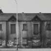
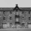
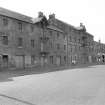
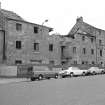
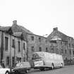
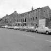
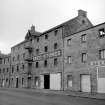
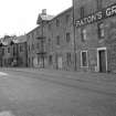
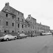
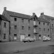
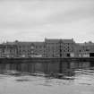
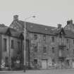
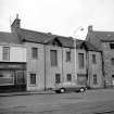
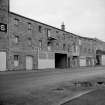
Ayr, 41-65 South Harbour Street, Warehouses
Wall (Period Unassigned), Warehouse(S) (Period Unassigned)
Site Name Ayr, 41-65 South Harbour Street, Warehouses
Classification Wall (Period Unassigned), Warehouse(S) (Period Unassigned)
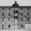
Alternative Name(s) Ayr Harbour, Warehouses; 41, 43, 45, 47, 49, 51, 53, 55, 57, 59, 61, 63, 65 South Harbour Street; Paton's Grain & Seed Stores
Canmore ID 41761
Site Number NS32SW 124
NGR NS 3345 2223
NGR Description Centred NS 3345 2223
Datum OSGB36 - NGR
Permalink http://canmore.org.uk/site/41761
- Council South Ayrshire
- Parish Ayr
- Former Region Strathclyde
- Former District Kyle And Carrick
- Former County Ayrshire
NS32SW 124 centred 3345 2223
See also NS32SW 123.00.
(Location cited as NS 335 223). Warehouses, Ayr Harbour, early 19th century. A range of four rubble-built warehouses, on the S quay (NS32SW 123.15) of Ayr Harbour. These are (E to W):
2-storey, 5-bay,
3-storey and attic, 7-bay,
4-storey and attic, 7-bay, and
3-storey, 13-bay.
Probably contemporary, but detached, is a 3-storey and attic, 2- by 18-bay store, at NS 336 222, with a projecting hoist.
J R Hume 1976.
Field Visit (November 2009)
NS 33462 22213 Part of a retaining wall at Ayr Harbour collapsed in early November 2009 after a prolonged period of wet weather. A site visit was undertaken on the 5 November 2009 to assess the archaeological significance of the exposed deposits, which are close to the remains of the mid-17th-century Cromwellian Citadel (NS32SW 15) and the reputed site of the medieval royal castle (NS32SW 12).
The collapse affected a 24m long section of the upper part of a vertical wall, c5.5m high x 0.5m wide, which had been retaining the gardens of houses near the medieval castle site, inside the NE bastion of Cromwell’s artillery fort. The wall had formed the rear wall of now-demolished warehouses on South Harbour Street (NS32SW 124), and appears to have been built against a cut into the natural sand subsoil and overlying deposits which formed the earthen backing to the ramparts of the 17th-century artillery fort. Debris and
rain-washed modern soils from gardens upslope somewhat obscured the soils behind, but the character of the retaining wall is uniform, and is in keeping with an early to mid-19th-century date. Its vertical angle and its placement well to the rear of the mid-19th-century OS marked line of the Cromwellian Citadel would further suggest that this structure is related to the construction of the 19th-century warehouses and not the 17th-century fortress.
Due to safety concerns, no archaeological examination or sampling of the exposed soils was possible. No pre-modern artefacts were observed, and wet conditions prevented accurate recording of the exposed earth face. Between 0.3–0.9m of modern garden deposits and buried surfaces lay above varying depths of what appeared to be homogeneous light brown loamy sand that in places appeared to overlie a sandier yellow soil. The homogeneous deposit appeared similar to redeposited make-up material uncovered during the evaluation of a site at Citadel Place, in the 17th-century fort’s SE bastion, in 2004 and 2007 (Sneddon DES 2007). Immediate remedial action to prevent further collapse had obscured the lower part of the exposed soil section before
recording could be carried out. It is hoped that further recording will take place during rebuilding.
Archive: Report and photographs – WoSAS SMR
Funder: South Ayrshire Council
Hugh McBrien – WoSAS


