
Pricing Change
New pricing for orders of material from this site will come into place shortly. Charges for supply of digital images, digitisation on demand, prints and licensing will be altered.
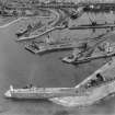
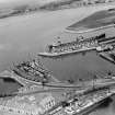
Ardrossan Harbour, Outer Harbour


Dock (Period Unassigned)
Site Name Ardrossan Harbour, Outer Harbour
Classification Dock (Period Unassigned)
Canmore ID 281349
Site Number NS24SW 36.01
NGR NS 22516 42236
Datum OSGB36 - NGR
Permalink http://canmore.org.uk/site/281349


- Council North Ayrshire
- Parish Ardrossan
- Former Region Strathclyde
- Former District Cunninghame
- Former County Ayrshire
NS24SW 36.01 22516 42236
Dock [NAT] (at NS 2251 4223)
OS 1:10,000 map, 1981.
Harbour [NAT] (at NS 22478 42266)
OS (GIS) AIB, May 2006.

