
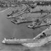
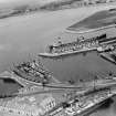
Ardrossan Harbour, Outer Harbour


Dock (Period Unassigned)
Site Name Ardrossan Harbour, Outer Harbour
Classification Dock (Period Unassigned)
Canmore ID 281349
Site Number NS24SW 36.01
NGR NS 22516 42236
Datum OSGB36 - NGR
Permalink http://canmore.org.uk/site/281349


- Council North Ayrshire
- Parish Ardrossan
- Former Region Strathclyde
- Former District Cunninghame
- Former County Ayrshire
NS24SW 36.01 22516 42236
Dock [NAT] (at NS 2251 4223)
OS 1:10,000 map, 1981.
Harbour [NAT] (at NS 22478 42266)
OS (GIS) AIB, May 2006.

