
Pricing Change
New pricing for orders of material from this site will come into place shortly. Charges for supply of digital images, digitisation on demand, prints and licensing will be altered.
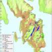
Bute, Dixon's Dam


Dam (19th Century), Sluice (19th Century)
Site Name Bute, Dixon's Dam
Classification Dam (19th Century), Sluice (19th Century)
Alternative Name(s) Robert Thom's Water Cuts
Canmore ID 304562
Site Number NS06SE 428
NGR NS 09121 60381
Datum OSGB36 - NGR
Permalink http://canmore.org.uk/site/304562

- Council Argyll And Bute
- Parish Kingarth
- Former Region Strathclyde
- Former District Argyll And Bute
- Former County Buteshire
NS06SE 428 09121 60381
A dam and sluice were constructed on the Kerrycroy Burn to supplement the water supplied to the ‘Big Cut’, part of the system of water channels constructed to supply the Rothesay Cotton Mill (NS06SE 5) by Robert Thom (Maclagan 1996). A sluice and dam, already breached at by this date, are depicted on the 1st edition of the OS 6-inch map (Buteshire 1869, Sheet CCXV). The annotation ‘Dixon’s Dam’ is applied to a building 420m to the S on both the 1:50000 and 1:25000 modern OS maps (published in 2002 and 2006 respectively).
Information from RCAHMS (GFG) 18 May 2010.
Desk Based Assessment (18 May 2010)
A dam and sluice were constructed on the Kerrycroy Burn to supplement the water supplied to the ‘Big Cut’, part of the system of water channels constructed to supply the Rothesay Cotton Mill (NS06SE 5) by Robert Thom (Maclagan 1996). A sluice and dam, already breached at by this date, are depicted on the 1st edition of the OS 6-inch map (Buteshire 1869, Sheet CCXV). The annotation ‘Dixon’s Dam’ is applied to a building 420m to the S on both the 1:50000 and 1:25000 modern OS maps (published in 2002 and 2006 respectively).
Information from RCAHMS (GFG) 18 May 2010.

