
Pricing Change
New pricing for orders of material from this site will come into place shortly. Charges for supply of digital images, digitisation on demand, prints and licensing will be altered.
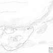
Bute, St Blane's


Farmstead (Period Unassigned), Manse (Period Unassigned)
Site Name Bute, St Blane's
Classification Farmstead (Period Unassigned), Manse (Period Unassigned)
Canmore ID 318542
Site Number NS05SE 5.40
NGR NS 09435 53369
Datum OSGB36 - NGR
Permalink http://canmore.org.uk/site/318542

- Council Argyll And Bute
- Parish Kingarth
- Former Region Strathclyde
- Former District Argyll And Bute
- Former County Buteshire
Field Visit (21 March 2012)
The presence of so many cultivation remains in and around the St Blane's monastic complex and the presence of a corn-drying kiln (NS05SE 50) strongly suggests that there ought to be a farmstead very close by. The only candidate is the pair of buildings on the SW side of the complex, one of which appears also to have been a manse until the late 17th century.
The disposition of the buildings – in an L-plan with a yard to the W, and set within a landscape of rigged cultivation and enclosure walls, would, in most other circumstances in Scotland immediately suggest a farmstead, and the juxtaposition of farmstead and manse is known from elsewhere, for instance at Northmavine in Shetland (HU27NE 22).
Rectangular on plan, the NE building - the one traditionally ascribed to being ‘The Manse’, measures 16.85m from NW to SE by 4.5m transversely within a wall up to 1.1m thick at the SE end and surviving up to 1m in height at the NW end, where the interior has been set into the foot of the slope. The interior was cleared out in the 1890s, revealing three compartments or rooms, the two smaller ones in the SE half of the building probably having entrances on the SW, but the large NW compartment apparently entered only by way of a gap through the partition wall at its SE end.
The second building, which is set at right-angles immediately to the SW of the first, is now visible only as fragmentary footings, though it measures 7m in breadth over all. The large mound immediately N of ‘The Manse’, which measures up to 13m across, is the spoil-tip from the 1890s excavation, a ‘barrow run’ still distinct on its top.
Visited by RCAHMS (JRS) 21 March 2012.

