
Bute, St Blane's


Quarry (Period Unassigned)
Site Name Bute, St Blane's
Classification Quarry (Period Unassigned)
Canmore ID 318534
Site Number NS05SE 5.37
NGR NS 09524 53558
Datum OSGB36 - NGR
Permalink http://canmore.org.uk/site/318534

- Council Argyll And Bute
- Parish Kingarth
- Former Region Strathclyde
- Former District Argyll And Bute
- Former County Buteshire
Field Visit (21 March 2012)
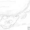
This quarry is situated on the NE edge of the scheduled area and has removed the N end of the low bank that runs NNE from the entrance gap through the NE side of the southerly of the two monastic enclosures. It has been dug into the foot of the slope at the N end of a ridge, probably to provide stone for the track that lies adjacent to the E. It measures at least 15 m in length from NW to SE and is crossed by the fence that defines the edge of the scheduled area.
Visited by RCAHMS (JRS) 21 March 2012.

