Pricing Change
New pricing for orders of material from this site will come into place shortly. Charges for supply of digital images, digitisation on demand, prints and licensing will be altered.
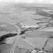
Glenury Viaduct
Railblock (Second World War) (1940), Railway Viaduct (19th Century)
Site Name Glenury Viaduct
Classification Railblock (Second World War) (1940), Railway Viaduct (19th Century)
Alternative Name(s) Stonehaven Viaduct; Cowie Water; Cowie Stop Line
Canmore ID 36945
Site Number NO88NE 60
NGR NO 86918 86944
NGR Description NO 86807 86813 to NO 86999 87013
Datum OSGB36 - NGR
Permalink http://canmore.org.uk/site/36945
- Council Aberdeenshire
- Parish Fetteresso
- Former Region Grampian
- Former District Kincardine And Deeside
- Former County Kincardineshire
NO88NE 60 86807 86813 to 86999 87013
Not to be confused with Skatie Shore viaduct (NO 8883 8800 to 8886 8812), for which see NO88NE 62.
(Location cited as NO 868 869). Glenury Viaduct, opened c. 1850 by rhe Aberdeen Rly. and rebuilt 1883-4 by Blaikie Bros., Aberdeen. A 10-span viaduct, with wrought-iron plate girders (formerly wooden arches) on masonry piers.
J R Hume 1977.
This viaduct carries the Glasgow-Aberdeen (main) line of the former Caledonian Rly. (which was extensively used by Edinburgh-Aberdeen trains of the former North British Rly.) over the deep valley of the Cowie Water.
Information from RCAHMS (RJCM), 19 September 1997.
Note (26 January 2021)
A railblock was established on the viaduct which was part of the Cowie Line a stop line of invasion defenses.
G Barclay 2013


