
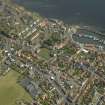
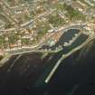
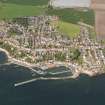
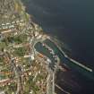
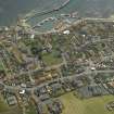
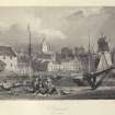
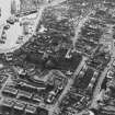
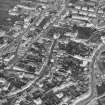
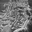
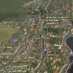
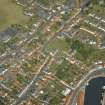
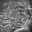
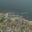
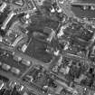
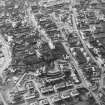
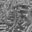
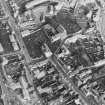
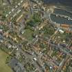
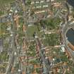
Pittenweem, General


Burgh (Medieval), Village (Period Unassigned)
Site Name Pittenweem, General
Classification Burgh (Medieval), Village (Period Unassigned)
Canmore ID 34252
Site Number NO50SW 58
NGR NO 5483 0259
NGR Description centred on NO 5483 0259
Datum OSGB36 - NGR
Permalink http://canmore.org.uk/site/34252


- Council Fife
- Parish Pittenweem
- Former Region Fife
- Former District North East Fife
- Former County Fife
NO50SW 58 centred on 5483 0259.
Incorporates material from cancelled site NO50SW 189
See Burgh Survey.
Recorded as a burgh of barony in 1526; became a royal burgh in 1540/1.
G S Pryde 1965.
See also:
Pittenweem, Harbour
Pittenweem, East Shore
Pittenweem, Mid Shore
Pittenweem, West Shore
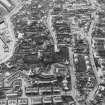
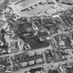
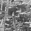
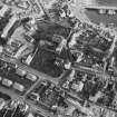
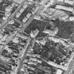
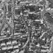
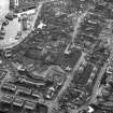
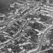
Photographic Survey (1941)
Photographic survey of buildings in Pittenweem, Fife in 1941 by the National Buildings Record Scottish Council.

