
Scheduled Maintenance
Please be advised that this website will undergo scheduled maintenance on the following dates: •
Tuesday 3rd December 11:00-15:00
During these times, some services may be temporarily unavailable. We apologise for any inconvenience this may cause.
Kirkbuddo


Temporary Camp (Roman)
Site Name Kirkbuddo
Classification Temporary Camp (Roman)
Alternative Name(s) Harefaulds
Canmore ID 33612
Site Number NO44SE 15
NGR NO 4905 4425
NGR Description Centred on NO 4905 4425
Datum OSGB36 - NGR
Permalink http://canmore.org.uk/site/33612


- Council Angus
- Parish Inverarity
- Former Region Tayside
- Former District Angus
- Former County Angus
NO44SE 15 centred 4905 4425.
(NO 491 442) Roman Camp (R) (Site of)
OS 6" map, (1959)
The marching camp of Kirkbuddo, 'Norway Dykes' or 'Harefaulds' (after the farm which lay just outside the middle of the NE side in the 18th century) measures 63 acres in area with 6 gates covered by tutuli, and therefore probably belongs to the possibly Flavian series of camps although it is longer and narrower than the others in the series (St Joseph 1958). A small annexe about 300' square on the SE side corresponds closely to those attached to Inverpefferay (NN91NW 14) and Broomhill (NO01NW 1) (St Joseph 1965) camps of that series.
In Roy's time the camp was almost perfect, all six gates and most of the annexe being preserved. The annexe, which occupied the highest ground, apparently had two lines of rampart and a ditch, as opposed to the single rampart and ditch of the main camp, and a traverse across its entrance. It is now visible only on air photographs.
The NW part of the camp now lies in arable land and can no longer be traced on the ground, but St Joseph air photographs have recorded its lines and show that the SW defences made a deviation from the straight to skirt a small bog - a most unusual feature in a Roman camp.
Most of the SW and SE sides lie in a wood, and, when visited in 1939 by Crawford, were very well preserved, including the three traverses. On the SE side, the 48' wide entrance and 40' long traverse lay immediately S of the road. A modern drainage ditch with a small bank followed the line of the rampart and was continiued across the entrance.
A considerable number of pieces of old square-toed shoes were found among the earth of four large mounds, when they were removed from the middle of the camp in the 18th century.
O G S Crawford 1949; J K St Joseph 1958; 1965.
Generally, the earthen bank of the camp is 5.5m broad, 1.5m high above the ditch and has a counterscarp c. 0.7m high. The ditch is generally 1.5m broad at base, and throughout its whole course a modern drain has been cut. No trace was found of the earthworks in the fields to N and E. That on the N was under grass at the time of investigation, and those on the E were under growing crops. No traces of the annexe exist.
Visited by OS (J L D) 12 August 1958.
The remains of the camp are generally as described.
Revised at 1/2500.
Visited by OS (R D) 8 September 1967.
63 acre,Severan.
J K St Joseph 1969.
Field Visit (31 July 1956)
Reconnaissance by RCAHMS (KAS) 31 July 1956.
Publication Account (17 December 2011)
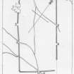
The camp at Kirkbuddo was one of the camps discovered by Captain Robert Melville while travelling through Strathmore in August 1754 (Balfour-Melville 1917: 123n; Jones and Maxwell 2008) and planned by Roy the following year (Roy 1793: Pl. XIV). When Roy planned it, most of the camp was upstanding, including six gates protected by tituli and an annexe on the south-east side, with only small portions of the north-east and south-west sides not visible. It is also depicted as a rectangle labelled ‘Roman camp’ on Ainslie’s map of Forfar and Angus (1794).
Writing in the late 18th century, Jameson noted that the local vulgar term for the site was Haerfauds, which means ‘the ditches, trenches or folds of the “strangers”’ (1786: 20). Gordon, quoting Commissary Maul (who was writing in 1606–12), refers to ‘Karboddo’ as the vestiges of a Danish camp known as ‘Norway Dikes’ near the village of Panbride (1726: 33, 154). Crawford notes this source, commenting on its significance of this as one of the earliest topographical accounts of Scottish antiquities (1949: 97n), although Panbride lies some 11km to the south-east. Visiting the camp in 1925, Crawford noted that much of the camp could still be seen, with the south part in the wood well preserved, and the north-west side visible in ploughed fields. By the time of his later visit in 1939, the north-west side could not be detected; most of the north-east side could be traced on both dates (1949: 98–9).
The camp lies in the Muir of Lour, some 7km SSE of Forfar and east of the Sidlaw Hills. The southern part of the camp is still extremely well preserved, lying in Whig Street Wood, while the rest of the camp is visible through cropmarks. The camp is oblong in shape, measuring 740m from north-west to south-east by 343m transversely, enclosing some 24.7ha (61 acres). The annexe planned by Roy is visible on air photographs attached to the east part of the south-east side, and measuring 91m to the southeast by at least 117m, enclosing at least 1ha (2.5 acres). There is no upstanding trace of the annexe in the wood, suggesting that the south-west side of the annexe lay in the ploughed field behind Woodside Cottage.
Part of the south-west side, immediately north of the wood, has been lost in boggy ground (this part was also lost in Roy’s day), and there is a clear change of direction in this area which indicates that the camp deviated around this ground, because there does not appear to have been a deviation at the point of an entrance.
In Whig Street Wood, the rampart survives up to a height of 1m and is spread some 4.6m, with the ditch at least 0.5m deep in places, and 1.5m wide. The best preserved titulus is that on the south part of the south-west side, some 14m from the camp, and it measures 13.5m in length. The titulus mound is 0.7m high, 5m wide, with the ditch about 1m deep and 2.5m wide. The corresponding entrance gap in the camp appears to narrow at the entrance (both rampart and ditch narrow), and the gap is 9m wide.
Excavations on the camp were conducted in 1955 and 1959, to obtain soil profiles beneath the upstanding rampart (Romans 1962).
R H Jones.

