
Pricing Change
New pricing for orders of material from this site will come into place shortly. Charges for supply of digital images, digitisation on demand, prints and licensing will be altered.
Cleaven Dyke


Cursus (Neolithic)
Site Name Cleaven Dyke
Classification Cursus (Neolithic)
Alternative Name(s) Meikleour; Blairgowrie Road
Canmore ID 28473
Site Number NO13NE 89
NGR NO 17350 39900
NGR Description From NO 1721 3998 to NO 1755 3979
Datum OSGB36 - NGR
Permalink http://canmore.org.uk/site/28473
Ordnance Survey licence number AC0000807262. All rights reserved.
Canmore Disclaimer.
© Bluesky International Limited 2024. Public Sector Viewing Terms
- Correction
- Favourite

SC 393554
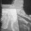
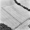
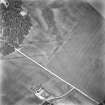
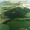
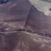
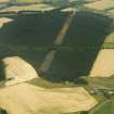
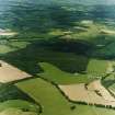
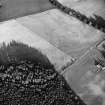
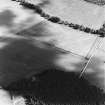
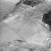
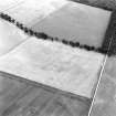
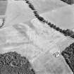
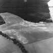
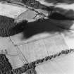
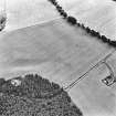
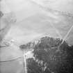
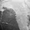
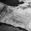
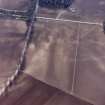
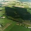
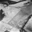
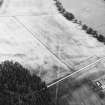
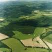
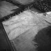
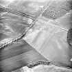
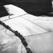
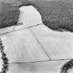
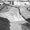
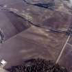
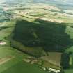
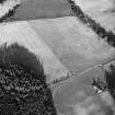
Oblique aerial view centred on cropmarks of the cursus with other cropmarks adjacent.
RCAHMS Aerial Photography
1983
© Crown Copyright: HES

DP 010863
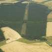
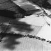
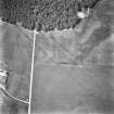
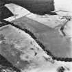
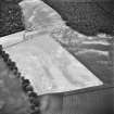
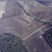
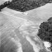
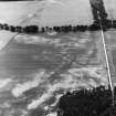
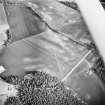
Oblique aerial view centred on the cropmarks and the remains of the cursus monument, taken from the SE.
RCAHMS Aerial Photography Digital
9/8/2005
© Crown Copyright: HES

SC 1551977
Papers of Professor Geraint Dyfed Barri Jones, archaeologist, Manchester, England
2/1982
© Courtesy of HES (G D B Jones Collection)

SC 1710599
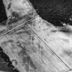
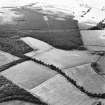
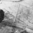
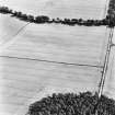
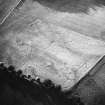
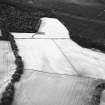
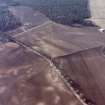
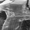
Oblique aerial view centred on cropmarks of the cursus with other cropmarks adjacent.
RCAHMS Aerial Photography
1990
© Crown Copyright: HES

SC 1710610
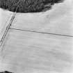
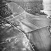
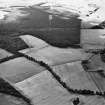
Oblique aerial view centred on cropmarks of the cursus with other cropmarks adjacent.
RCAHMS Aerial Photography
30/6/1994
© Crown Copyright: HES

SC 1710618
Oblique aerial view centred on cropmarks of the cursus with other cropmarks adjacent.
RCAHMS Aerial Photography
1992
© Crown Copyright: HES

SC 1710631
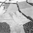
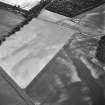
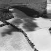
Oblique aerial view centred on cropmarks of the cursus, taken from the WNW.
RCAHMS Aerial Photography
15/8/1996
© Crown Copyright: HES

SC 1710633
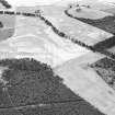
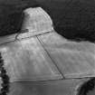
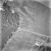
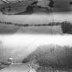
Oblique aerial view of the Cleaven Dyke centred on the cropmarks of a cursus, taken from the S.
RCAHMS Aerial Photography
14/8/1997
© Crown Copyright: HES

SC 1710641
Oblique aerial view centred on the Cleaven Dyke cursus, taken from the SE.
RCAHMS Aerial Photography
8/7/1999
© Crown Copyright: HES

SC 1710668
Oblique aerial view centred on cropmarks of the cursus with other cropmarks adjacent.
RCAHMS Aerial Photography
1981
© Crown Copyright: HES

SC 1710680
Oblique aerial view centred on cropmarks of the cursus with other cropmarks adjacent.
RCAHMS Aerial Photography
1989
© Crown Copyright: HES

SC 1710681
Oblique aerial view centred on cropmarks of the cursus with other cropmarks adjacent.
RCAHMS Aerial Photography
1989
© Crown Copyright: HES

SC 1710722
Oblique aerial view centred on cropmarks of the cursus with other cropmarks adjacent.
RCAHMS Aerial Photography
1990
© Crown Copyright: HES

SC 1710753
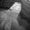
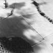
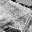
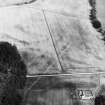
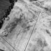
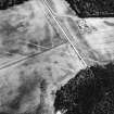
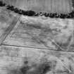
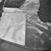
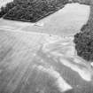
Oblique aerial view centred on soilmarks of the cursus.
RCAHMS Aerial Photography
1993
© Crown Copyright: HES

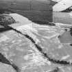
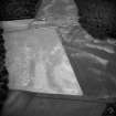
SC 1116467
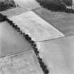
Excavation photograph: Film 95/BW/2: OLS after removal of first spit at Cleaven Dyke. Illustration 32.
Historic Scotland Archive Project
29/5/1995
© Courtesy of HES. Sponsored excavations

SC 1709538
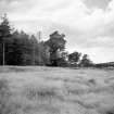
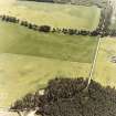
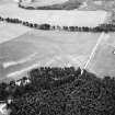
Oblique aerial view centred on the remains of the Cleaven Dyke cursus, taken from the W.
RCAHMS Aerial Photography
15/6/2000
© Crown Copyright: HES

SC 1710613
Oblique aerial view centred on cropmarks of the cursus with other cropmarks adjacent.
RCAHMS Aerial Photography
30/6/1994
© Crown Copyright: HES

SC 1710615
Oblique aerial view centred on cropmarks of the cursus.
RCAHMS Aerial Photography
30/6/1994
© Crown Copyright: HES

SC 1710636
Oblique aerial view of the Cleaven Dyke centred on the cropmarks of a cursus, taken from the WNW.
RCAHMS Aerial Photography
14/8/1997
© Crown Copyright: HES

SC 1710664
Oblique aerial view centred on cropmarks of the cursus with other cropmarks adjacent.
RCAHMS Aerial Photography
1977
© Crown Copyright: HES

SC 1710669
Oblique aerial view centred on cropmarks of the cursus.
RCAHMS Aerial Photography
1981
© Crown Copyright: HES

SC 1710739
Oblique aerial view centred on cropmarks of the cursus with other cropmarks adjacent.
RCAHMS Aerial Photography
1990
© Crown Copyright: HES

SC 1783617
Oblique aerial view centred on soilmarks of the cursus.
RCAHMS Aerial Photography
1993
© Crown Copyright: HES

SC 2253193
Trench (one negative)
Excavations at Cleaven Dyke, Perthshire
1975
© Historic Scotland

SC 623996
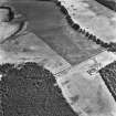
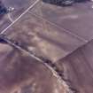
Oblique aerial view centred on cropmarks of the cursus, taken from the ESE.
RCAHMS Aerial Photography
15/8/1996
© Crown Copyright: HES

SC 1116470
Excavation photograph: Film 95/BW/1: Site after cleaning to second planning spit at Cleaven Dyke. Illustration 34.
Historic Scotland Archive Project
23/5/1995
© Courtesy of HES. Sponsored excavations

DP 010864
Oblique aerial view centred on the cropmarks and the remains of the Cleaven Dyke cursus monument, taken from the ESE.
RCAHMS Aerial Photography Digital
9/8/2005
© Crown Copyright: HES

SC 1709533
Oblique aerial view centred on the remains of the Cleaven Dyke cursus, taken from the ESE.
RCAHMS Aerial Photography
15/6/2000
© Crown Copyright: HES

SC 1710603
Oblique aerial view centred on cropmarks of the cursus with other cropmarks adjacent.
RCAHMS Aerial Photography
1990
© Crown Copyright: HES

SC 1710607
Oblique aerial view centred on cropmarks of the cursus with other cropmarks adjacent.
RCAHMS Aerial Photography
1992
© Crown Copyright: HES

SC 1710611
Oblique aerial view centred on cropmarks of the cursus with other cropmarks adjacent.
RCAHMS Aerial Photography
30/6/1994
© Crown Copyright: HES

SC 1710620
Oblique aerial view centred on cropmarks of the cursus with other cropmarks adjacent.
RCAHMS Aerial Photography
1992
© Crown Copyright: HES

SC 1710630
Oblique aerial view centred on cropmarks of the cursus, taken from the NNW.
RCAHMS Aerial Photography
15/8/1996
© Crown Copyright: HES

SC 1710632
Oblique aerial view centred on cropmarks of the cursus, taken from the SE.
RCAHMS Aerial Photography
15/8/1996
© Crown Copyright: HES

SC 1710634
Oblique aerial view of the Cleaven Dyke centred on the cropmarks of a cursus, taken from the SE.
RCAHMS Aerial Photography
14/8/1997
© Crown Copyright: HES

SC 1710635
Oblique aerial view of the Cleaven Dyke centred on the cropmarks of a cursus, taken from the NW.
RCAHMS Aerial Photography
14/8/1997
© Crown Copyright: HES

SC 1710654
Oblique aerial view centred on soilmarks of the cursus.
RCAHMS Aerial Photography
1983
© Crown Copyright: HES

SC 1710659
Oblique aerial view centred on cropmarks of the cursus with other cropmarks adjacent.
RCAHMS Aerial Photography
1983
© Crown Copyright: HES

SC 1710662
Oblique aerial view centred on cropmarks of the cursus.
RCAHMS Aerial Photography
1976
© Crown Copyright: HES

SC 1710667
Oblique aerial view centred on cropmarks of the cursus with other cropmarks adjacent.
RCAHMS Aerial Photography
1981
© Crown Copyright: HES

SC 1710679
Oblique aerial view centred on cropmarks of the cursus with other cropmarks adjacent.
RCAHMS Aerial Photography
1989
© Crown Copyright: HES

SC 1710721
Oblique aerial view centred on cropmarks of the cursus with other cropmarks adjacent.
RCAHMS Aerial Photography
1990
© Crown Copyright: HES

SC 1783618
Oblique aerial view centred on soilmarks of the cursus.
RCAHMS Aerial Photography
1993
© Crown Copyright: HES

SC 1783681
Oblique aerial view centred on cropmarks of the cursus with other cropmarks adjacent.
RCAHMS Aerial Photography
1993
© Crown Copyright: HES


SC 1710604
Oblique aerial view centred on cropmarks of the cursus with other cropmarks adjacent.
RCAHMS Aerial Photography
1992
© Crown Copyright: HES

SC 1710617
Oblique aerial view centred on cropmarks of the cursus with other cropmarks adjacent.
RCAHMS Aerial Photography
1992
© Crown Copyright: HES

SC 1710626
Oblique aerial view centred on soilmarks of the cursus.
RCAHMS Aerial Photography
1993
© Crown Copyright: HES

SC 1710637
Oblique aerial view of the Cleaven Dyke centred on the cropmarks of a cursus, taken from the SSW.
RCAHMS Aerial Photography
14/8/1997
© Crown Copyright: HES

SC 1710639
Oblique aerial view centred on the cropmarks of the Cleaven Dyke, taken from the NW.
RCAHMS Aerial Photography
18/8/1998
© Crown Copyright: HES

SC 1710653
Oblique aerial view centred on soilmarks of the cursus.
RCAHMS Aerial Photography
1983
© Crown Copyright: HES

SC 1710656
Oblique aerial view centred on soilmarks of the cursus.
RCAHMS Aerial Photography
1983
© Crown Copyright: HES

SC 1710657
Oblique aerial view centred on soilmarks of the cursus.
RCAHMS Aerial Photography
1983
© Crown Copyright: HES

SC 1710658
Oblique aerial view centred on cropmarks of the cursus with other cropmarks adjacent.
RCAHMS Aerial Photography
1983
© Crown Copyright: HES

SC 1710740
Oblique aerial view centred on cropmarks of the cursus with other cropmarks adjacent.
RCAHMS Aerial Photography
1990
© Crown Copyright: HES

SC 1783619
Oblique aerial view centred on soilmarks of the cursus.
RCAHMS Aerial Photography
1993
© Crown Copyright: HES

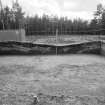
SC 2253192
Trench (two negatives) looking N along section.
Excavations at Cleaven Dyke, Perthshire
1975
© Historic Scotland

SC 1116461
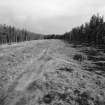
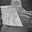
View of cleared segment during excavation at Cleaven Dyke from roof of storage container in 1995.
Historic Scotland Archive Project
29/5/1995
© Courtesy of HES. Sponsored excavations

SC 1116463
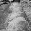
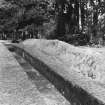
Publication photograph: View along the NW part of the bank of the Cleaven Dyke, looking towards the terminal, in 1997, after clearing of trees. Illustration 25.
Historic Scotland Archive Project
1997
© Courtesy of HES. Sponsored excavations

SC 1709535
Oblique aerial view centred on the remains of the Cleaven Dyke cursus, taken from the NNW.
RCAHMS Aerial Photography
15/6/2000
© Crown Copyright: HES

SC 1710600
Oblique aerial view centred on cropmarks of the cursus with other cropmarks adjacent.
RCAHMS Aerial Photography
1990
© Crown Copyright: HES

SC 1710605
Oblique aerial view centred on cropmarks of the cursus with other cropmarks adjacent.
RCAHMS Aerial Photography
1992
© Crown Copyright: HES

SC 1710612
Oblique aerial view centred on cropmarks of the cursus with other cropmarks adjacent.
RCAHMS Aerial Photography
30/6/1994
© Crown Copyright: HES

SC 1710628
Oblique aerial view centred on cropmarks of the cursus, taken from the ENE.
RCAHMS Aerial Photography
24/7/1996
© Crown Copyright: HES

SC 1710638
Oblique aerial view centred on the cropmarks of the Cleaven Dyke, taken from the E.
RCAHMS Aerial Photography
18/8/1998
© Crown Copyright: HES

SC 1710642
Oblique aerial view centred on the Cleaven Dyke cursus, taken from the SE.
RCAHMS Aerial Photography
8/7/1999
© Crown Copyright: HES

SC 1710655
Oblique aerial view centred on soilmarks of the cursus.
RCAHMS Aerial Photography
1983
© Crown Copyright: HES

SC 1710661
Oblique aerial view centred on cropmarks of the cursus.
RCAHMS Aerial Photography
1976
© Crown Copyright: HES

SC 1710720
Oblique aerial view centred on cropmarks of the cursus with other cropmarks adjacent.
RCAHMS Aerial Photography
1990
© Crown Copyright: HES

SC 1783621
Oblique aerial view centred on soilmarks of the cursus.
RCAHMS Aerial Photography
1993
© Crown Copyright: HES

SC 1783623
Oblique aerial view centred on soilmarks of the cursus.
RCAHMS Aerial Photography
1993
© Crown Copyright: HES

SC 2253190
Trench (two negatives)
Excavations at Cleaven Dyke, Perthshire
1975
© Historic Scotland


SC 2682288
Cleaven Dyke, NO13SE RRX 519, Ordnance Survey index card, Recto
Records of the Ordnance Survey, Southampton, Hampshire, England
c. 1958
© Crown Copyright: HES (Ordnance Survey Archaeology Division Collection)

SC 1116464
Excavation photograph: Film 93/BW/1: Ditch section A1 after emptying at Cleaven Dyke. Illustration 28.
Historic Scotland Archive Project
17/9/1993
© Courtesy of HES. Sponsored excavations

SC 1709534
Oblique aerial view centred on the remains of the Cleaven Dyke cursus, taken from the ESE.
RCAHMS Aerial Photography
15/6/2000
© Crown Copyright: HES

SC 1709536
Oblique aerial view centred on the remains of the Cleaven Dyke cursus, taken from the NNW.
RCAHMS Aerial Photography
15/6/2000
© Crown Copyright: HES

SC 1710601
Oblique aerial view centred on cropmarks of the cursus with other cropmarks adjacent.
RCAHMS Aerial Photography
1990
© Crown Copyright: HES

SC 1710616
Oblique aerial view centred on cropmarks of the cursus with other cropmarks adjacent.
RCAHMS Aerial Photography
30/6/1994
© Crown Copyright: HES

SC 1710619
Oblique aerial view centred on cropmarks of the cursus with other cropmarks adjacent.
RCAHMS Aerial Photography
1992
© Crown Copyright: HES

SC 1710622
Oblique aerial view centred on soilmarks of the cursus.
RCAHMS Aerial Photography
1993
© Crown Copyright: HES

SC 1710627
Oblique aerial view centred on cropmarks of the cursus, taken from the SE.
RCAHMS Aerial Photography
24/7/1996
© Crown Copyright: HES

SC 1710629
Oblique aerial view centred on cropmarks of the cursus, taken from the ESE.
RCAHMS Aerial Photography
15/8/1996
© Crown Copyright: HES

SC 1710665
Oblique aerial view centred on cropmarks of the cursus with other cropmarks adjacent.
RCAHMS Aerial Photography
1977
© Crown Copyright: HES

SC 1710666
Oblique aerial view centred on cropmarks of the cursus.
RCAHMS Aerial Photography
1977
© Crown Copyright: HES

SC 1710671
Oblique aerial view centred on cropmarks of the cursus.
RCAHMS Aerial Photography
1981
© Crown Copyright: HES

SC 1710673
Oblique aerial view centred on cropmarks of the cursus with other cropmarks adjacent.
RCAHMS Aerial Photography
1988
© Crown Copyright: HES

SC 1710674
Oblique aerial view centred on cropmarks of the cursus with other cropmarks adjacent.
RCAHMS Aerial Photography
1988
© Crown Copyright: HES

SC 1783620
Oblique aerial view centred on soilmarks of the cursus.
RCAHMS Aerial Photography
1993
© Crown Copyright: HES

SC 1783678
Oblique aerial view centred on cropmarks of the cursus with other cropmarks adjacent.
RCAHMS Aerial Photography
1993
© Crown Copyright: HES

SC 1783680
Oblique aerial view centred on cropmarks of the cursus with other cropmarks adjacent.
RCAHMS Aerial Photography
1993
© Crown Copyright: HES

SC 622568
Oblique aerial view centred on cropmarks of the cursus with other cropmarks adjacent.
RCAHMS Aerial Photography
1992
© Crown Copyright: HES

SC 1709537
Oblique aerial view centred on the remains of the Cleaven Dyke cursus, taken from the NW.
RCAHMS Aerial Photography
15/6/2000
© Crown Copyright: HES

SC 1710602
Oblique aerial view centred on cropmarks of the cursus with other cropmarks adjacent.
RCAHMS Aerial Photography
1990
© Crown Copyright: HES

SC 1710606
Oblique aerial view centred on cropmarks of the cursus with other cropmarks adjacent.
RCAHMS Aerial Photography
1992
© Crown Copyright: HES

SC 1710614
Oblique aerial view centred on cropmarks of the cursus.
RCAHMS Aerial Photography
30/6/1994
© Crown Copyright: HES

SC 1710621
Oblique aerial view centred on cropmarks of the cursus with other cropmarks adjacent.
RCAHMS Aerial Photography
1992
© Crown Copyright: HES

SC 1710624
Oblique aerial view centred on soilmarks of the cursus.
RCAHMS Aerial Photography
1993
© Crown Copyright: HES

SC 1710670
Oblique aerial view centred on cropmarks of the cursus.
RCAHMS Aerial Photography
1981
© Crown Copyright: HES

SC 1710672
Oblique aerial view centred on cropmarks of the cursus with other cropmarks adjacent.
RCAHMS Aerial Photography
1988
© Crown Copyright: HES


First 100 images shown. See the Collections panel (below) for a link to all digital images.
- Council Perth And Kinross
- Parish Caputh
- Former Region Tayside
- Former District Perth And Kinross
- Former County Perthshire
Cancelled. Crossing two OS 1:10,000 quartersheets, the Cleaven Dyke was originally recorded as a linear feature with separate records for each mapsheet.
NO14SE 80 (Canmore Id: 73146) has been retained as the record for the Cursus.
NO13NE 89 (Canmore Id: 28473), covering the SE end of the Cursus has been cancelled.
Information from HES (Peter McKeague) 14 April 2021
Measured Survey (26 August 1991 - 27 August 1991)
RCAHMS surveyed the Cleaven Dyke cursus (NO13NE 89) with plane-table and self-reducing adlidade between 26-27 August 1991 at a scale of 1:500. The resultant plans and sections were redrawn in ink and published at a scale of 1:1000 (RCAHMS 1994b, 27).

