Pricing Change
New pricing for orders of material from this site will come into place shortly. Charges for supply of digital images, digitisation on demand, prints and licensing will be altered.
Grandtully, St Mary's Church
Church (16th Century)
Site Name Grandtully, St Mary's Church
Classification Church (16th Century)
Alternative Name(s) Grandtully Chapel; Nether Pitcairn
Canmore ID 25724
Site Number NN85SE 6
NGR NN 88692 50638
Datum OSGB36 - NGR
Permalink http://canmore.org.uk/site/25724
First 100 images shown. See the Collections panel (below) for a link to all digital images.
- Council Perth And Kinross
- Parish Logierait
- Former Region Tayside
- Former District Perth And Kinross
- Former County Perthshire
NN85SE 6 88692 50638
(NN 8869 5062) Church (NR)
OS 6" map, Perthshire, 2nd ed., (1902)
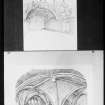
The 16th century church of Grandtully, dedicated to St Mary, was first mentioned in a document of 1533. It is a plain building, 79' x 23' but is remarkable for its painted ceiling at the E end, with heraldic and symbolic subjects. It is not known if the paintings ever extended the whole length of the building. The work was done c. 1636 by Sir William Stewart.
D MacGibbon and T Ross 1897; S Piggott and W D Simpson 1970.
St Mary's Church is in good condition. Not in normal use.
Visited by OS (B S) 11 Feburary 1975.
Scheduled as Grandtully, St Mary's Church.
Information from Historic Scotland, scheduling document dated 6 June 1994.
NN85SE 6 88692 50638
NN85SE 71 88694 50620 Churchyard
NMRS REFERENCE:
Grandtully Chapel.
Plans:
Thomas Bonnar Drawings - 1 sheet (coloured) tempera ceiling.
A.W. Lyon drawings - 1 drawing of ceiling.
For complete Architecture Notes, refer to Architecture catalogue.
Field Visit (15 August 1942)
This site was included within the RCAHMS Emergency Survey (1942-3), an unpublished rescue project. Site descriptions, organised by county, vary from short notes to lengthy and full descriptions and are available to view online with contemporary sketches and photographs. The original typescripts, manuscripts, notebooks and photographs can also be consulted in the RCAHMS Search Room.
Information from RCAHMS (GFG) 10 December 2014.
Publication Account (1987)
The church is a simple building with lime-washed rubble walls and blue slate roof. It gives the appearance of a long low 18th century farm steading, whose walls and roof are not quite straight It is believed to have been constructed prior to the Reformation and is known to have been repaired in 1636. The approach is by a fenced path on the east side of a farm steading and the exterior lacks any interesting qualities. This makes the interior all the more breathtaking. The simple rectangular shell has a 17th century painted timber vault extending one-third of the length of the interior. The remainder of the roof is exposed timbers. The Renaissance-style painting combines family heraldry with biblical illustration. The central panel shows death about to claim the occupant of a canopy bed.
On leaving the church many visitors fail to realise that the graveyard lies to the west of the building and that to gain access one must continue up the path to the north gable and round to the other side of the church. There is a strange feeling of antiquity in this small space, particularly when the lime-washed walls of the church show signs of weathering.
There is an excellent view of Grandtully Castle from the track as one returns to the main road.
Information from ‘Exploring Scotland’s Heritage: Fife and Tayside’, (1987).


